Record wettest or record driest? Autumn started with stark divisions

Sharp divides set up across Canada and the U.S. through the first month of autumn, keeping some areas dry while others dealt with flooding rains
El Niño left its fingerprints all over the beginning of autumn across North America as heavy rains brought deluge to some communities and left neighbouring areas high and dry.
A striking pattern developed throughout the continent as plumes of tropical moisture streamed from both the Gulf and the Pacific.
Intense deluges brought significant totals to areas that hardly see any rain this time of year.
DON’T MISS: Staying safe from flash floods, a serious and deadly hazard
Sharp contrasts between soaked and parched
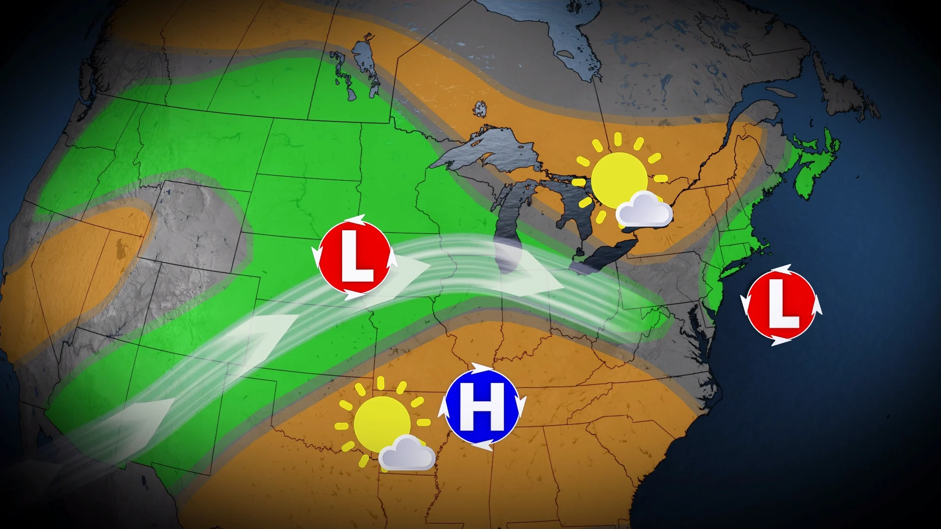
The overall setup across North America during the first month of autumn magnified rainfall extremes in both directions.
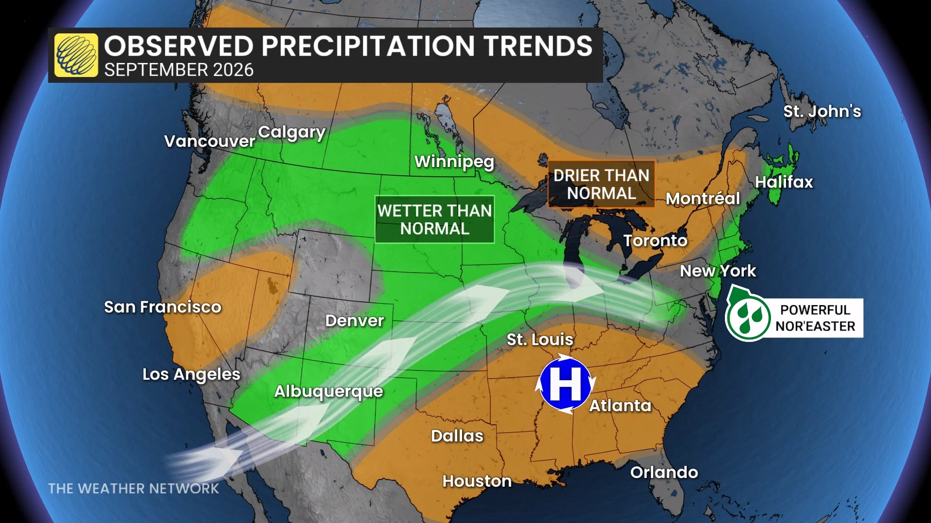
A stubborn ridge of high pressure over the Southeast kept the active storm track flowing from the U.S. Southwest toward the Midwest, largely missing southern Ontario as it plunged back toward the south.
Many communities from southern New Mexico to central Iowa saw one of their wettest Septembers on record after the extremely active eastern Pacific hurricane basin pumped excess moisture inland. Albuquerque, New Mexico, picked up nearly 400 per cent of its normal monthly rainfall.
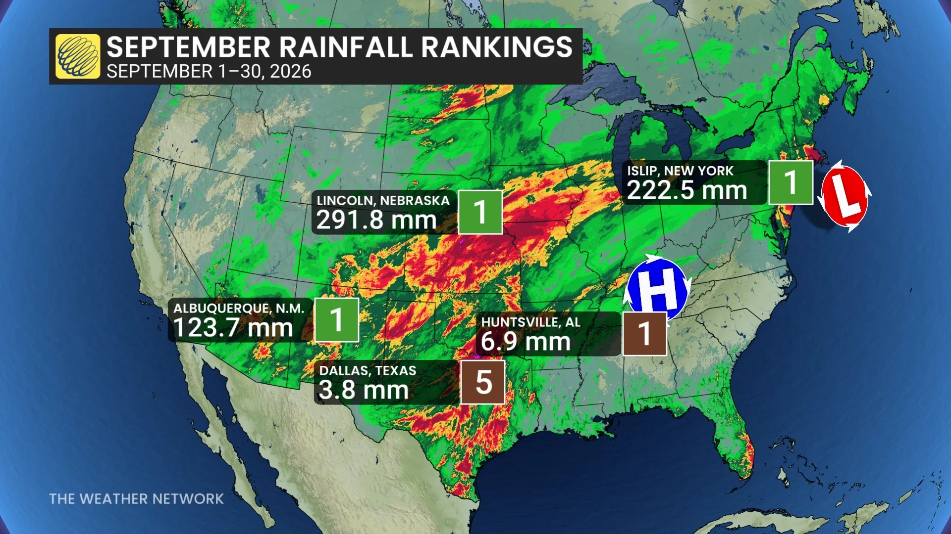
California also got in on the action, with a rare 16.5 mm of rain in Los Angeles even as many cities throughout the state saw no measurable precipitation at all.
Meanwhile, conditions stayed very warm and dry beneath the ridge. This was the hottest start to autumn on record throughout a vast swath of the U.S. South, with several cities also notching a top-five driest September.
Split patterns seeped north of the border to Canada
We saw this feast-or-famine setup extend north of the border, as well. No major cities saw record-wettest or -driest conditions this September, but we did witness some hefty rainfall surpluses and deficits.
Large sections of the southern Prairies saw 100-200 per cent of their normal monthly rainfall in September. Regina received 114.8 mm of rain through the month against an average of just 31.8 mm.
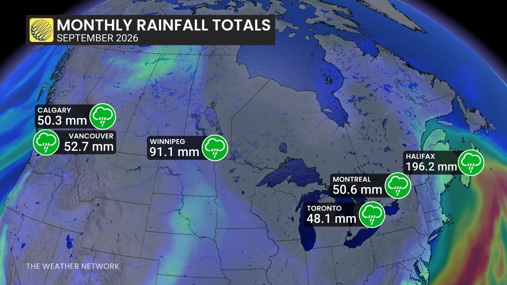
The southward dive in the storm track was readily apparent across southern Ontario. While Windsor saw near-normal rainfall, gauges in Toronto, Ottawa, and Montreal only saw 30-50 per cent of their normal rainfall for September.
A strong, early-season nor’easter that spun-up off the East Coast helped rainfall totals recover across the Maritimes as it produced record rains south of the border. Halifax recorded 196.2 mm of rain through the month, compared to an average of 107.3 mm.