PHOTOS: Winter storm illuminates skies and buries roads in Ontario

An intense winter storm roared through southern Ontario Friday night, bringing howling wind gusts, thundersnow and hefty snowfall amounts that resulted in dangerous travel and scattered power outages
Spring is just a few weeks away, but winter is keeping a tight grip on southern Ontario.
Such was the case Friday night into Saturday morning with one of the region's biggest snowfall events of the season. For most of the south, the heaviest snowfall and gustiest winds lasted through the early morning hours on Saturday.
RELATED: How vivid thundersnow stole the show in Toronto's big snowstorm
During the height of the storm, snowfall rates of over 5 centimetres per hour were forecast, along with wind gusts of 60-70+ km/h. Thundersnow was also reported in many locales experiencing the most intense snowfall rates.
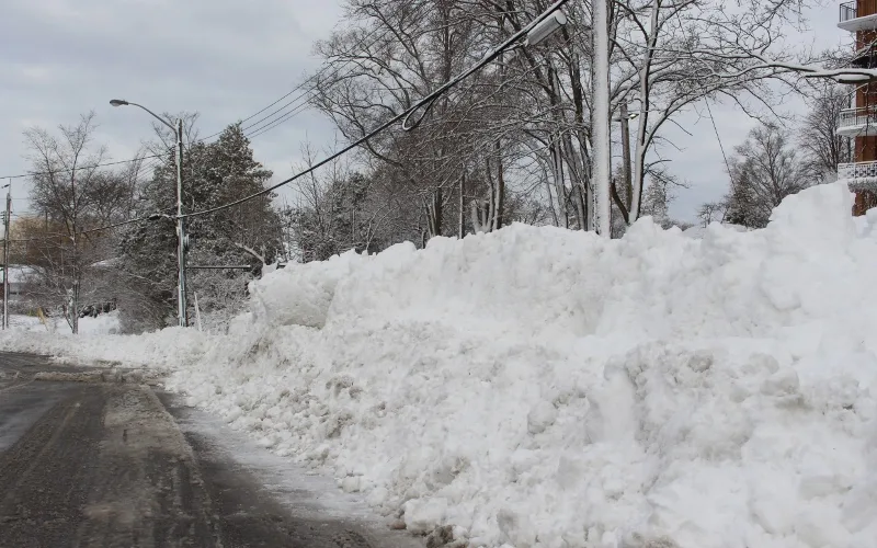
The result was dangerous travel conditions, localized power outages, and flight delays and cancellations as high winds and heavy snowfall blanketed the region. Poor conditions hung on into Saturday morning for the south and will linger into the afternoon for eastern sections.
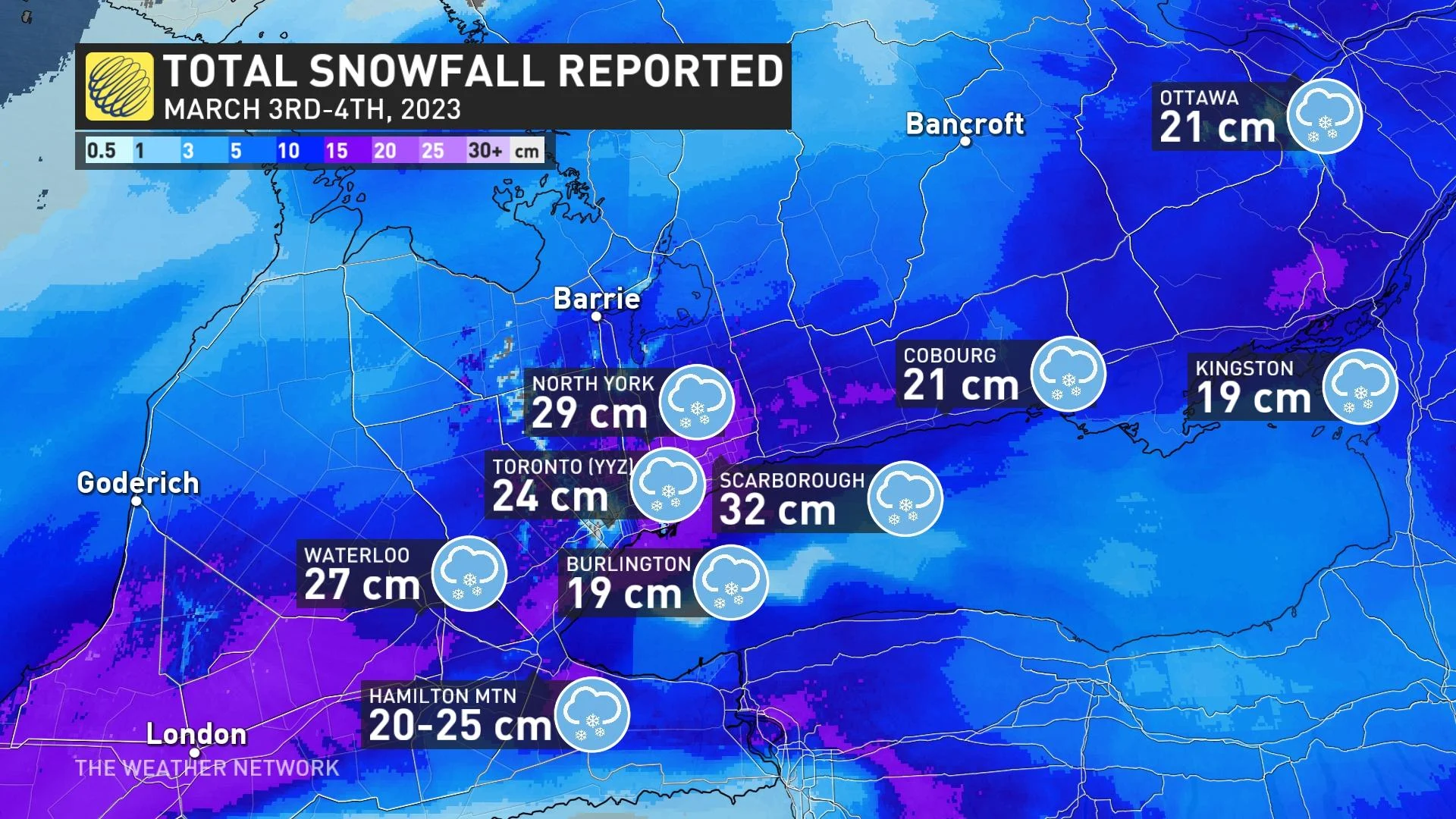
As of Saturday evening, hefty snowfall totals have been reported in several locales including 32 cm in Scarborough and Orangeville, 31 cm at Trenton airport, 30 cm in Vaughan and Newmarket, 29 cm in North York, 27 cm in Waterloo and 24 cm at Toronto's Pearson International Airport.
Visit our Complete Guide to Spring 2023 for an in-depth look at the Spring Forecast, tips to plan for it and much more!
Below is a selection of visuals from the storm, during and after, currently making the rounds on social media.
WATCH: Storm brings thundersnow light show to the GTA, see it here
WATCH: Deep snow covers much of Ontario even as spring is in the air
Thumbnail image courtesy of Susan Higham, taken in North York, Ont.