
PHOTOS: Damaging severe storms tear across Ontario, Quebec

A powerful round of severe thunderstorms prompted tornado watches and warnings across portions of southern Ontario and southern Quebec on Thursday afternoon. Storms stretched from the Greater Toronto Area all the way to Quebec City, with some of the strongest storms hitting the northern shores of Lake Ontario and the Montreal metro area.
The storms developed courtesy of a cold front pushing into plenty of warm and unstable air, which brought bouts of torrential downpours, intense wind gusts, hail, thunder, and lightning across southern Ontario before pushing east into Quebec and crossing the international border.
Relatively minor damage was reported in Brooklin, just north of Whitby, Ont., Thursday afternoon, with one social media user sharing photos of downed trees and structural damage on Highway 12 near Duffs Rd.
East of there, in Belleville, there were reports of roof and structural damage along with debris scattered across roads and sidewalks. A peak wind gust of 106 km/h was reported there.
READ MORE: Everyone needs a home emergency kit. Here’s what to stock in yours
As of Thursday afternoon, there were no reports of any injuries as a result of these fast-moving storms, though thousands of customers were left without power at the height of the storm, according to Hydro One.
Western University's Northern Tornadoes Project will be investigating the damage in order to determine if any tornadoes occurred.
BELOW: QUEBEC HOMES BURN DOWN FROM LIGHTNING STRIKE DURING STORMS
At the storm's most intense phase, 41000 Hydro-Québec customers were also without power and rainfall amounts of 40 to 60 mm fell in less than three hours in the Greater Montreal area, causing some flooding.
Additionally, hail the size of 4 to 6 cm was reported from Pointe-Fortune/Lachute to Deux-Montagnes.
While cooler temperatures will follow behind Thursday’s troublesome cold front, more thunderstorms are possible for some areas throughout the day on Friday. Severe thunderstorm watches and warnings lined parts of southern Quebec first thing.
Folks across social media shared images of the storms and their aftermath. Check out some of the most compelling images, below.
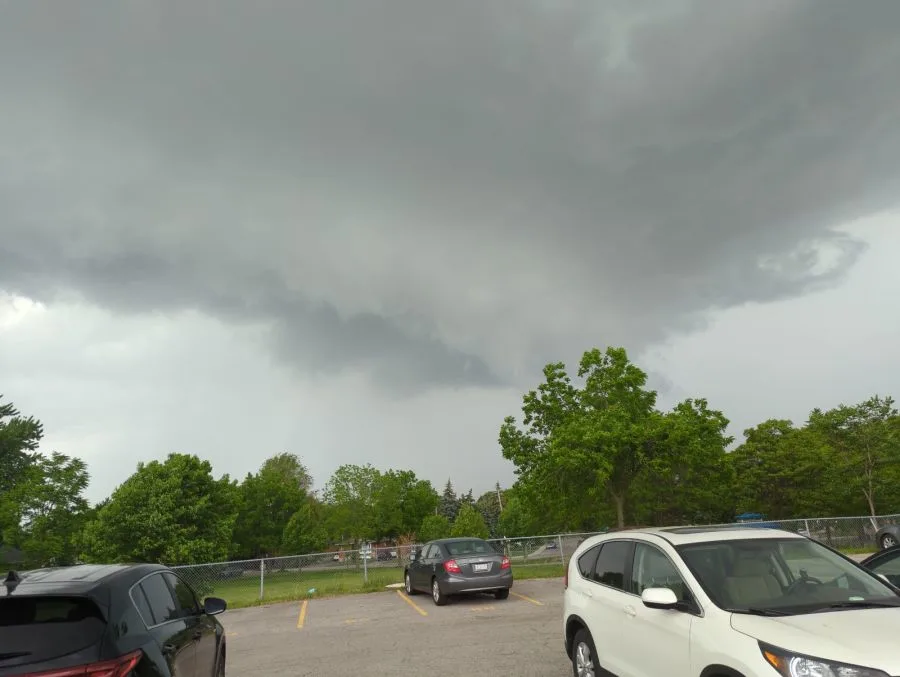
(Hamilton, Ont. Credit: Brian Bernard/The Weather Network)
Thumbnail courtesy of Jeanette Arsenault.


