PHOTOS: Scary shelf and scud clouds cover Ontario as storms roll in

The thunderstorms that pushed across parts of southern Ontario Tuesday afternoon and evening made for photogenic opportunities as many of the cells contained stunning shelf and scud clouds
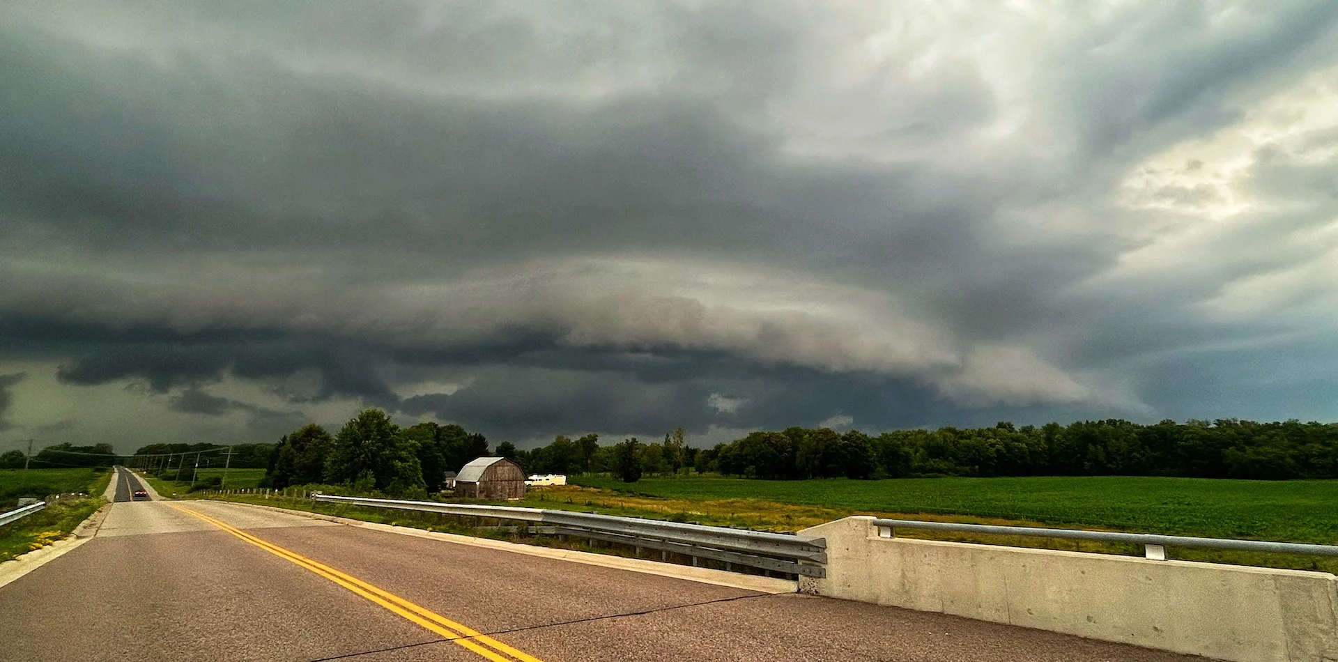
A line of thunderstorms that bubbled up ahead of a cold front Tuesday afternoon led to some striking images of shelf and scud clouds as they pushed through southern Ontario.
Storms that developed were scattered along the front, putting on a scenic show for many. Not all regions saw a thunderstorm, but many regions were put under severe thunderstorm watches as conditions were favourable.

Shelf cloud near Brussels, Ont. (Mark Robinson/The Weather Network)
SEE ALSO: How the atmosphere bakes a perfect thunderstorm
Those that did see storms faced the standard threats, and more than a handful of them reached severe limits, prompting warnings from Environment and Climate Change Canada (ECCC). In addition to the scary-looking clouds, there were several reports of hail, blustery wind gusts, frequent lightning, and even some crop and tree damage.
Come Wednesday, the storm threat will return for some. A warm front will slowly lift through the day, with rain showers returning across the southwest, including Windsor. Light sleepers should be aware, as Wednesday could feature some overnight rumbles of thunder as the system reaches the Greater Toronto Area. Continuing its movement northeast, another cold front could trigger stronger afternoon storms across the Golden Horseshoe.
It didn't take long for visuals of the fast-moving storms to surface on social media. Below is a selection of what is currently making the rounds.
WATCH: Heavy rainfall and scary clouds accompany storms in southern Ontario
Thumbnail courtesy of Mark Robinson, meteorologist and Storm Hunter at The Weather Network.