PHOTOS: Possible tornadoes, funnel clouds as intense storms slam Ontario

The severe storms rolled through eastern Ontario Sunday afternoon, generating numerous tornado warnings and damage in several communities, but no twisters have been confirmed at this point.
Sunday was quite active in southern and eastern Ontario, from early-morning rain and thunder to afternoon tornado-warned storms moving through the latter region.
A low-pressure system tracked through the region Saturday overnight, bringing a round of heavy rain and embedded storms through Sunday morning in southern Ontario. A warm front helped set off severe storms in eastern areas in the afternoon, prompting numerous tornado warnings in the region including in the City of Ottawa, lasting for about 2.5 hours.
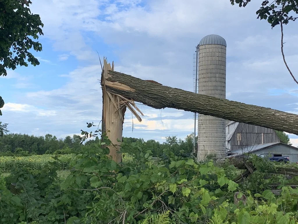
While there were reports of funnel clouds and possible tornadoes, with damage incurred in Camden East, Oxford Mills and Kinmount, nothing has been confirmed as of Sunday night.
In Camden East, there were reports of damage to roofs, multiple uprooted trees and downed power lines. Several trees and power lines were brought down in Kinmount and there was tree damage and a video of a possible tornado in Oxford Mills. The storms also brought torrential rains, strong winds and frequent lightning across the province.
TORNADO-WARNED STORMS MARCH THROUGH EASTERN ONTARIO
Below is some of the visuals currently making the rounds on social media, lit up by the storms as they paraded through Sunday afternoon. Among the selection are funnel cloud, possible tornado sightings and damage from the storm.

Lightning strikes over Lake Ontario. Photo: Michael Kirouac.
Thumbnail courtesy of Mark Robinson.