PHOTOS: Poorly timed snow, ice in southern Ontario creates travel chaos

The final two days in February got off to a stormy start in southern Ontario as a mighty Colorado low responsible for destructive weather stateside brought a mix of winter weather that created chaos on the roads. This won't be the last of it either, with eyes already on a high impact storm to end this week.
SEE ALSO: Snow creates travel problems in Ontario, next storm on the horizon
Precipitation that started out as rain in the southwest on Monday made the switch to ice pellets and freezing rain in the afternoon, particularly along the Highway 402 corridor and up towards the Goderich area, making for tricky travel.
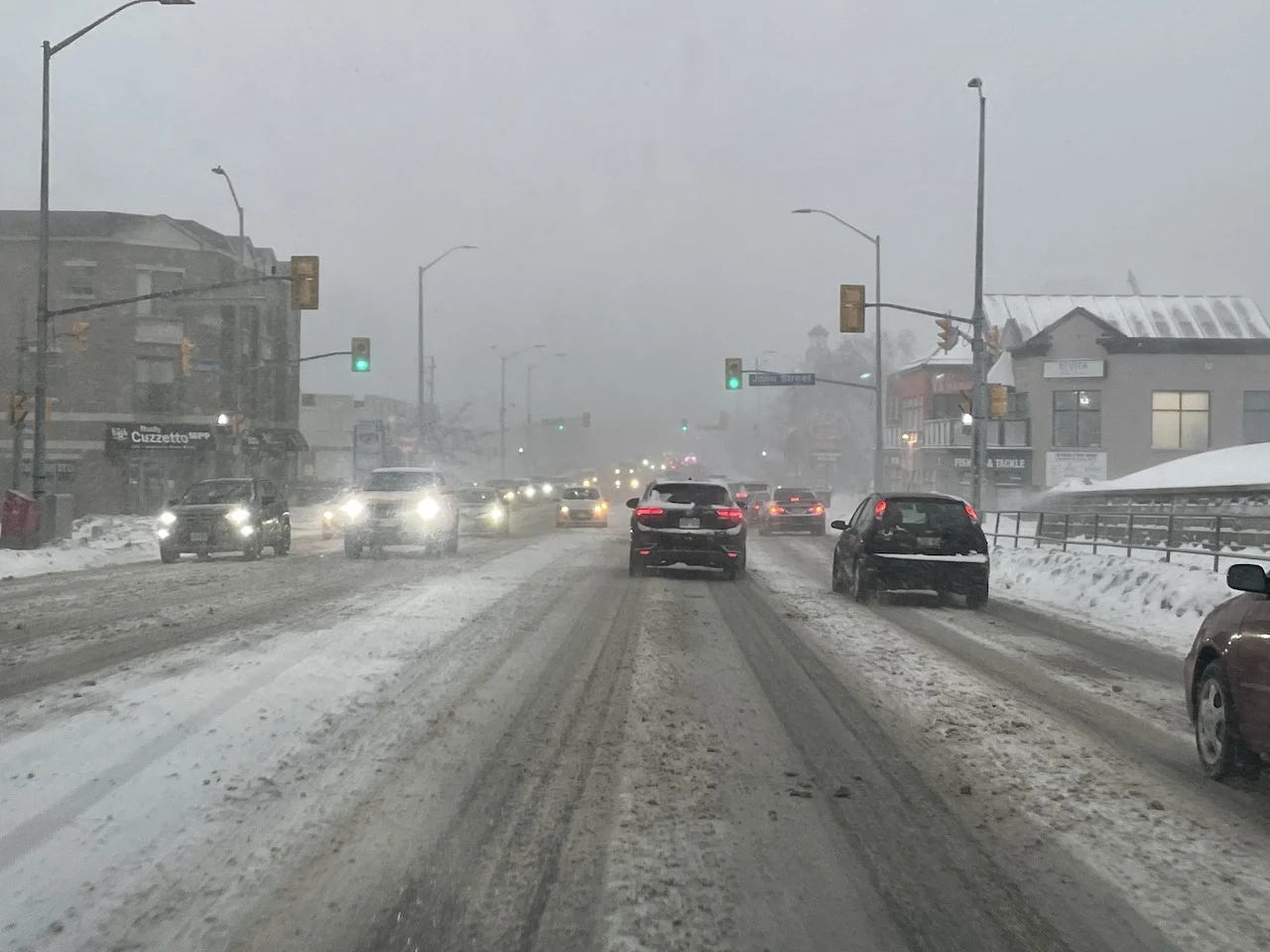
The Greater Toronto Area (GTA) saw precipitation start off as snow Monday evening, leading to significant impacts on the commute across the region. Bursts of heavy snow and gusty winds of 50-70 km/h reduced visibility on many roadways including the 400-series highways.
Photos and videos of the storm showed roads covered in snow and slush, and traffic almost at a standstill in spots because of near whiteout conditions at times.
READ MORE: There’s plenty of winter left. Fight off those seasonal blues with these 9 suggestions
Between 5-15 cm of snow fell across the GTA through early Tuesday, with higher amounts forecast in higher elevations, away from the lakeshores. Nearly 6 cm was reported at Toronto's Pearson airport and a peak wind gust of 55 km/h. At Hamilton airport, 12 cm was reported.
Up to 15 cm of snow is expected across eastern Ontario as well, with a snowfall warning remaining in effect for the Ottawa area early Tuesday.
Beyond this early-work week, wintry mess, more systems are expected to follow as an active storm track sets up over the Great Lakes. Warm air to the south continues to fight back on Arctic air attempting to descend, spawning a stormy corridor the entire week.
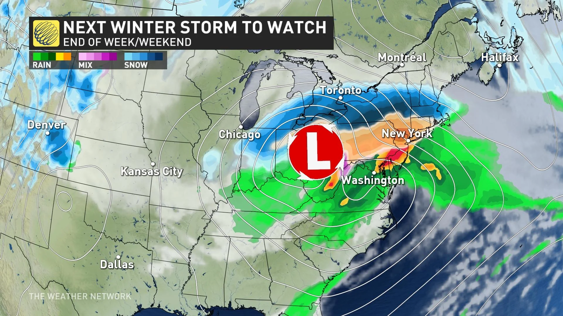
Forecasters are already eyeing another messy system with high snowfall totals expected for southern Ontario Friday and into the weekend, so check back with us on the latest forecast for the storm coming late week.
Below is just a selection of visuals from the nightmare on the roads that ensued during the Monday night and Tuesday morning commutes.


