PHOTOS: Huge hail, possible tornado reported as storms hit Ontario

Multiple rounds of severe storms hit southern Ontario on Saturday, pummeling the region with large hail, high winds, and even reports of funnel clouds
Multiple rounds of severe thunderstorms moved across southern Ontario through the day Saturday, hitting communities with large hail and high winds. We’ve even seen a few reports of funnel clouds and a possible tornado on Saturday.
Saturday’s storms hit the region in two waves. The first round of thunderstorms swept toward the Golden Horseshoe during the morning hours, bringing widespread severe thunderstorm warnings to the region.
GET THE LATEST: Tornado risk, large hail expected in southern Ontario on Saturday
Communities in the path of those early storms saw high winds, large hail, and rotation. A funnel cloud was reported north of Caledonia, and experts are surveying damage in the area to see if a tornado touched down.
Later in the day, a second round of powerful thunderstorms developed around the Barrie area and trekked toward eastern Ontario through the mid-afternoon hours.
These supercell thunderstorms took full advantage of high instability and favourable dynamics to grow into supercells, or thunderstorms with rotating updrafts. This rotation allowed the storms to produce very large hail along their path.
STAY SAFE: Don't fall victim to these seven dangerous tornado myths
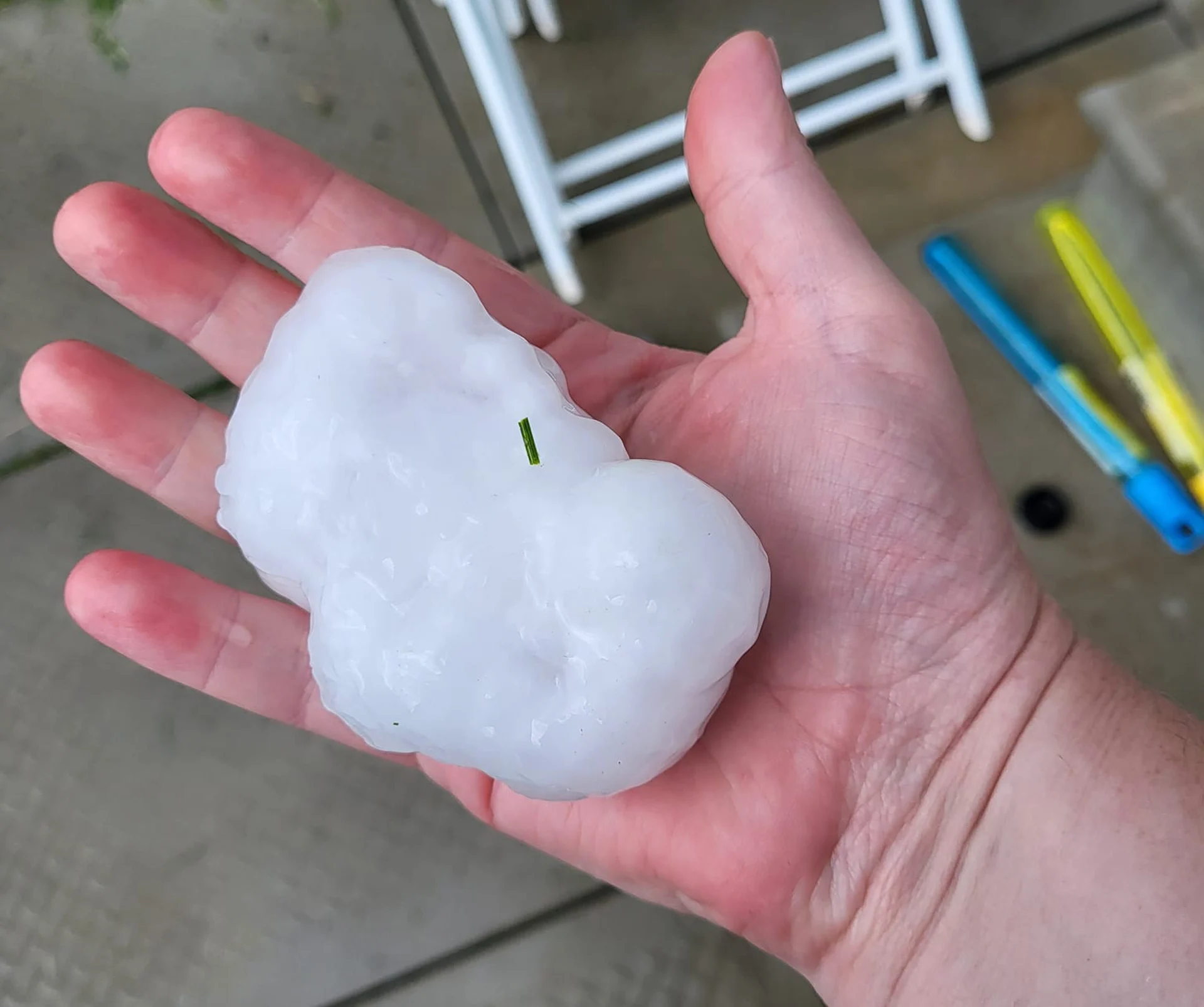
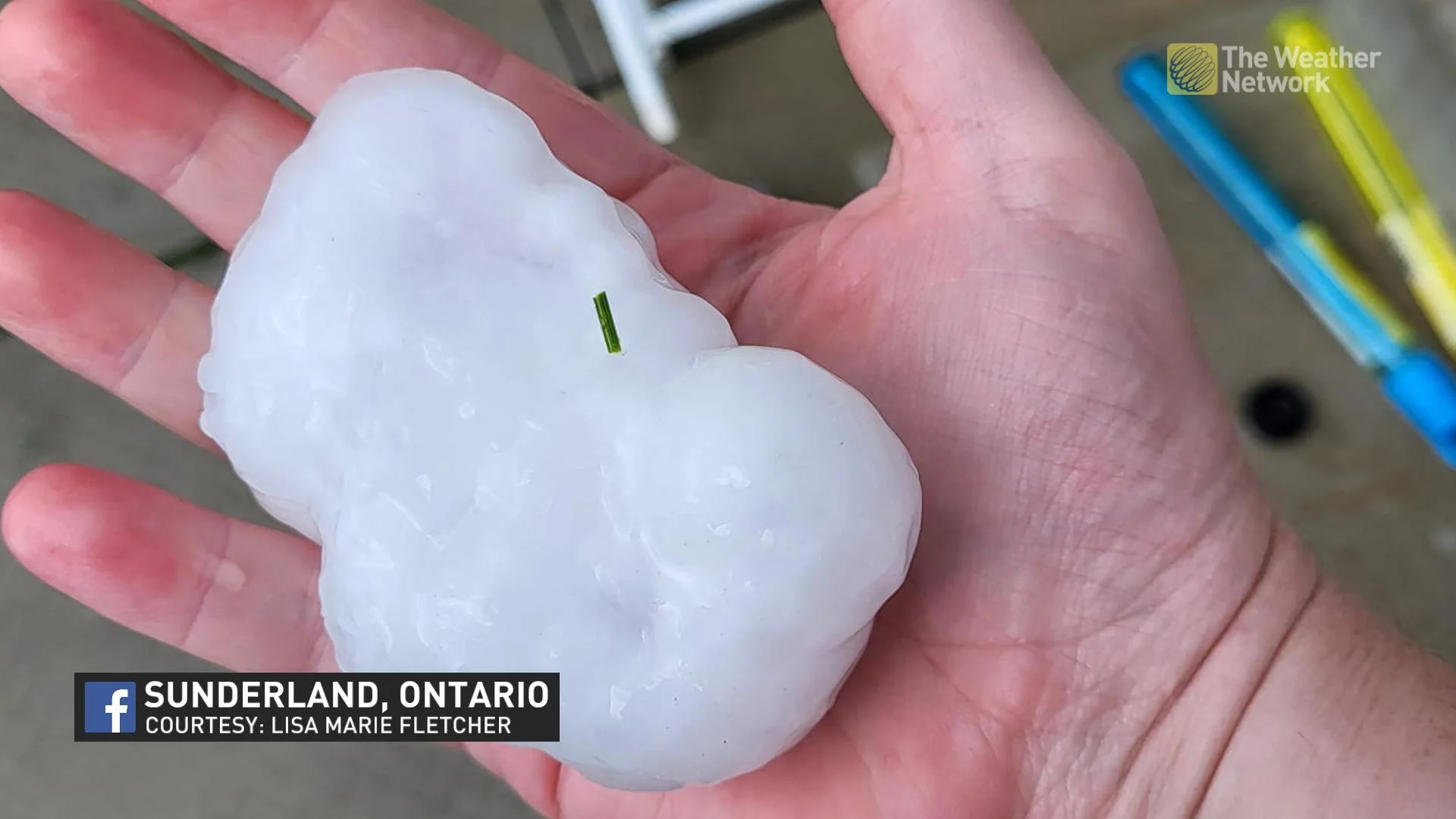
The storms may have produced a tornadic waterspout over Lake Huron near Wasaga Beach before moving into the Barrie area. Once inland, numerous reports came in throughout the Lake Simcoe area of hail the size of ping pong balls or larger. A few residents reported hail larger than golf balls.
Check out some of the scenes from Saturday's storms below:
Header image courtesy of Lisa Marie Fletcher in Sunderland, Ontario.


