Parts of B.C. grapple with hazardous air quality caused by wildfire smoke
Visit The Weather Network's wildfire hub to keep up with the latest on the active start to wildfire season across Canada.
Residents in some parts of central and northern B.C. are being warned about the extremely poor air quality caused by the smoke from wildfires burning across the region.
According to the latest data from the B.C. government on Wednesday, Prince George and Quesnel have a score of "10+" on the air quality health index (AQHI), indicating that people living there and in the surrounding areas face high health risks due to air pollution.
Williams Lake, located approximately 100 kilometres south of Quesnel, has a score of "8" on the index.
RELATED: British Columbians encouraged to reduce water use; here’s why
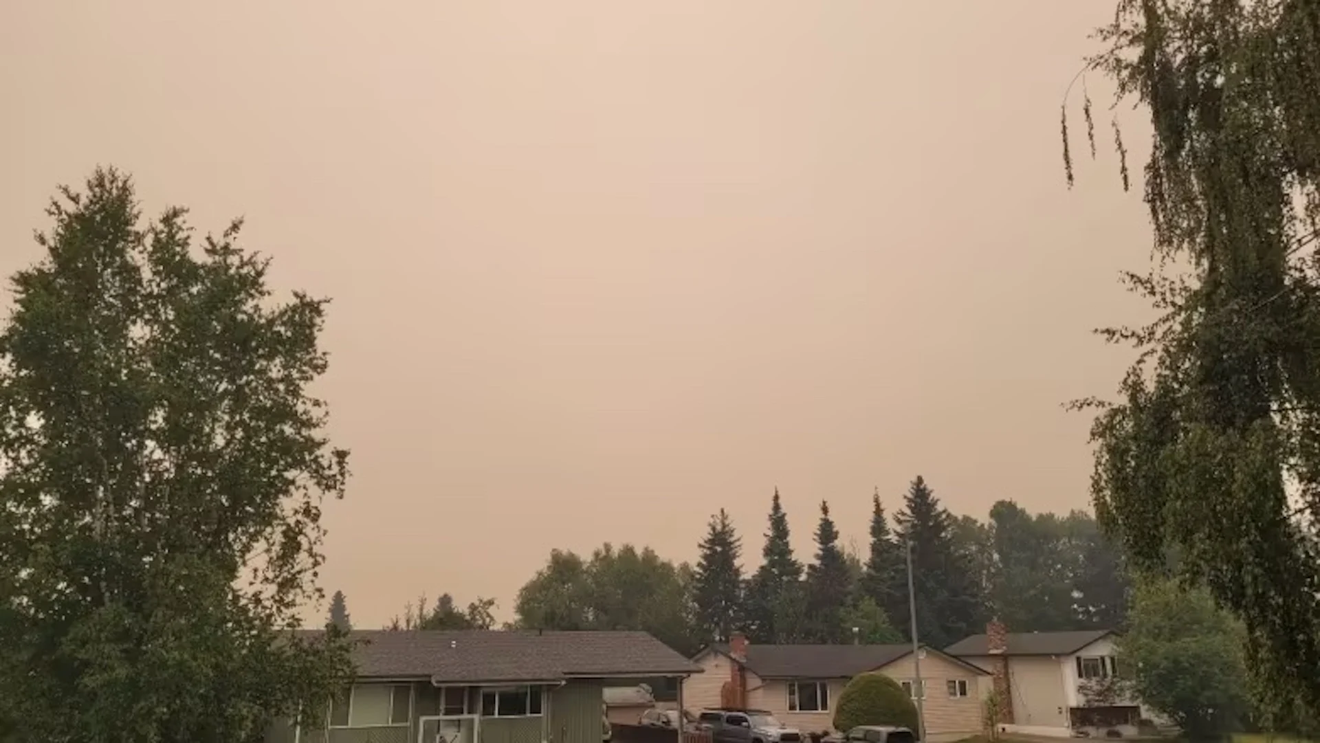
A light white ash has been seeing falling from the sky in those cities, covering cars and buildings.
Fort St. John in northeastern B.C., the closest city to the Donnie Creek wildfire, which has already burned over 580,000 hectares of land, has a score of "4" on the index.
Smithers and Terrace near the North Coast, on the other hand, both have a score of "1" on the index, despite a number of wildfires burning in northwestern B.C.
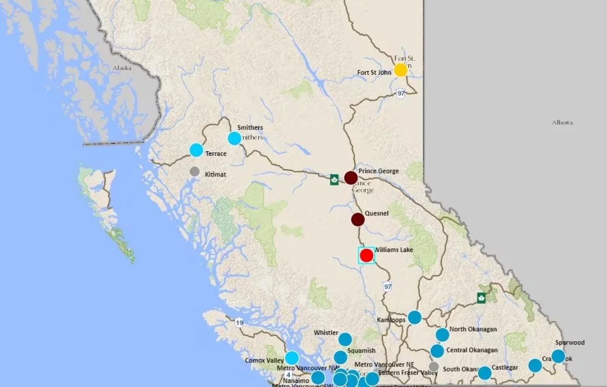
The air quality health index map compiled by the B.C. government shows dark red dots for Prince George and Quesnel, indicating scores of '10+' on the scale due to extremely poor air quality in those areas. (B.C. government)
The AQHI is an online health information communication tool developed by Health Canada. It assesses the severity of air pollution and how it can impact both the general population and at-risk groups, such as seniors, infants, and individuals with heart or lung conditions, in the short term.
The index incorporates real-time levels of three common pollutants found in Canadian air: fine particulate matter, ground-level ozone, and nitrogen dioxide.
About 300 fires currently burning in central, northern B.C.
The B.C. Wildfire Service reports that more than two-thirds of the province's approximately 330 fires are burning in central and northern B.C.
At least 12 new evacuation orders or alerts have been issued over the last day in British Columbia as lightning storms and drought conditions add to the challenge of fighting hundreds of wildfires.
Flames are not threatening any large communities, but an additional evacuation order has been issued for the fire just east of the Village of Burns Lake, and evacuations are also posted for a number of properties outside Houston.

Fires of note across British Columbia on July 11. (CBC)
In its air quality advisory on Tuesday, the British Columbia government emphasized that individuals with pre-existing health conditions, respiratory infections, seniors, children and pregnant people are more susceptible to the adverse effects of poor air quality.
The province recommends that the vulnerable population follow these guidelines:
Reduce or cease physical activity if experiencing difficulty in breathing.
Stay cool and stay hydrated by drinking plenty of water.
Always carry any necessary rescue medications with you.
WATCH: What exactly is in wildfire smoke, and how can we protect ourselves?
Thumbnail courtesy of Andrew Kurjata/CBC.
The story was written and published for CBC News. It contains files from The Canadian Press.