Ottawa River flooding forcing some Gatineau residents from homes
THE LATEST:
Water levels on the Ottawa River continue to stabilize between Gatineau and Carillon, Que., according to Wednesday afternoon's update from the Ottawa River Regulation Planning Board.
Levels have stabilized between Pembroke and Lake Deschenes in west Ottawa.
Several hundred buildings in Gatineau are at risk of flooding, while 13 roads are only accessible by boat.
The City of Gatineau has opened a support centre at 850 boulevard de la Gappe.
As the Ottawa River flood waters generally stabilize, one of the major cities along its shoreline says some residents have left their homes and many more have registered with the Red Cross for help.
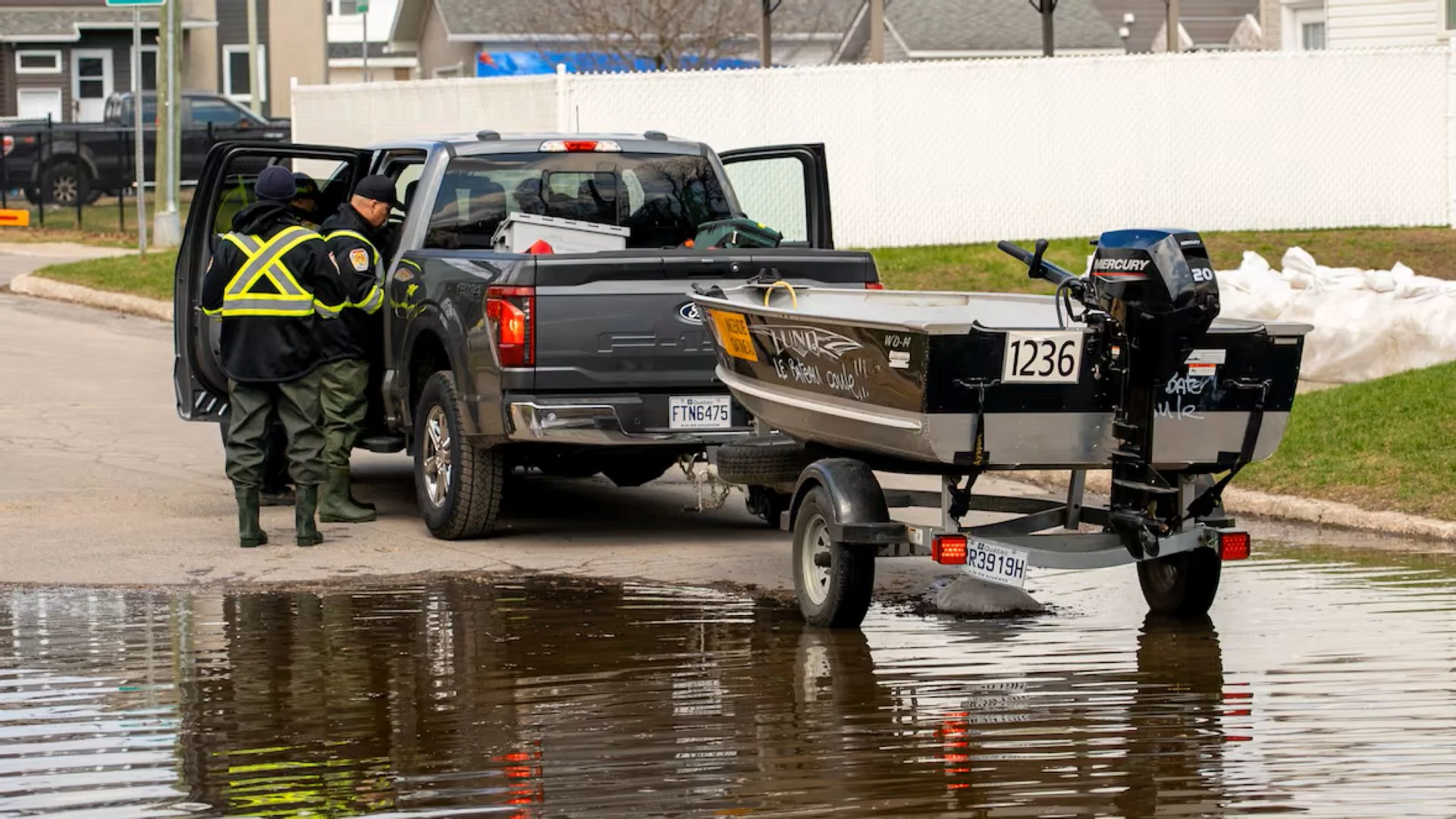
Officials in Gatineau, Que., said Wednesday that a dozen residents had voluntarily been evacuated, while more than 100 had requested services from the Red Cross.
Nearly 200 buildings have flooded, the city said, and about 300 more are at risk.
Thirteen of the city's roadways between Pointe-Gatineau and Buckingham are now accessible only by boat, they added.
Anyone who wants help leaving a flooded home should call 311 to reach the city, which can then send firefighters in either a truck or boat. A support centre remains open at the sports complex at 850 boulevard de la Gappe, officials said.
Sandbag stations remain in the hardest hit area, and the city is also setting up waste containers there.

Firefighters in Gatineau, Que., are seen near one of their boats in the boulevard Hurtubise area near the Ottawa River on Tuesday. (Jason MacLellan/CBC)
Traversiers Bourbonnais, the ferry between Gatineau's Masson-Angers area and Cumberland in east Ottawa, suspended operations Tuesday evening because of the river's rapid rise.
The Ecolos ferry between Clarence-Rockland, Ont., and Thurso, Que., is also closed.
The City of Ottawa lists 11 road closures and 15 sandbag stations as part of its flooding response, which is concentrated in Constance Bay, Cumberland, Fitzroy Harbour and Orléans.
Other municipalities along the river, such as Whitewater Region, Ont., and Fort-Coulonge., Que., are also supporting flood-affected people and places.
Residents should check with their specific municipalities for more details.
Below 2023 levels
It's now the fourth big spring flood along the Ottawa River over the last 10 years, with previous flooding in 2017, 2019 and 2023.
The spring of 2019 set high-water records from the Pembroke area to the Britannia area west of downtown Ottawa.
Hull in downtown Gatineau and Thurso, Que., experieced record peaks in 2017.

This drone photo, taken Wednesday by CBC, captures flooding in the area of Avenue des Tourterelles along the north Ottawa River shore, west of Gatineau, Que. (Félix Desroches/CBC)
It's likely little solace to people either leaving or working furiously to protect their homes or businesses, but the Ottawa River Regulation Planning Board that manages and monitors its waters said levels are expected to crest, for now, just below levels seen in 2023.
The board said in its Wednesday update that water levels and flows are stabilizing between Gatineau and Carillon, Que., at levels roughly five to 15 centimetres below peaks seen three years ago.
"With moderate temperatures forecast and no major precipitation expected in the next few days, spring runoff from the central unregulated portion of the basin is expected to gradually decrease over the coming week," the board said.
While water levels and flows from Pembroke to the edge of Ottawa have stabilized, they are expected to still keep increasing upstream from Pembroke, the board said.
New flood warning
Outside of the Ottawa River, the Mississippi Valley Conservation Authority upgraded a flood watch to a flood warning for Dalhousie Lake and flood-prone areas of the river on Wednesday.
That means flooding is happening or likely about to happen in those areas. People should take precautions like checking sump pumps and moving valuables from basements, the authority said.
None of eastern Ontario's five other conservation authorities, nor the area further north watched by the Ministry of Natural Resources, have a flood warning connected to the situation on the Ottawa River.
Quebec's flood map mentions moderate flooding, which means a risk of evacuations and sewer backups, on the Petite Nation River near Ripon and the Coulonge River in Mansfield-et-Pontefract.
Thumbnail courtesy of Jason MacLellan/CBC.
The story was originally written by and published for CBC News.