Ottawa River flood watch: Here's the latest
Water levels and flows along the main stem of the Ottawa River continue to rise slowly from Mattawa to Pembroke, while they are stable or slightly declining between Lake Coulonge and Carillon, according to the latest update from the Ottawa River Regulation Planning Board.
In Mattawa, water levels are expected to exceed the major flood level, the board's Wednesday update added.
Snowmelt is increasing in the northern part of the basin, sending more spring runoff downstream.
RELATED: Tips to stay safe during a flash flood as peak season draws near
"The rainfall that began [Tuesday] is leading to increased runoff from the northern and central parts of the basin, with volumes depending on how much additional rain falls and where," the board stated. "This is expected to lead to water levels and flows increasing gradually in all locations over the next few days."
In the longer term, a second flood peak from Pembroke to Montreal remains "possible" in the coming weeks.
More rain on the way
Ottawa-Gatineau has remained under a moderate rainfall warning throughout Wednesday, with up 50 millimetres of rain expected in the evening.
Environment Canada says the heavy rain is caused by a low-pressure weather system that might create pools of water in low-lying areas.
"The ground, which is already nearly saturated, will have a reduced ability to absorb more rain," the weather agency warned.

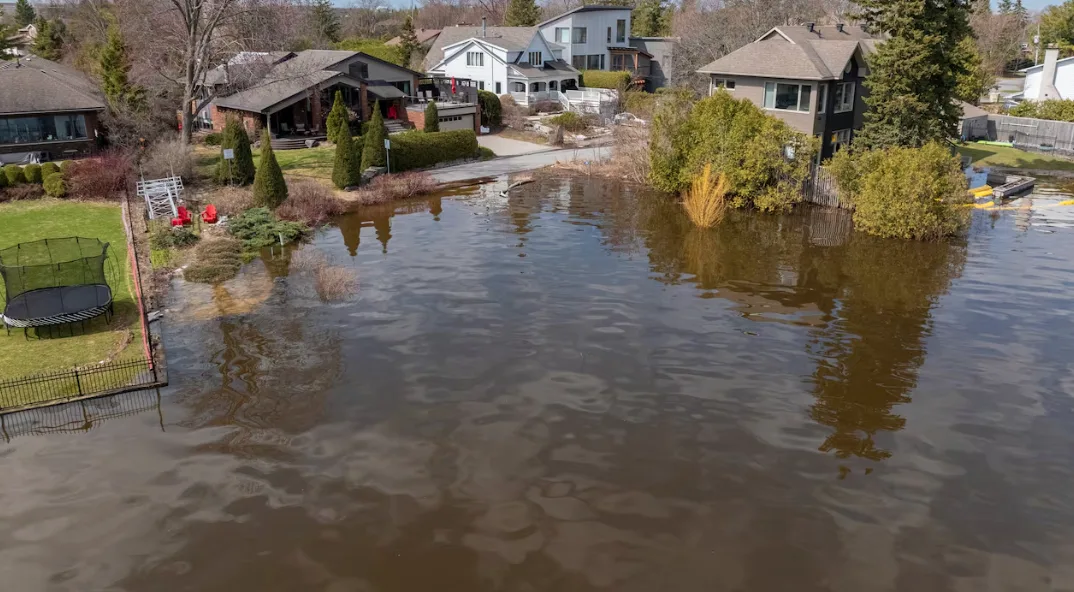
Some homes have been able to escape rising water levels along the Ottawa River, while others have seen water creep up to their yards and homes. This image was taken on April 22, 2026. (Félix Desroches/CBC)
What you need to know
In Ottawa, there were 15 locations as of Wednesday afternoon where residents could pick up sand and sandbags.
The city keeps an updated list of road and pathway closures in addition to the NCC's interactive map.
The City of Gatineau also has an interactive road closure map that lays out sandbag stations and waste drop-off locations in the hardest-hit areas.
Several dozen roads have been affected by flooding, some of which are only accessible by boat. City officials have suggested some roads could soon be reopened to local traffic.
A flood relief centre is open at the Centre sportif de Gatineau at 850 boulevard de la Gappe from 10 a.m. to 6 p.m. daily and there are showers available at the Lucien-Houle and Paul-Pelletier pools.
The Ecolos ferry between Clarence-Rockland, Ont., and Thurso, Que., remains closed and there are restrictions on the Bourbonnais ferry between Gatineau's Masson-Angers area and Cumberland in east Ottawa.
People living in communities outside Ottawa-Gatineau can check their municipality's website for the latest on flooding in their area.
Aside from the Ottawa River, the Mississippi Valley Conservation Authority has downgraded its flood warning to a flood watch for Dalhousie Lake and flood-prone areas of the Mississippi River.
WATCH BELOW: Three tips to protect against flooded basement damage
This article, written by Justin Ball, was originally published for CBC News