How Ontario saw simultaneous October tornado warning and frost alert

We explain the atypical weather event that took place in Ontario on Friday: A tornado warning was issued in close proximity to a frost advisory. Learn about the specific, atmospheric conditions required for such an occurrence in the fall.
A tornado warning and a frost advisory were in effect concurrently in Ontario on Friday, Oct. 9, with the former alert catching many off guard.
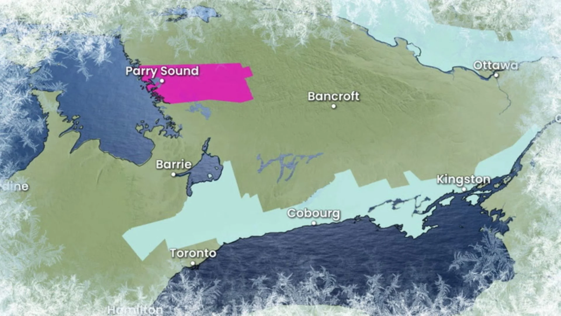
The alerts weren't too far apart, either, with a tornado warning in effect east of Georgian Bay and the frost advisory lining parts of the Greater Toronto Area (GTA) and extending as far north as the shores of southeastern Lake Simcoe.
"Yeah, it's a little weird, a little bit unusual, but not unheard of," said Mark Robinson, Storm Hunter and meteorologist at The Weather Network.
Because fall and spring are known as shoulder seasons, with the right parameters, you can get severe thunderstorms and tornadoes, Robinson said.
With the right amount of wind shear and heat, "everything is balanced" so you can get them, he added.
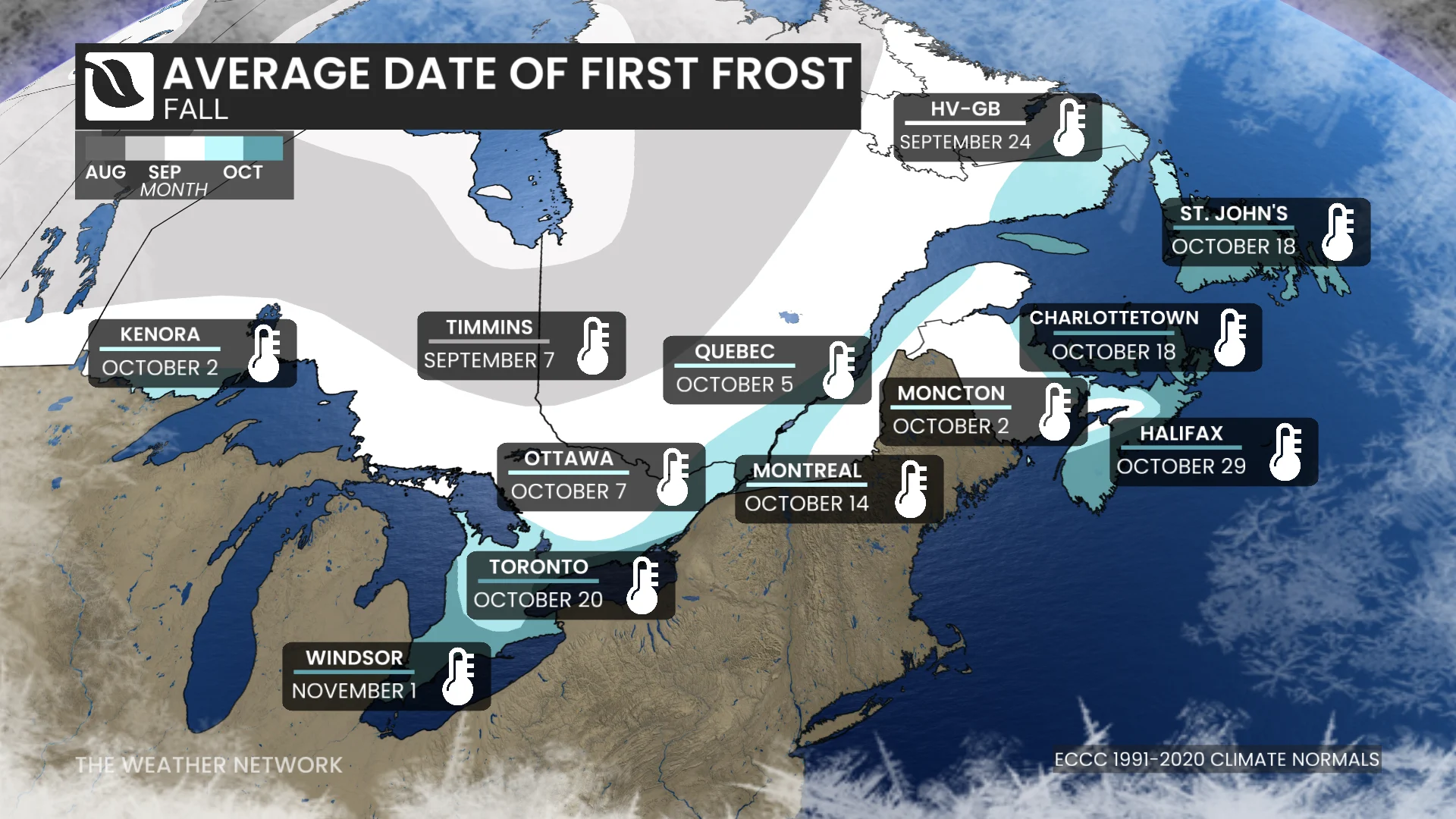
And typically, frost does occur in the fall under the right conditions. In Ontario, the average occurrence of the first frost will vary, as outlined in the graphic above.
What led to the tornado warning?
Daytime heating and a lakeside boundary gave way to the development of isolated supercells off of Georgian Bay in northeastern Ontario on Friday.
Despite not being a very unstable environment, the combination of the daytime heating and the change in wind direction caused some storms to become severe in nature, with wind shear raising the threat of a tornado.

Not a current warning. A snapshot of the tornado warning that was issued on Friday, Oct. 9, in Ontario. (The Weather Network)
"These are what we call low-topped supercells. These are not the cells that are 60,000 feet tall and spinning up gigantic tornadoes," said Robinson.
"They do have that spin. [If] there is just enough shear in the atmosphere to kick them off to get those storms spinning a little bit, the dynamics are there. The heat isn't quite there, but everything else is sort of in place for it."
In addition to the tornado warning, there was a confirmed waterspout on Georgian Bay, near Christian Island. No damage was reported.
While tornado season typically winds down by the end of September, it has been a highly active year across Canada for severe weather, and above-seasonal temperatures may help extend the storm season slightly.
While October doesn't often tend to generate many tornadoes, they can and have occurred during the month.
For example, there have been five tornadoes over land in October in Ontario since 2017.
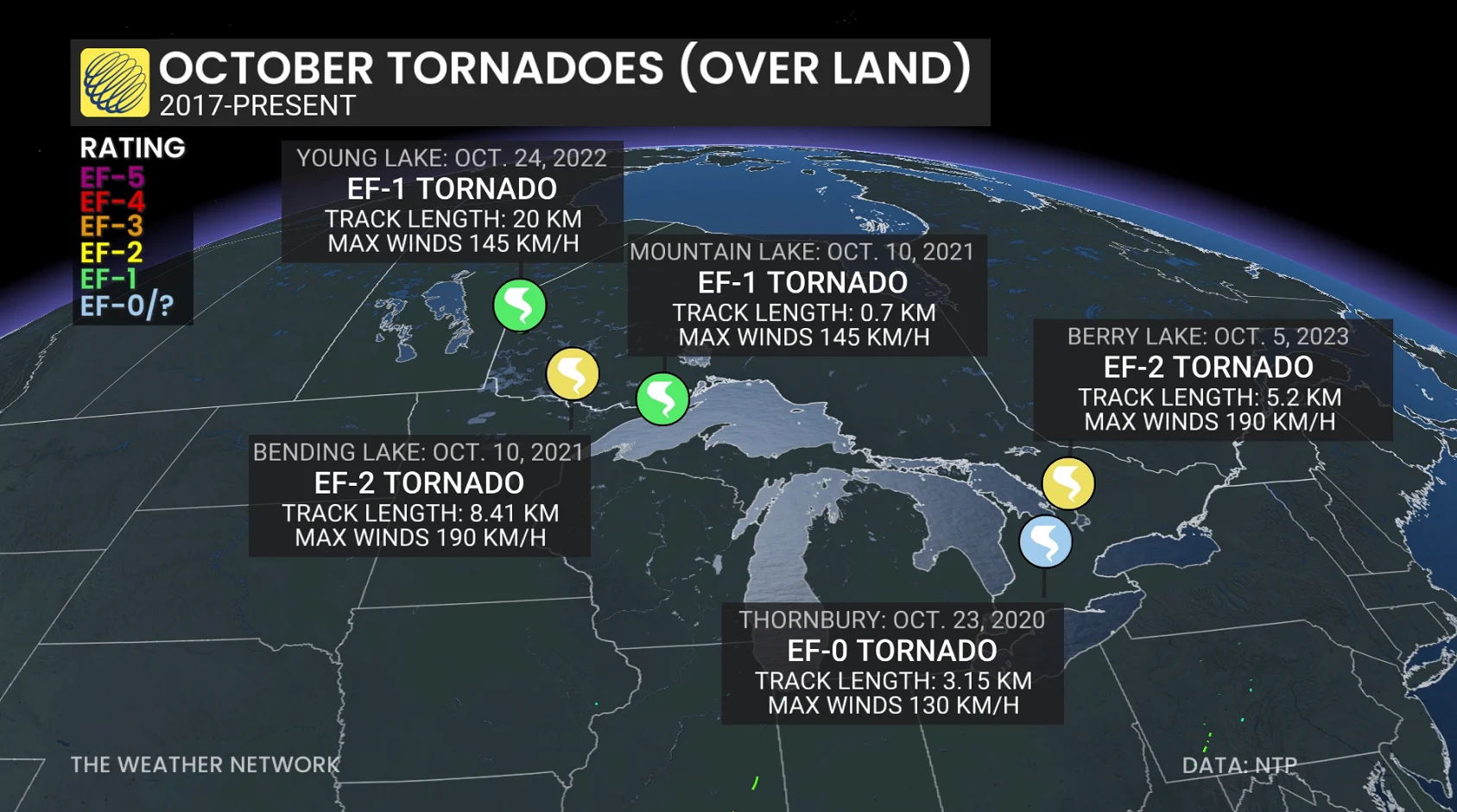
The strongest were rated EF-2 on the Enhanced Fujita scale.
Bending Lake, Ont: Oct. 10, 2021: Maximum winds of 190 km/h
Berry Lake, Ont.: Oct. 5, 2023: Maimum winds of 190 km/h (the most recent tornado over land in October)
In fact, even November tornadoes aren't that out of the ordinary, with multiple, notable events happening in Ontario over the years.
Three tornadoes over land have occurred in the province in November, with the strongest-rated twister an EF-1 in the Georgetown, Ont., area on Nov. 15, 2020.
"Yes, you can see a frost warning and a tornado warning that are that close to one another in Ontario in the fall," said Robinson.
With files from Tyler Hamilton, a meteorologist at The Weather Network.