Historic rains produce catastrophic, deadly flooding in Tennessee

Heavy thunderstorms produced as much as 432 mm of rain west of Nashville, Tennessee, on Saturday, likely shattering the state’s one-day rainfall record, according to the U.S. National Weather Service.
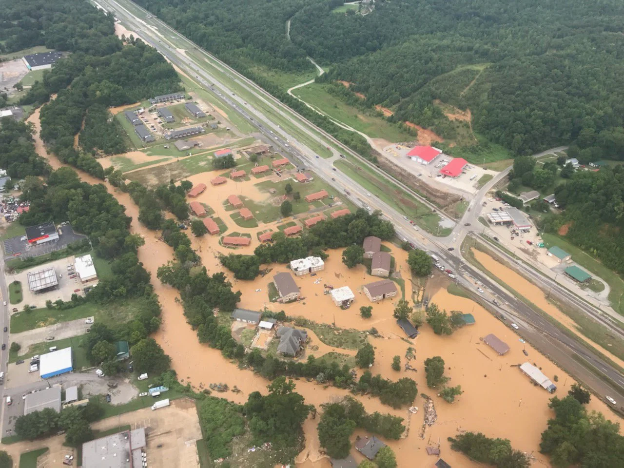
Catastrophic flash flooding swept through some communities west of Nashville, Tennessee, on Saturday, after thunderstorms produced more than 430 mm of rain in just one day. The floods reportedly killed more than 20 people and left dozens more missing.
HISTORIC ONE-DAY RAINFALL TOTALS
Persistent thunderstorms on Saturday produced intense rainfall rates across Humphreys, Dickson, Houston, and Hickman Counties in west-central Tennessee. Widespread rainfall totals greater than 200 mm were reported across the region, with even higher amounts in some spots.

The U.S. National Weather Service (NWS) office in Nashville, Tenn., reported that the town of McEwen, located in Humphreys County about 80 km west of Nashville, recorded 432.3 mm (17.02 in) of rain on Saturday.
The NWS tweeted that this would be the highest one-day rainfall total ever reported in the state. The preliminary measurement in McEwen would surpass the state’s previous 24-hour rainfall record of about 345 mm (13.60 in) set back in September 1982.

A river gauge for the Piney River near Vernon, Tennessee, showed a spike in river levels after unprecedented rain fell over central Tennessee on August 21, 2021. (Graph by NOAA/USGS)
A flood gauge on the Piney River just south of Humphreys County recorded the enormous influx of water as thunderstorms raged over the area.
The river’s level surged from 1.3 m (4.3 ft) at 5:15 a.m. CDT to a historic crest of 9.69 m (31.8 ft) six hours later, according to data collected by the U.S. Geological Survey.
Saturday’s deluge in central Tennessee was the result of training thunderstorms, or storms that redevelop one after another, moving over the same communities for hours at a time like train cars on railroad tracks.
These training thunderstorms tapped into a deep reserve of tropical moisture over the southeastern United States, allowing the storms to produce unprecedented rainfall rates and catastrophic flash flooding as they moved through the region.
WATCH NOW: STREET TURNS INTO A RIVER DURING EXTREME FLOODING IN TENNESSEE
FLOODS KILL MORE THAN 20 PEOPLE
Floods hit the towns of McEwen and nearby Waverly particularly hard. Excess runoff overwhelmed drainage systems and surged local waterways out of their banks, sending a rush of floodwaters through streets and neighbourhoods throughout the region.
Officials said that the floods killed at least 21 people and left dozens more missing, according to a report by The Tennessean on Sunday afternoon.
Photographs on social media showed widespread destruction in areas hit hardest by the floods. The flash floods inundated homes, washed away roads, and tossed cars downstream with little effort. Swift currents left behind large piles of debris, the rubble of homes and businesses swept away by the raging waters.
Thumbnail from the Nashville, Tenn. Fire Department via Twitter.