Flooding, mudslides force highway closures across B.C.’s Interior

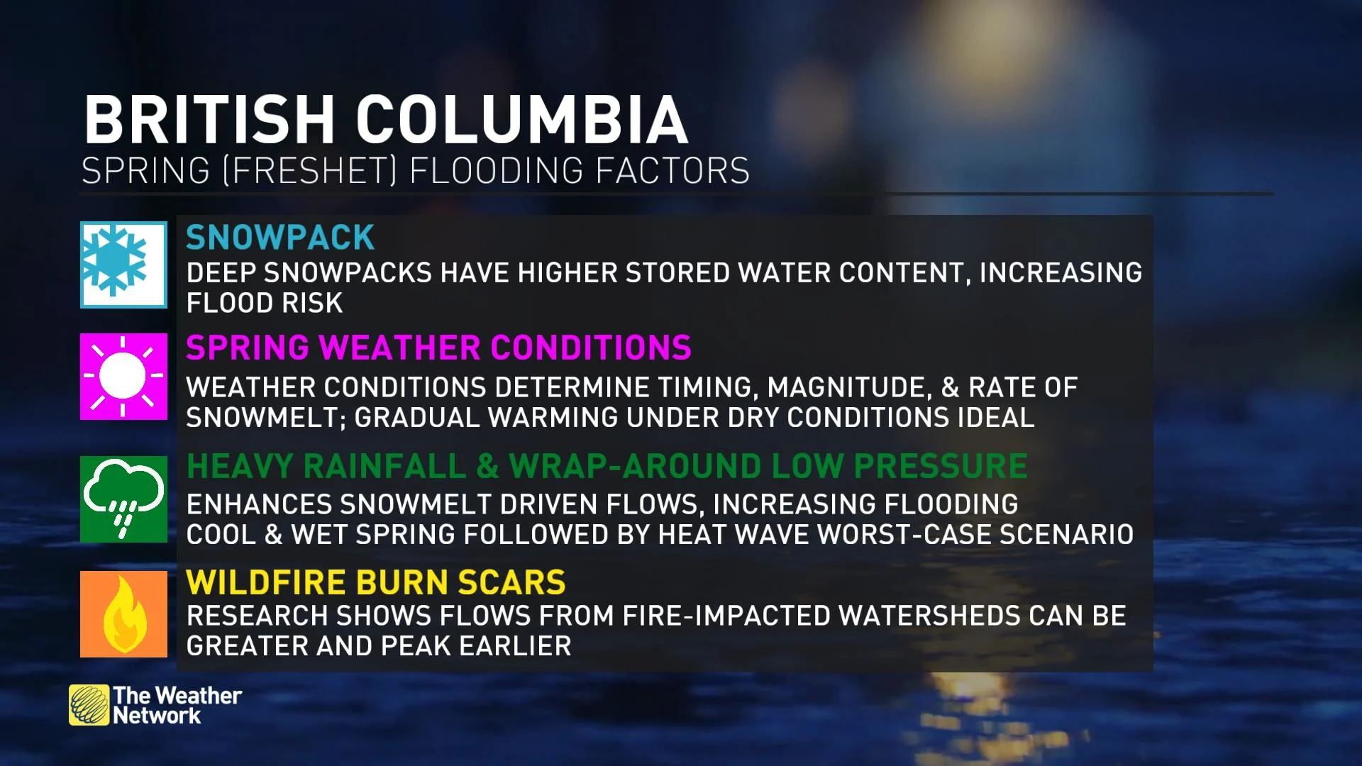
A rapid snowmelt underway across B.C. forced the closure of multiple highways across parts of the Interior this week
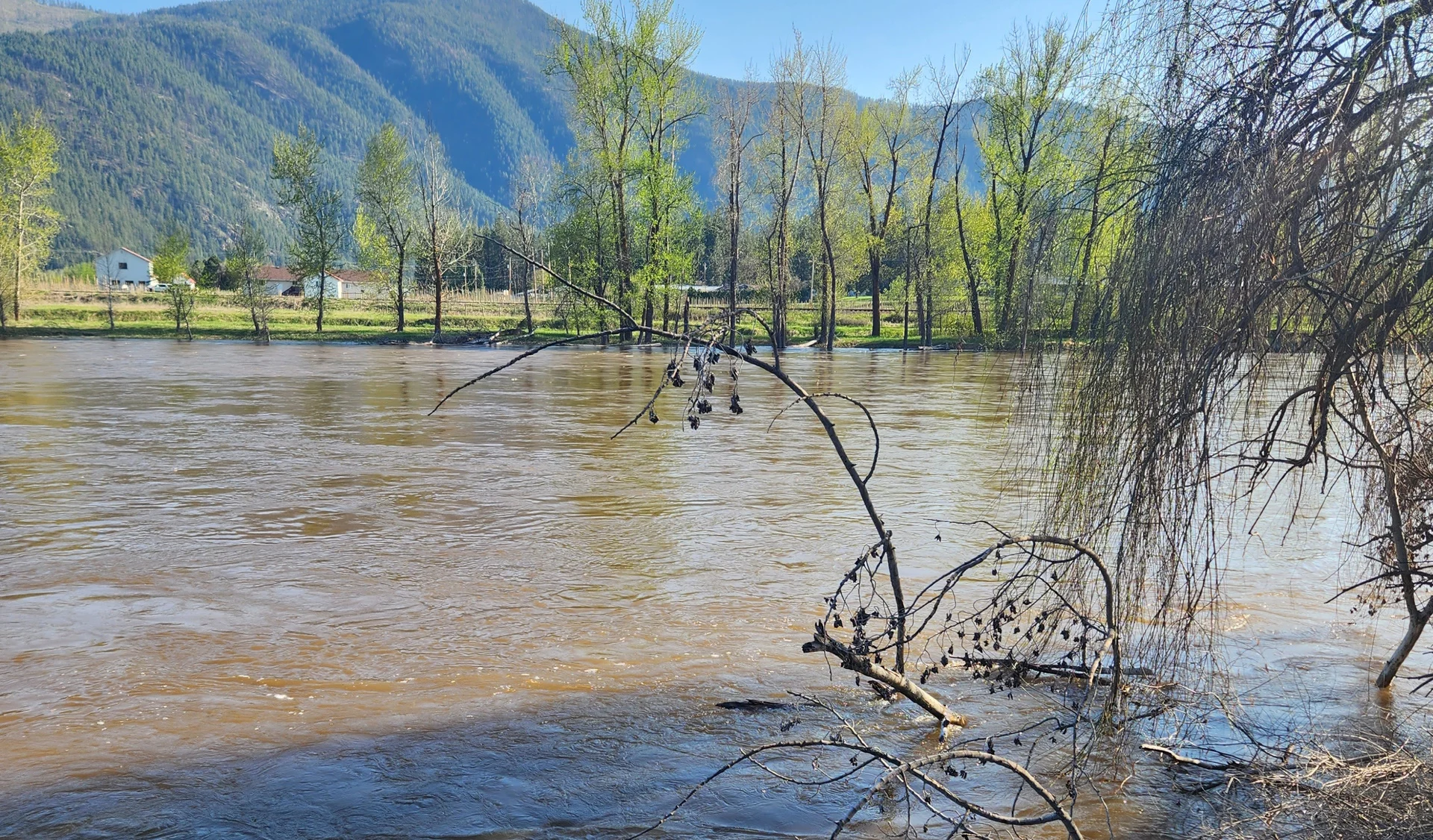
Sunny skies and warm temperatures accelerated the ongoing spring snowmelt in British Columbia, forcing the closure of multiple highways throughout the province’s Interior region as a result of rising floodwaters.
Continued snowmelt triggered by the unseasonable warmth, followed closely by a wet weekend ahead, will make the flooding worse for vulnerable locations, with provincial officials expecting more impacts in the coming days.
DON’T MISS: Evacuation order, alerts remain in place after landslide in Vallican, B.C.
Widespread flood watches, warnings throughout B.C.
A bevy of flood alerts are in effect up and down B.C.’s Interior as the province ended April and started May on a toasty note.

Snowmelt from the summer-like warmth prompted high streamflow advisories as far north as the Stikine Plateau, with flood watches blanketing the southern Interior down to the international border.
Flood warnings are in effect for both a section of the Thompson River basin and the Boundary region.
“Severe flooding may be possible in areas that receive high rainfall amounts,” the B.C. River Forecast Centre said in its flood warning for the Boundary region.
Disruptive road closures continue in B.C. Interior
Significant road closures remain in effect around Cache Creek, a few kilometres west of Kamloops in the Cariboo Region.
Flooding prompted the closure of Highway 1 and Highway 97 around Cache Creek, with lengthy detours in effect for both northbound and southbound travellers passing through the region.
GET PREPARED: Six tips to manage flooding
Northbound travellers are advised to take Highway 97C to Highway 5, while southbound drivers should take Highway 24 to Highway 5, according to DriveBC. Given the rugged terrain and relatively sparse road network in the region, these are both long detours.
Farther south near the international border, a 65-km stretch of Highway 3 between Highway 6 and Creston remained closed Thursday due to a mudslide that covered the highway.
Flooding shuttered another section of Highway 3 between Castlegar and Highway 3B. An update from DriveBC showed an estimated time of reopening around 5:00 p.m. local time Thursday.
Additional flooding expected through the weekend
The current flooding situation across B.C.’s Interior will get worse before it gets better.
An impending pattern change will put an end to the summer-like warmth we’ve seen across the province recently, allowing cooler and wetter conditions to take hold for the first weekend of May.

GET THE LATEST: From thunderstorms to snow, spring snaps back into reality across B.C.
While the cooler temperatures will help stem the rate of the snowmelt, precipitation could contribute further to rising waters throughout the region.
“Moderate flooding is likely in Grand Forks starting on Friday,” B.C.’s Ministry of Emergency Management and Climate Readiness said in a statement on Wednesday.
“Into the weekend, significant flood hazard is expected throughout small and medium-sized watersheds in the Central Interior, Okanagan, Boundary and Southern Kootenays,” the ministry added.
Thumbnail image of the Kettle River courtesy of Christina.