Flooding, high winds hit Southern California as Kay skirts region

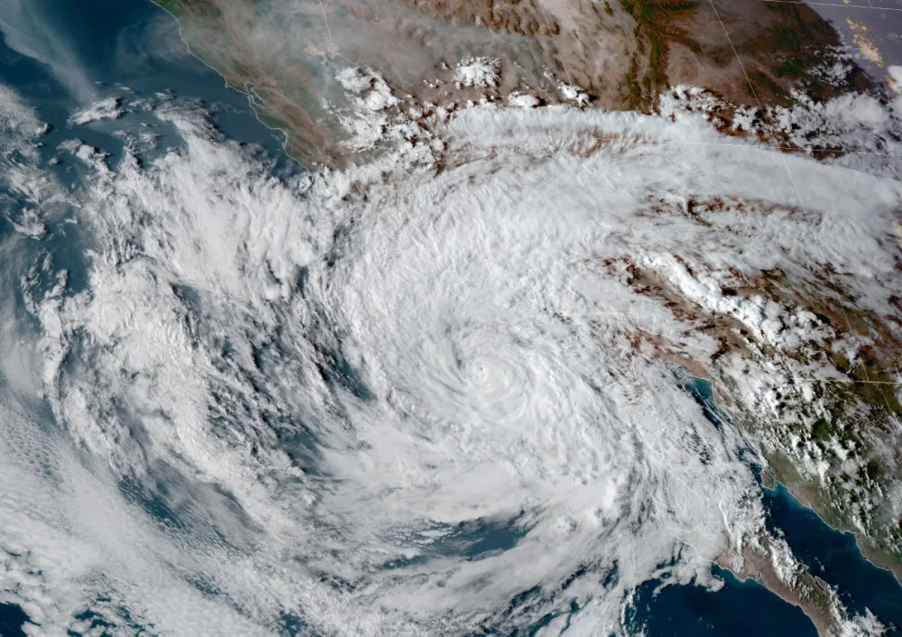
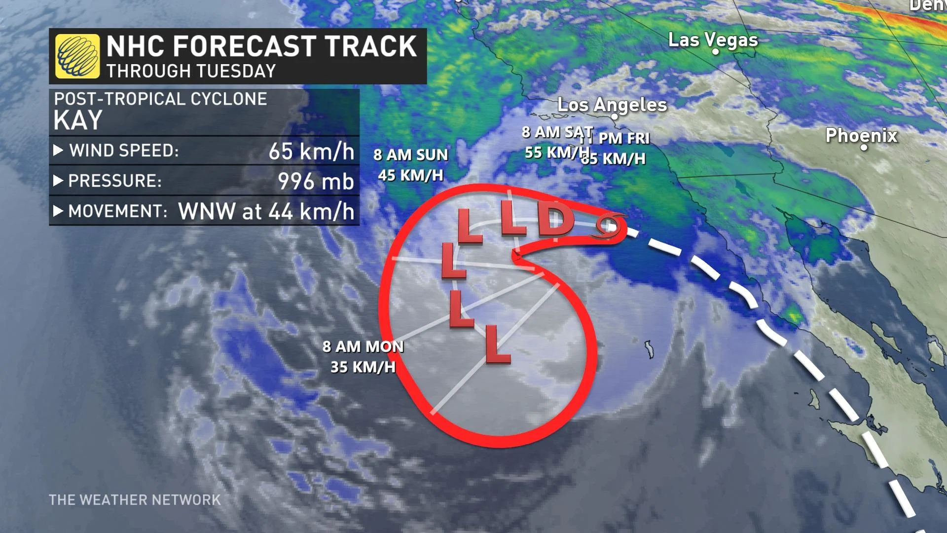
Now a post-tropical cyclone, Kay is close enough to Southern California to bring the region a risk for flash flooding, mudslides, and damaging winds through the weekend.
A dangerous situation will continue through the weekend as flooding rains and gusty winds from what used to be Tropical Storm Kay spread over Southern California, a part of the world certainly not accustomed to this kind of weather.
Post-tropical cyclone Kay is a rare system that survived its trek up Mexico’s Baja Peninsula, bringing the storm within a stone’s throw of the U.S.-Mexico border.
While the storm won’t make direct landfall in California, the system’s heavy rains and strong winds are buffeting the region.
DON’T MISS: California avoids power outages, conservation still needed in heat wave
Heavy rain and high winds hit typically tranquil Southern California
Coastal areas, including the Los Angeles and San Diego metro regions, could see 25-35 mm of rain through Sunday as the surge of tropical moisture washes over the southern half of the state.
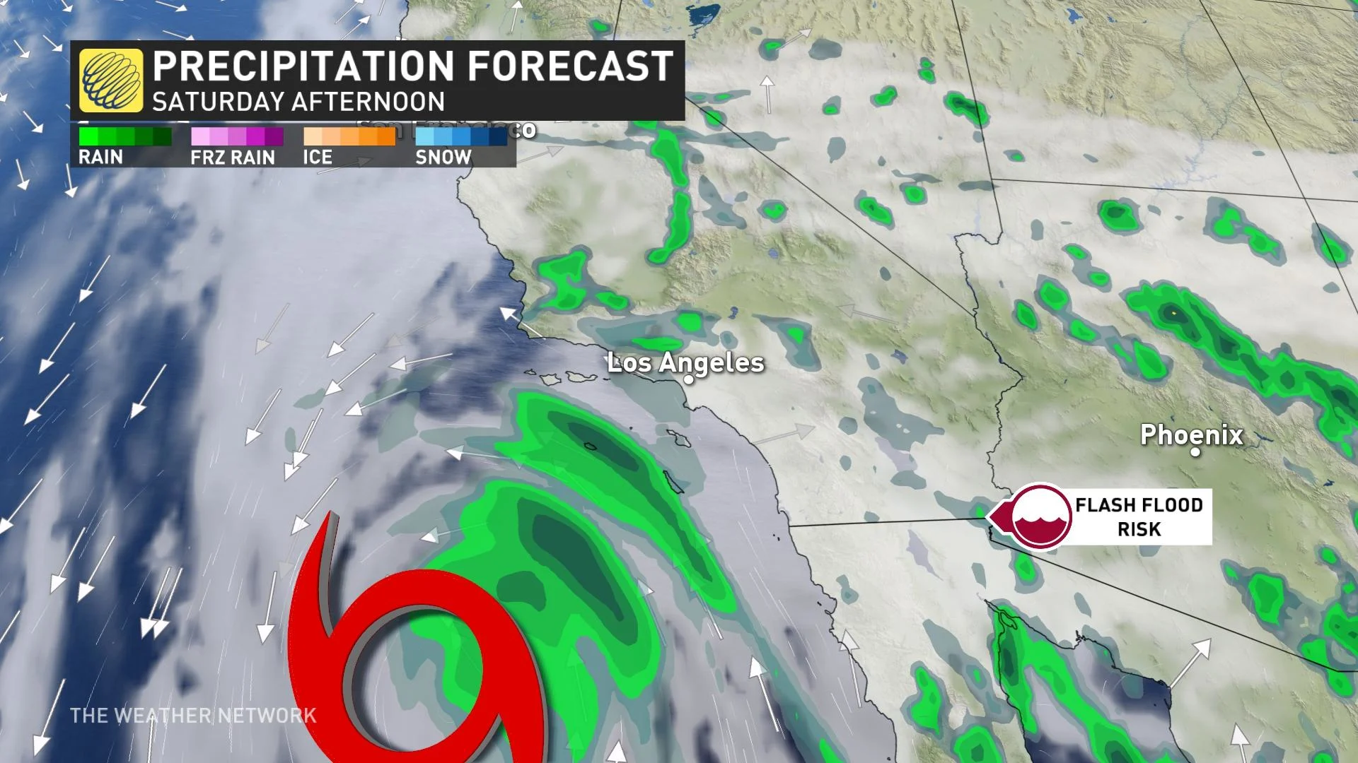
25-35 mm may not sound like much, but it’s a significant amount of rain in Southern California, especially around this time of year.
Southern California’s wet season lasts from late fall through early spring. Ninety-six per cent of all of downtown Los Angeles’ annual rainfall occurs between Oct. 1 and April 30, with that remaining four per cent -- accounting for just 14 mm of the city’s annual rainfall of about 361 mm that falls between the late spring and early autumn.
Rain is a big deal to begin with in this region, but a solid thump of tropical rainfall can cause a slew of problems that folks back east don’t have to deal with. Even relatively small amounts of rain can lead to mudslides and rockslides, especially around burn scars, as well as flash flooding across inland sections due to the impermeable desert soils.
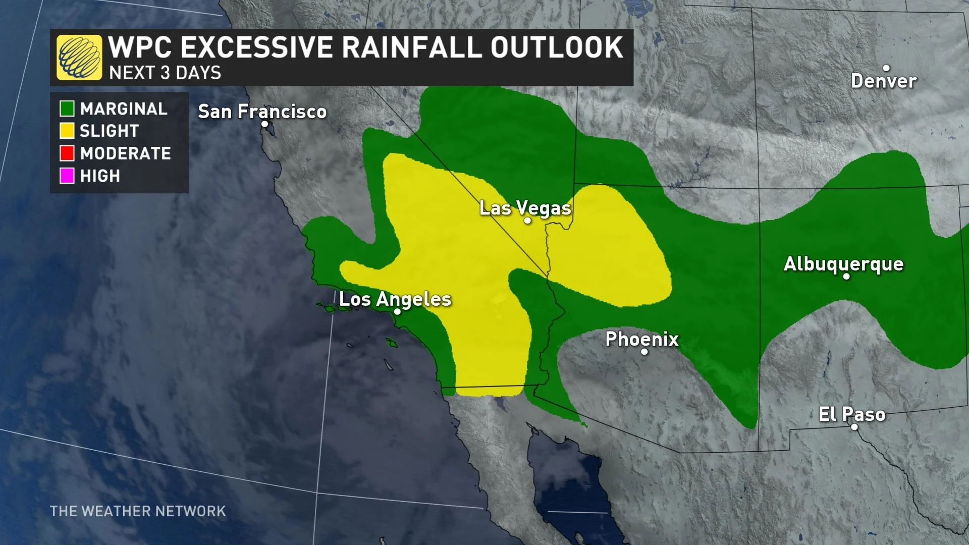
The situation is downright dangerous farther inland, where the mountains east of San Diego could see 50-100 mm of rain through this weekend, with isolated pockets of up to 150 mm possible. This could affect travel along interstates 8 and 10, both heavily travelled routes that connect Southern California with the rest of the desert southwest.
Heavy rain isn’t the only threat with post-tropical cyclone Kay. Strong winds accompanied the system’s downpours as it skirted the region.
Widespread gusts of 50+ km/h occurred throughout the day on Friday, with numerous reports of downed trees and power lines throughout Southern California.
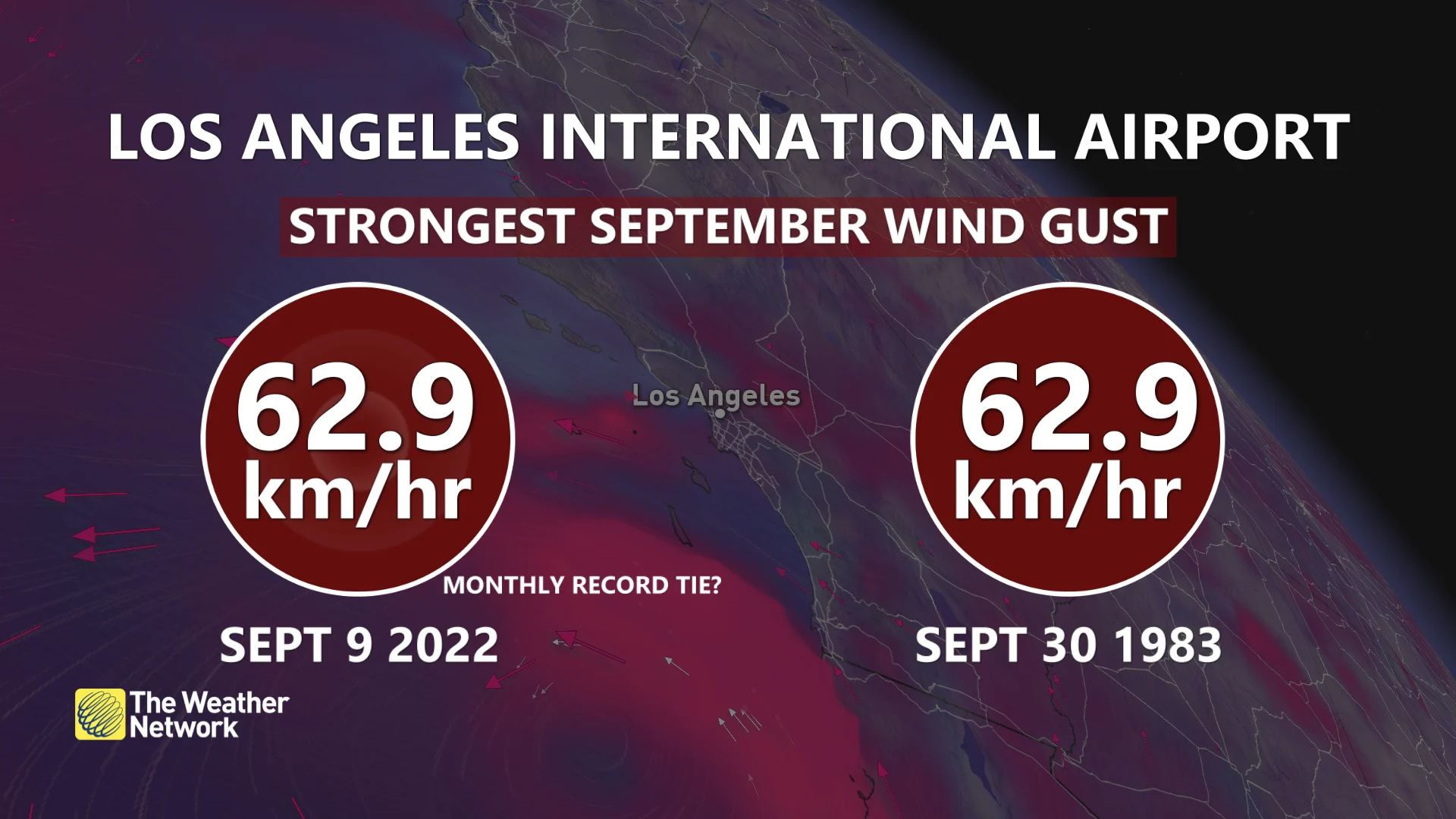
A 63 km/h wind gust at the Los Angeles International Airport tied the all-time strongest gust ever recorded there during the month of September. The highest gust so far was a whopping 175 km/h gust on Cuyamaca Peak, a 2000-metre mountain that stands east of San Diego.
WATCH: Searing heat wave shatters records from Saskatchewan to California
Tropical storms are extremely rare in California
Kay is among a rare handful of storms on record to come close to Southern California. Sea surface temperatures off the California coast are far too cold for tropical cyclones to survive. These chilly waters force storms to rapidly weaken long before they reach the state.
Even the mere remnants of tropical storms have a tough time reaching California. The remnants of storms that track over the Baja Peninsula typically curve northeast toward Arizona and New Mexico.
MUST READ: Disastrous megaflood could cause historic damage in California, study warns
NOAA’s hurricane database shows that only five tropical storms have come within 250 km of San Diego since 1949. The most recent storm to reach California as an intact tropical storm was 1997’s Nora, which came inland from the Gulf of California and rolled across the Sonoran Desert near the Arizona border.
Only one tropical storm in the past century has made a direct landfall in California. An unnamed storm in 1939 brought gusty winds and heavy rain when it came ashore north of Los Angeles. A fast-moving hurricane grazed San Diego in 1858 and caused widespread damage as its high winds raked the area.
Thumbnail courtesy of NOAA.