Some roads closed as water continues to rise in multiple N.B. communities
The lower Saint John River continues to rise and Fredericton firefighters have started going door to door in areas that often get hit by flooding to check in with residents.
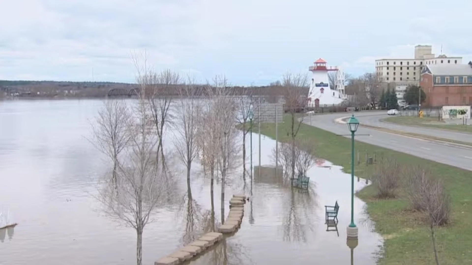
The river breached its banks in Fredericton, Gagetown and Hartland as of Wednesday morning. And as of 2:30 p.m., Maugerville was slightly above flood stage, a day earlier than predicted.
Dwayne Killingbeck, the Fredericton fire chief and director of the city's Emergency Measures Organization, said water levels should be at a peak in the city for the next couple of days, and then start to subside over the weekend.
DON'T MISS: Uncertainty swirls around 2023 hurricane season as El Niño looms
He advised people to be careful by the shore because the water is moving faster than normal and there's floating debris.
In the Waterloo Row area near the downtown, Killingbeck said there are berms in place to slow overland flooding, but he said if the water gets higher than Wednesday's level, there may be ground seepage as far down as Grey Street and University Avenue.
It's important for residents in those areas "to keep an eye on the situation," he said.

Dwayne Killingbeck, the Fredericton fire chief and director of the city's Emergency Measures Organization, addressed reporters on Wednesday about flooding in the city. (Shane Fowler/CBC)
A provincial public advisory says by Thursday, Jemseg and Maugerville are expected to reach flood stage as well.
Water will continue to rise in Grand Lake, Sheffield-Lakeville Corner, Oak Point, Hampton and Quispamsis-Saint John.
"Drivers should follow road closure notices and do not move or drive around barricades," the advisory says. "Water may be deeper than it appears and may conceal sinkholes or other damage and debris."
People should also be on the lookout for wildlife on the roads, who may be moving to higher ground as their habitat gets flooded.
SEE ALSO: Montreal on spring flood alert as water levels climb
According to real-time data from Environment and Climate Change Canada, water levels in Fredericton were one metre above the flood stage, as of 1 p.m. AT.
Flood stage for Gagetown is four metres and as of 2 p.m., Upper Gagetown is at 5.2 metres, and Gagetown is at 4.5 metres.
Hartland also officially surpassed flood levels on Wednesday morning.
Flooding is imminent in Woodstock, Simonds and Jemseg where the river is 0.5 metres or less below flood levels.

A section of Riverside Drive at Watters Drive in Fredericton was closed Wednesday because of water over the road. (Colleen Kitts-Goguen/CBC)
Quispamsis, Saint John, Lakeville corner, Durham Bridge and Perth Andover are now one metre below flood stage.
A section of Riverside Drive at Watters Drive on Fredericton's north side closed Wednesday morning because of water over the road and a detour is in place.
WATCH: 4 provinces on alert as flooding targets millions of Canadians
In the Bouctouche area, Mill Creek Road is closed in both directions from McNairn Branch Road to 2.5 kilolmetres before Girouardville Road.
The province's 511 shows washouts on Scotch Lake Road from Old Springfield Road to Highway 105, making the route impassable. It also shows that in the Maugerville area, Highway 690 to Bluebird Lane is closed because of water over the road.
Keswick resident keeping an eye on rising waters
In Keswick, Highway 105 from Highway 104 to Gilmore Drive is closed because of flood damage and water over road.
Austin Versloot, a dairy farmer in Keswick, around 18 kilometres east of Fredericton, said the water had covered the road by 9 a.m. Wednesday.

Austin Versloot, a resident of Keswick, said his family always keeps a close eye on flood forecasts and in years past, they have had to build dikes around the house. (Jon Collicott/CBC)
He said the family always keeps a close eye on flood forecasts each year and in years past, they have had to build dikes around the house.
Flooding also delays operations on the family's farm, said Versloot.
"I know with talking to some farmers, they're already spreading fertilizer and manure and stuff. Where here, obviously we can't because the fields are underwater," he said.
Flooding also prevents the milk truck from getting to the farm. One year, Versloot said the water was over the road for a week straight so he had to put a milk tank on the back of a trailer and drive it through the water to ship it out.
WATCH: Residents on alert as Saint John River expected to rise above flood stage
Geoffrey Downey, spokesperson for the New Brunswick Emergency Measures Organization, previously said the seven-metre mark in is when people start seeing water on the green by the river.
Walking trails by the river bank were almost fully inundated on Wednesday.
Thumbnail courtesy of Jon Collicott/CBC.
This article was originally published for CBC News.