Canada's summer defined by record wildfires, damaging floods and storms

The summer of 2023 in Canada will be remembered for many extreme events, from deadly floods to a destructive tornado, but it was the damaging wildfires that had the spotlight
Summer 2023 in Canada will not be forgotten any time soon. It will be remembered for many notable and extreme weather events, but none more so than its record-breaking wildfires.
It didn't take long for the wildfire season to be deemed Canada's worst this century, and maybe on record.
SEE ALSO: Crews find destructive Canada Day tornado in Alberta was an EF-4
But the wildfires weren't the only destructive forces seen in the summer of 2023.
Read on for a recap of Canada's wicked weather from June to September.
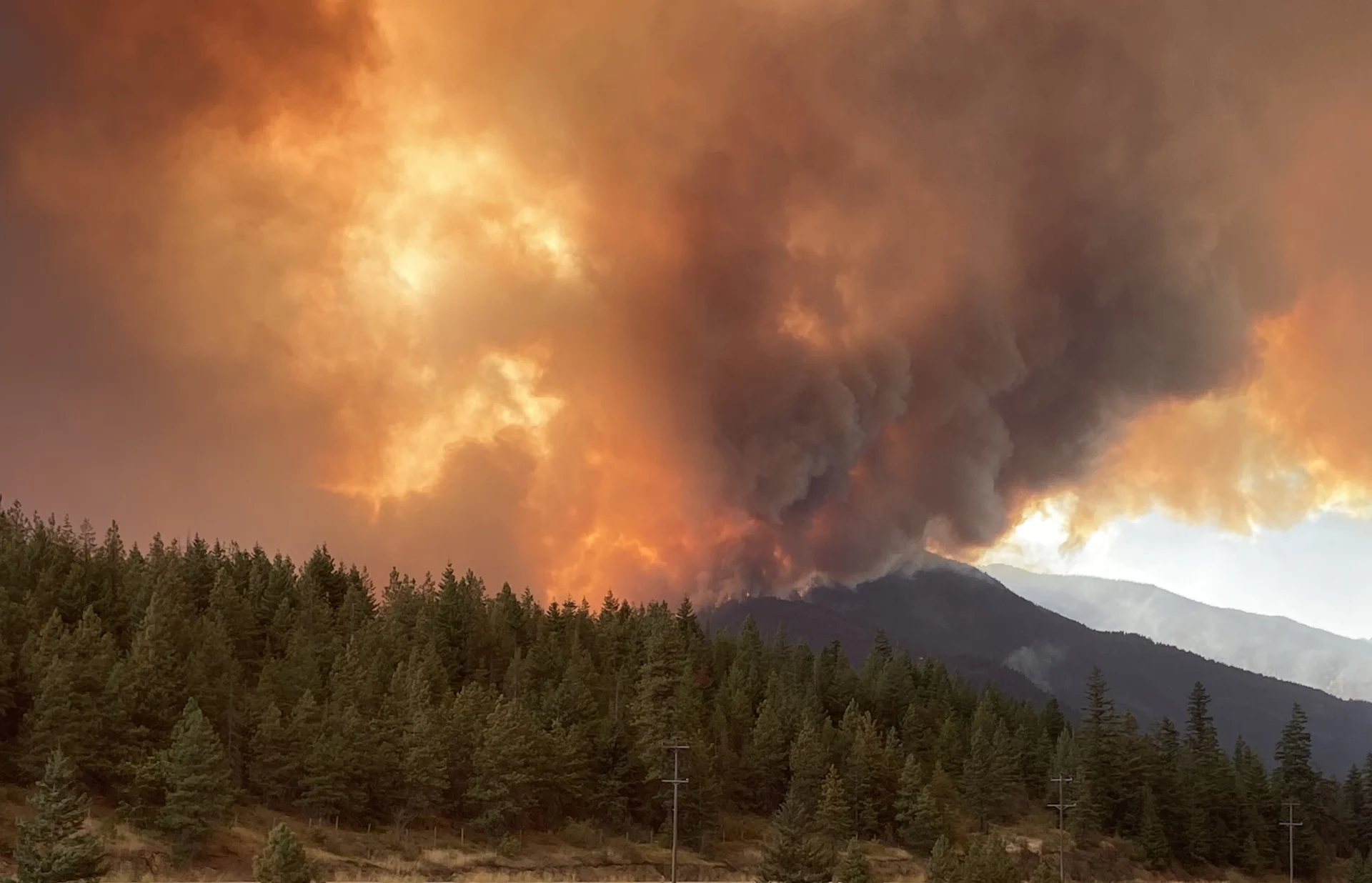
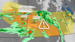
(BC Wildfire Service/X)
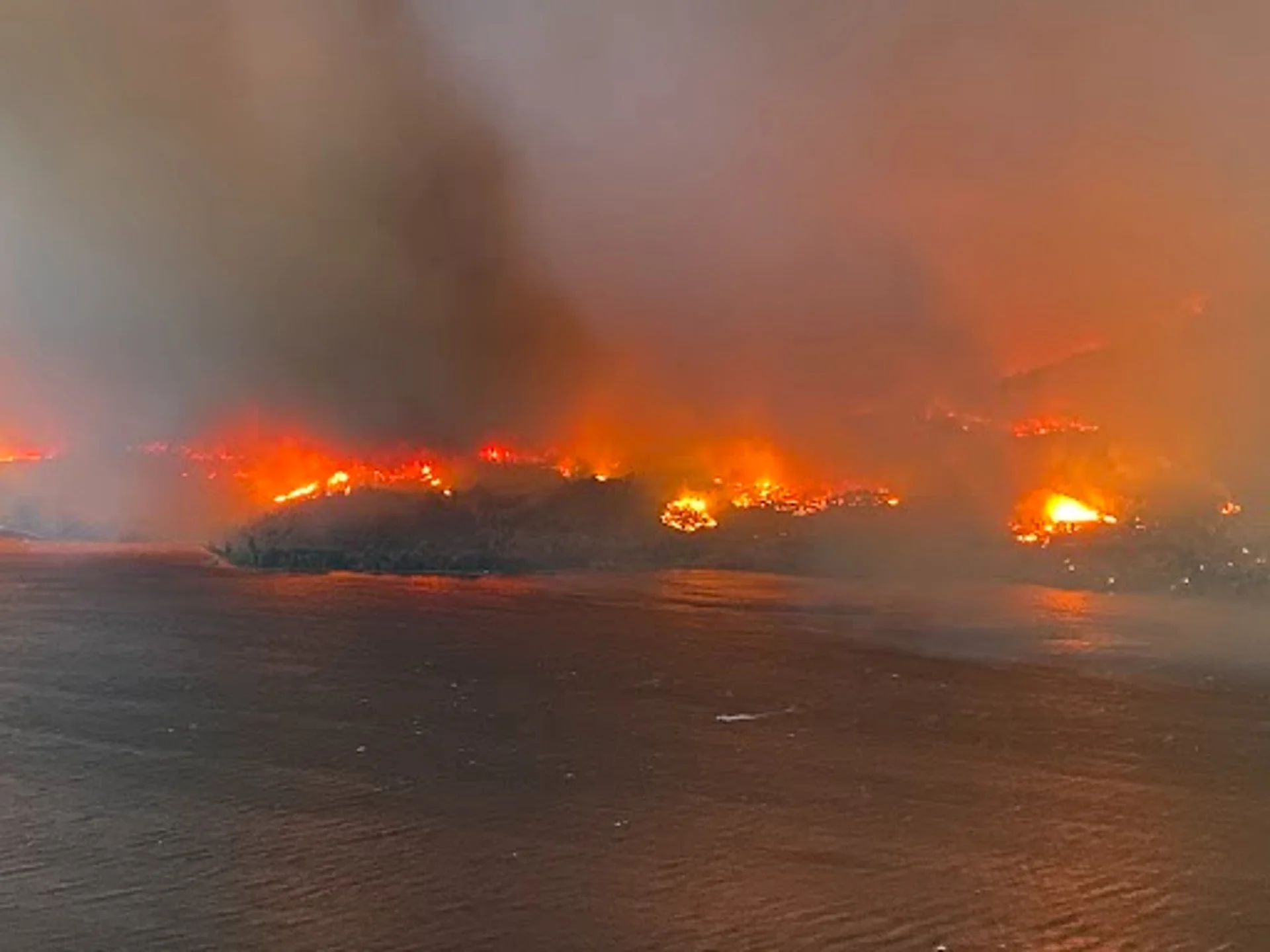
Early, explosive start to wildfire season
The wildfire season got off to an early and quick start, with fires springing up in Alberta and Nova Scotia in May, followed by B.C., Ontario and Quebec as summer began and progressed –– prompting thousands to evacuate at certain points during the season as the blazes quickly spread and became out of control.
Visit The Weather Network's wildfire hub to keep up with the latest on the record-breaking wildfire season across Canada.
While things have calmed down in many parts of Canada, wildfires continue to burn in B.C. as we've entered the fall season.
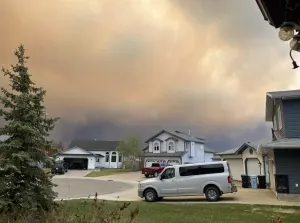
Hazardous wildfire smoke sets records
With the wildfires came the copious amount of smoke that infiltrated many Canadian communities this summer, including Calgary and Edmonton, Alta., Ottawa, Ont., Montreal, Que. and Halifax, N.S., just to name a few.
At one point, the wildfire smoke resulted in parts of Canada having the worst air quality in the world.
There were hazardous air quality levels for million of Canadians for a number of weeks. Wildfire smoke even set records in Alberta and Saskatchewan.
Deadly, historic floods
Halifax was hit with significant flooding this summer, not once, but twice -- and only two weeks apart.
The first event occurred in late July. Significant, historic flash flooding swept through communities near Halifax on a Friday evening after relentless tropical downpours dropped 150-200+ mm of rain on the area in just a few hours. It led to the deaths of four people.
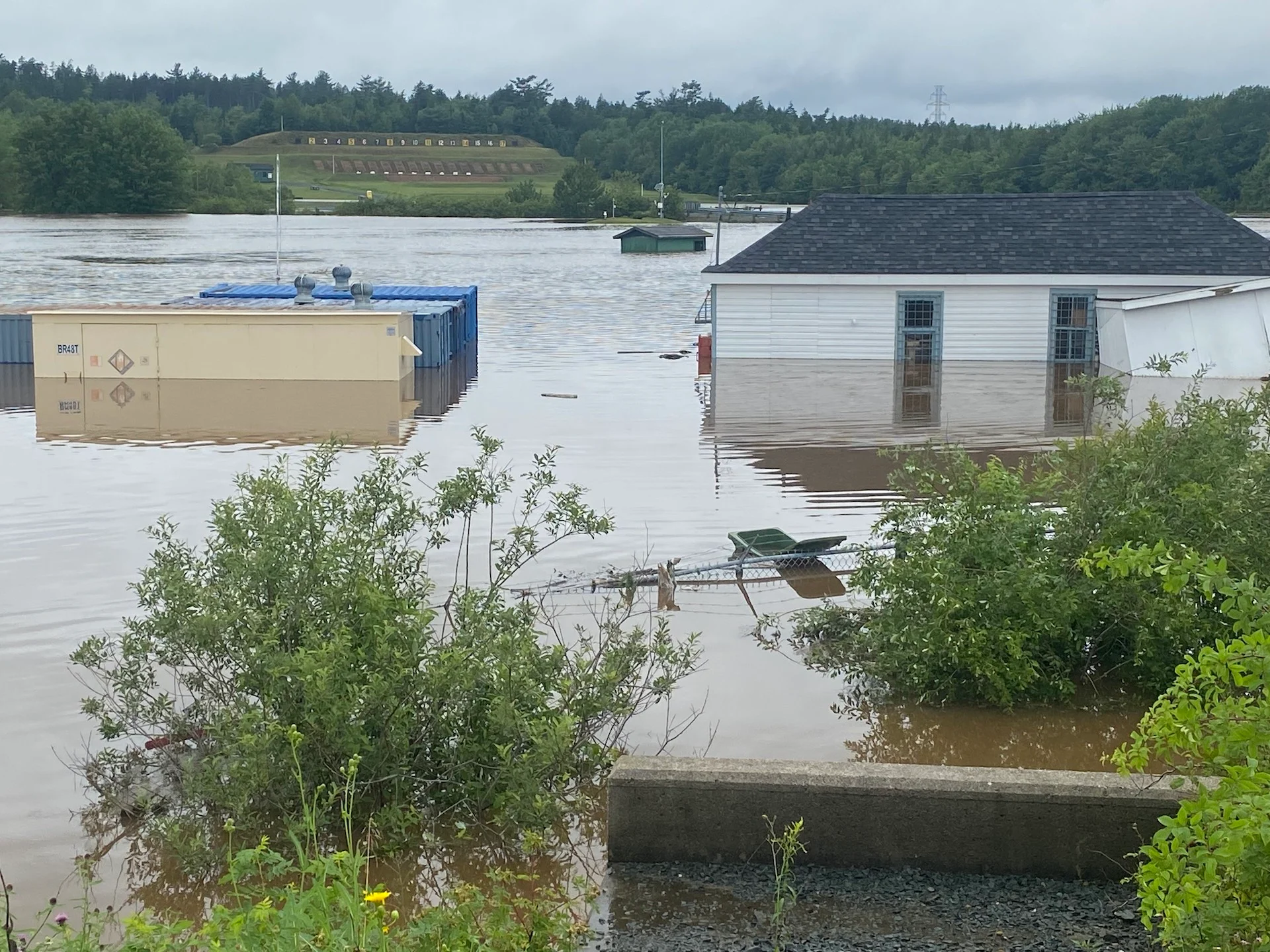
(Nathan Coleman/The Weather Network)
The second incident took place in early August, just two weeks later. Rainfall rates in excess of 30 mm per hour were observed, leading to quite a bit of flooding that forced the closures of some roads. Heavy rain affected ditches, roads and other infrastructure still being repaired from the previous flooding.
Damaging Alberta tornado was the country's strongest in five years
Earlier this year, Canada experienced its strongest tornado since 2018 after an EF-4-rated twister struck Didsbury, Alta., on Canada Day. Miraculously, no one was killed and there were only a few minor injuries.
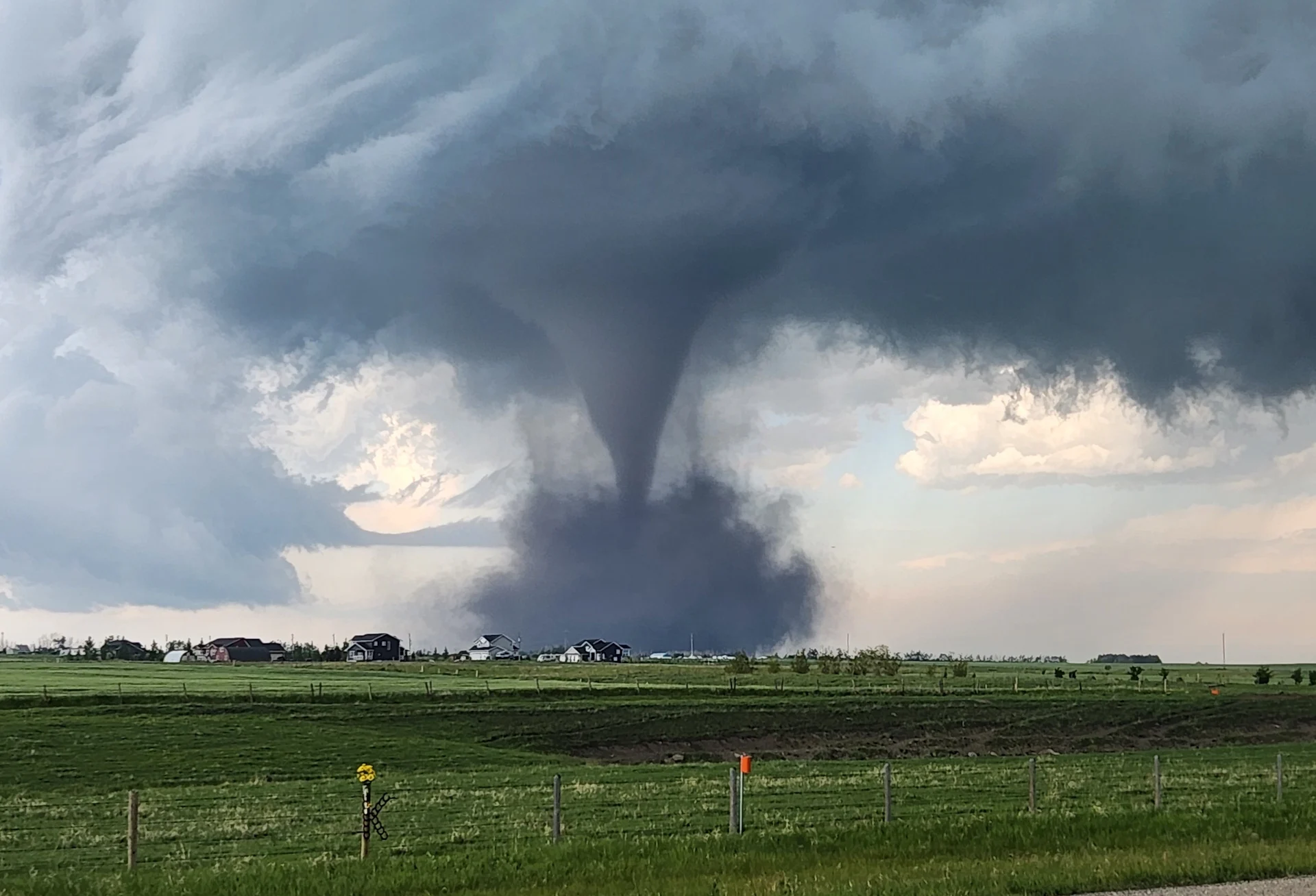
(David Hart/Submitted to The Weather Network)
It was also the highest-rated Alberta tornado since Edmonton in 1987, according to the Northern Tornadoes Project (NTP).
A summary compiled by Environment and Climate Change Canada (ECCC) reported several homes damaged by the tornado between the towns of Didsbury and Carstairs, located west of the QE2, about halfway between Calgary and Red Deer, Alta.
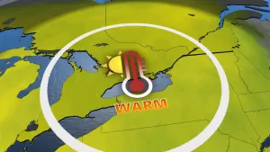
Extreme heat in the North
Summer heat wasn't just exclusive to Southern Canada this summer. The Far North got in on the action, as well. In July, astonishing heat across the Far North ranked among the hottest temperatures ever recorded near Canada’s Arctic.
The first week of July broke several records for the globe, not just in Northern Canada. Monday, July 5 was the world’s hottest day ever measured until Tuesday, July 6 broke the record again. Tuesday’s benchmark record itself only stood for two days until Thursday’s global average temperature came in as the new hottest reading on record.
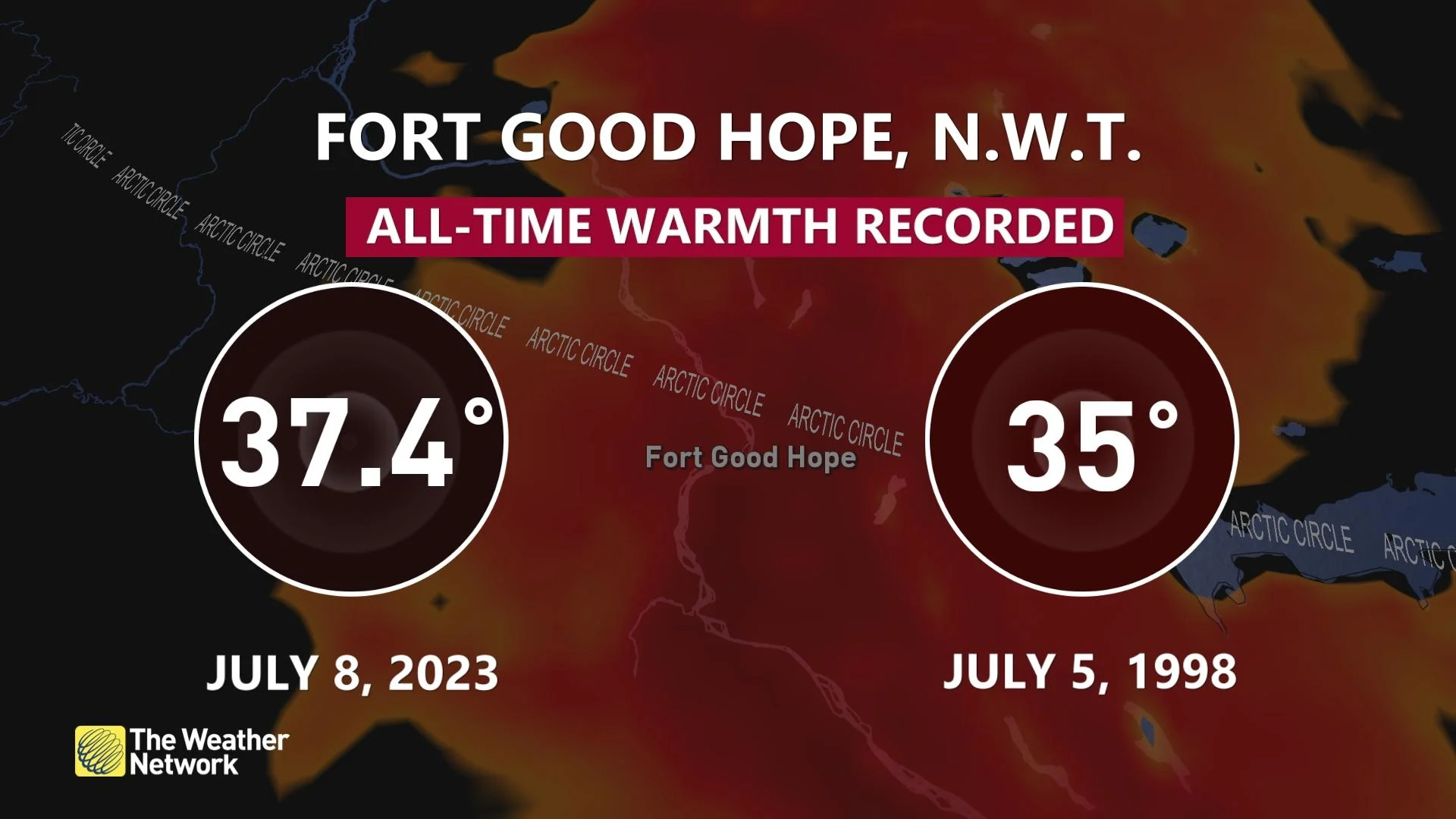
Then, on Saturday, July 8, Fort Good Hope, N.W.T., witnessed an astonishing high temperature of 37.4°C. Saturday’s high temperature in Fort Good Hope eclipsed the community’s previous all-time record of 35.0°C back on July 5, 1998, and it earned the dubious distinction of the Far North's hottest temperature on record.
Multiple Alberta tornadoes occur during Alberta outbreak
The first half of summer was particularly active for severe weather on the Prairies. Just before the official start of the season, a whopping total of 10 tornadoes hit Alberta during a prolific stretch of storms that swept the province on June 14.
All 10 tornadoes occurred between 2:30 p.m. and 6 p.m. local time, spanning eastern portions of the province from Iron Springs to Vermillion. Some communities dealt with more than one tornado during the outbreak.
Ontario sees Prairie-like, gigantic hail in severe storm
It's common to see hail in southern Ontario thunderstorms in the summer, but not stones that are of sizes comparable to what you would see on the Prairies normally. On Aug. 12, that's what happened.
Multiple rounds of thunderstorms powered their way through the region, with some of them developing into supercells, which took full advantage of high instability and favourable dynamics to incorporate rotating updrafts. The rotation allowed the storms to produce very large hail along their paths.
One such storm produced a gigantic, nine-centimetre-sized hailstone in Sunderland, Ont., just southeast of Lake Simcoe. By comparison, that is bigger than a baseball and more commonly seen on the Prairies.
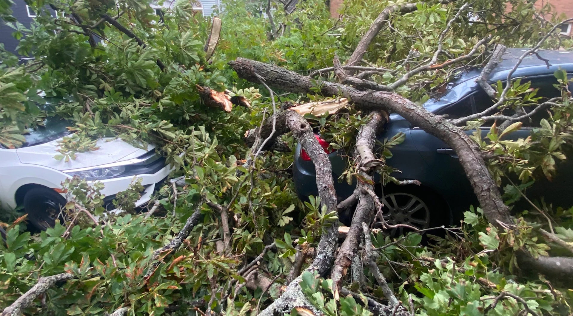
Lee leaves the Maritimes with widespread power outages, damage
Visit The Weather Network's hurricane hub to keep up with the latest on tropical developments in Canada and around the world
(Nathan Coleman/The Weather Network)
Toward the end of summer, Lee came to life in the Atlantic, eventually becoming a Category 5 hurricane. It took more than two weeks for Lee to reach the Maritimes, but when it finally did, it certainly left its mark on the region.
During the peak of the storm, Lee left more than 100,000 customers across the Maritimes without power after its howling winds knocked down trees and power lines throughout the region. The storm also brought storm surge, leading to coastal flooding, and soaking rains.
We didn't have the space to cover all of the impactful weather events that happened this summer. Two other events in 2023 that came to mind can be read, here and here.
With files from Dennis Mersereau, a digital journalist at The Weather Network.
Follow Nathan Howes on the X platform, formerly known as Twitter.