Canada’s high-impact severe risk draws U.S. storm chasers

A multi-day severe storm event hitting the Prairies has drawn plenty of storm chasers to the region
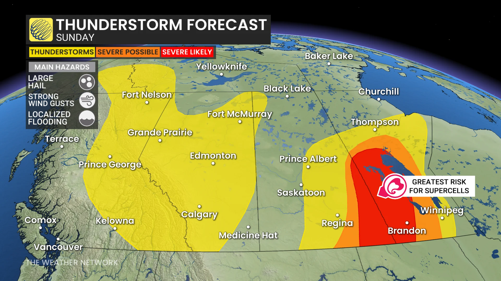
Parts of Canada will take centre stage with the risk for severe thunderstorms over the next couple of days as favourable conditions develop on the Prairies.
This is a setup ripe for supercell thunderstorms and possible tornadoes, drawing both storm chasers and news outlets from the United States to catch the atmospheric show.
GET THE LATEST: Prairies severe weather threat builds through Sunday
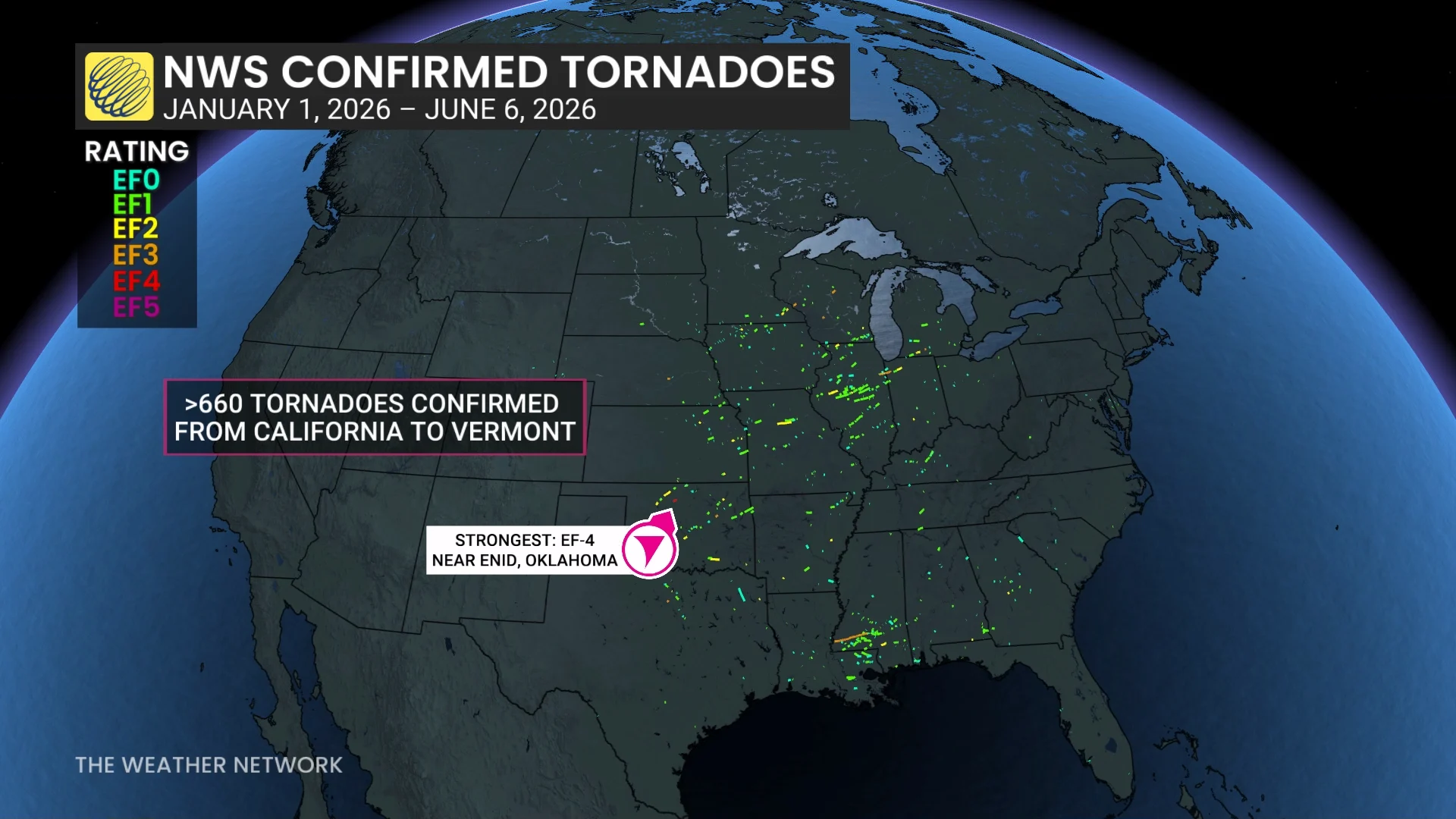
The U.S. is the world’s most tornado-prone country, recording more than 1,100 tornadoes during an average year.
Tornado activity there this year is unfolding a bit different than normal, with many twisters touching down early in the season across the Midwest and Deep South.
An odd tornado season south of the border has sent storm chasers and news outlets looking north toward Canada for decent storm chasing opportunities.
As of early Saturday evening, we’ve already seen one supercell thunderstorm capable of producing baseball size hail in southwestern Manitoba, which prompted the first known red warning for a severe thunderstorm.
We’ll see a renewed risk for severe weather develop over southern portions of Saskatchewan and Manitoba during the day Sunday, which may feature an even more volatile setup than we saw on Saturday.
Residents are advised to pay attention to watches and warnings in their area, staying alert for rapidly changing weather conditions. And, please, leave storm chasing to the professionals.