Back-to-back cyclones to hit Australia, people missing after flooding

The widespread flooding from the remnants of Seth comes as the northern sections of Australia are bracing for impact from the country's second tropical cyclone, Tiffany, in recent days.
Going through one cyclone can be quite devastating, but Australia is now seeing its second such storm in recent days.
The first of the storms, what was once Tropical Cyclone Seth, powered through parts of the country recently, bringing heavy downpours and thunderstorms. This resulted in scores of missing people including a 14-year-old girl and at least one fatality. Hundreds have been evacuated, according to reports.
SEE ALSO: Flooding extremes in Northern Canada are becoming the new normal
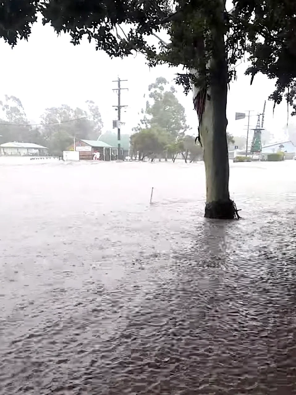
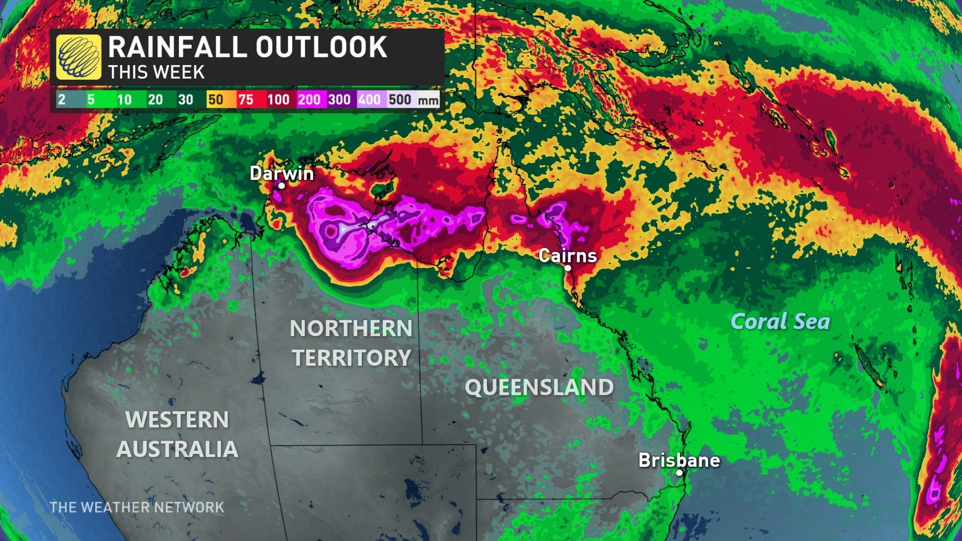
As a result of Seth, hundreds of millimetres of rain fell in parts of Queensland over the past several days, with major flood warnings for the Mary River, according to Australia's Bureau of Meteorology. RACQ LifeFlight Rescue Helicopters had been involved in more than 10 flood-related incidents through the weekend, Reuters reported.
The first casualty from the flooding was verified to be a 22-year-old Sunshine Coast man. It occurred after his vehicle became submerged in floodwaters in Kanigan, north of Brisbane, Friday evening.

(Chook Wilson via Storyful)
Meanwhile, a 40-year-old man was retrieved from his car safely after being swept away Saturday morning in Booubyjan, located in Queensland’s southeastern end. According to local media, he and a 14-year-old girl were able to get out of the car before it was caught up in floodwaters near Burnett Highway and Murgon Gayndah Road. While the man was discovered hanging onto a tree, the girl remains missing, police said.
TIFFANY COMES TO LIFE AS SECOND CYCLONE IN DAYS IMPACTS AUSTRALIA
But the trouble is far from over, however.
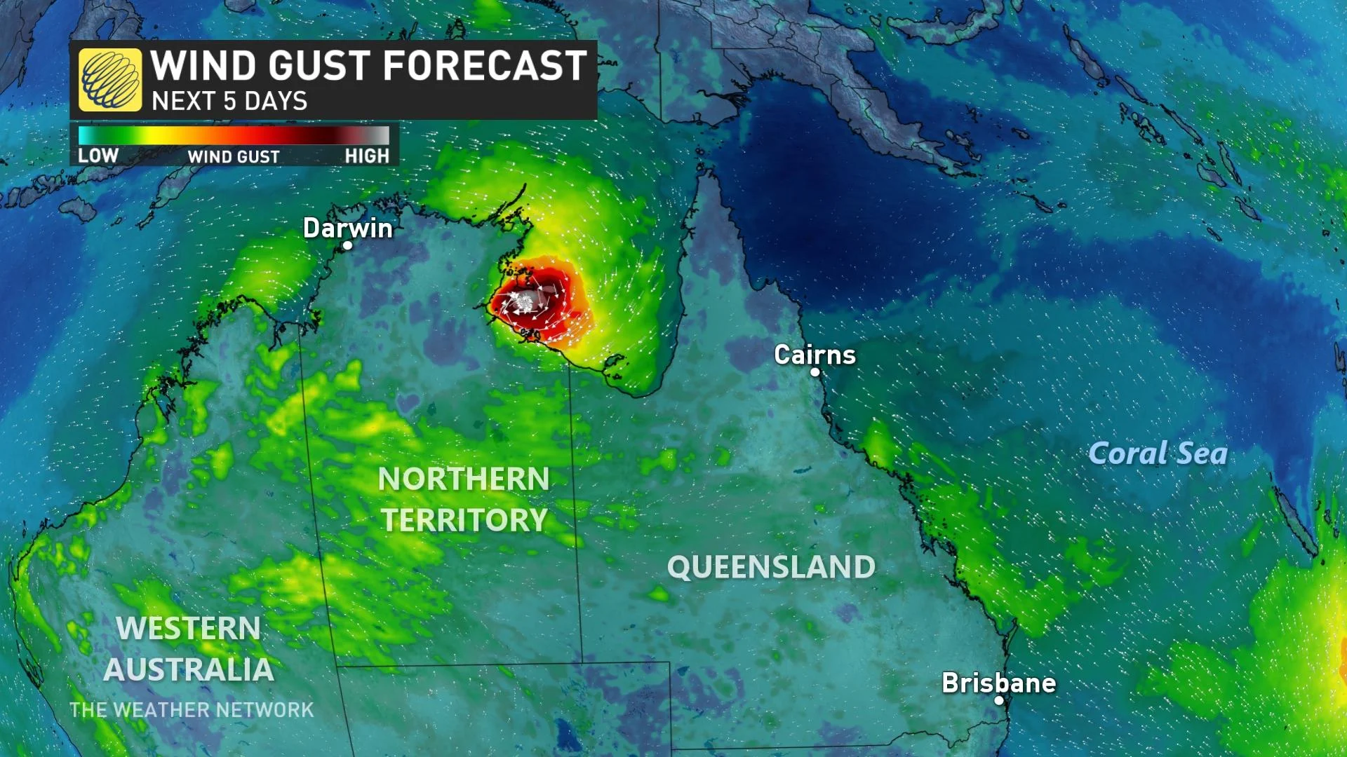
The widespread flooding comes as the northern sections of Australia are now dealing with Tropical Cyclone Tiffany. As of early Monday morning local time, Tiffany is a Category 2 storm on the Australian Tropical Cyclone Intensity Scale as it approaches the far northern coast of Queensland.
Landfall is expected soon between Cooktown and Lockhart River, with the timing dependent on whether the storm moves south or north of Cape Melville. A cyclone warning extends across the Cape York Peninsula.
At the present, it is packing sustained winds near the centre of 95 km/h with wind gusts reaching 130 km/h.
In addition to the potentially damaging winds, heavy downpours are occurring in the warning area. The deluge is expected to continue through Monday and into Tuesday as the system moves across the Cape York Peninsula. Widespread 24-hour totals of 100-150 mm are anticipated, with isolated amounts of 200-250 mm on the table.
Despite another cyclone pushing through, Queensland Premier Annastacia Palaszczuk stated all agencies were “well prepared” for Tiffany. “To all of the residents in those areas – please be on the lookout. We’ll be keeping a very close eye on that,” said Palaszczuk.
With files from Reuters.
Thumbnail courtesy of Chook Wilson via Storyful.
Follow Nathan Howes on Twitter.