160 collisions in the GTHA since winter storm took hold, OPP says
The Greater Toronto Area remains under a yellow winter storm warning Wednesday afternoon, with a "wintry mix" of snow, freezing rain and ice pellets falling across the region.
Environment Canada’s alert says the mix may cause icy and slippery conditions. A low-pressure system could bring the region between five and 10 centimetres of snow and ice pellet amounts.
DON'T MISS: Toronto's record winter highlights snow removal challenges in North America
The federal weather agency added areas predominantly west of Toronto could face multiple hours of freezing rain and ice buildup. Burlington and Oakville could see ice build-up of three to seven centimetres.
“Even a few centimetres of ice pellets can result in travel conditions that can be more hazardous than heavy snowfalls,” the warning said. “Roads and walkways will likely be difficult to navigate.”
Environment Canada recommends preparing for quickly deteriorating travel conditions and allowing adequate time for travel.
Environment Canada operational meteorologist Mark Schuster said the worst of the conditions set in during the morning's rush hour commute, as temperatures fell to near the freezing mark.
"Conditions should start to go downhill pretty quickly," he told CBC Toronto on Wednesday. "Regardless of the type of precipitation that falls, it's going to be hazardous."
Those west of Toronto may also see as much as five milimetres of ice on trees and power lines, Schuster said. But he added much of the GTA will see a mix of snow and ice pellets, with winds gusting up to 50 or 60 km/h.
"I know that five centimetres does not sound like a lot, but with ice pellets, even a few centimetres can be very tricky to drive through and certainly very difficult to shovel," he said.

Environment Canada recommends preparing for quickly deteriorating travel conditions and allowing adequate time for travel. (Patrick Morrell/CBC)
Those northeast of Toronto, including Barrie and Durham Region, may see as much as 15 centimetres of snow Wednesday, Schuster said.
"Ideally, if you don't have to travel today, it's a good day to just stay at home," he said.
"But if you do have to travel, definitely give yourself some extra time. Leave plenty of space between you and the car in front of you. And ... make sure your head lighting system is on and clear your vehicle of any snow and ice pellets before heading out."
Schools to remain open
Multiple school boards shared social media posts Wednesday morning about their plans for the inclement weather.
The Toronto District School Board said schools remained open. School buses, however, were cancelled due to weather-related delays.
The Toronto Catholic District School Board noted schools would remain open but all school buses would be cancelled due to expected freezing rain and icy road conditions.
The Peel District School Board said schools would remain open, but all buses in all zones would be cancelled “out of an abundance of caution.”
READ MORE: Trio of winter storms bring messy impacts to millions across Canada
All Halton District School Board (HDSB) and Halton Catholic District School Board schools remained open, but school buses in Zones 1, 2 and 3 were cancelled, Halton Student Transportation Services said.
"Parents/guardians who keep their children at home when schools are open must report this absence before the school day starts," the HDSB said in a social media post.
According to Durham Student Transportation Services, all transportation was cancelled Wednesday "due to inclement weather."

Environment Canada operational meteorologist Mark Schuster said the worst of the conditions set in during the morning's rush hour commute, as temperatures fell to near the freezing mark. (Paul Smith/CBC)
In a statement Wednesday morning, Student Transportation Services of York Region said York Region District School Board and York Catholic District School Board schools would remain open. All school bus and taxi transportation service for the two boards was cancelled region-wide.
The University of Toronto said all three of its campuses will be operating as normal Wednesday, though the situation will be monitored.
WATCH: Messy, winter storm wrapping up in southern Ontario
Metrolinx service updates
Metrolinx also warned of potential delays to GO Transit and UP Express service Wednesday.
As of early Wednesday afternoon, there were no alerts issued for GO Transit and UP Express trains were on schedule. However, Metrolinx noted GO Trains would be running on a special schedule.
In a statement Tuesday, the agency encouraged commuters to plan ahead and allow extra time to get to their destinations. Riders can monitor the GO and UP websites for updates on delays and disruptions. GO riders can also sign up for real-time alerts.
In a post to social media, the Toronto Transit Commission said it is monitoring conditions.
"In areas where heavy snow or freezing rain may cause buses to become stuck, we may temporarily take select stops on certain routes out of service," it said.
In another social media post, the TTC said its express routes would be operating as local service due to the winter weather conditions.
The TTC's Line 6 was down between Duncanwoods and Signet Arrow stations due to a mechanical issue, the transit agency said in a separate post to social media Wednesday.
In a social media post Wednesday, the City of Toronto said crews began salting expressways, arterial roads and local roads Tuesday night and crews are set to plow once snow accumulation reaches established thresholds.
RELATED: More than $2M in parking tickets issued in Toronto following historic snowstorm
"Take care on roads and sidewalks, and give yourself extra time for your commute," the city said. "Drivers should follow at a safe distance and brake, steer, and accelerate gently."
In a separate post, the city said it will keep four warming centres open due to weather conditions. The centres are located at 81 Elizabeth St., 349 George St., 12 Holmes Ave. and 885 Scarborough Golf Club Rd. The parks department also said city crews are available to respond to damaged trees.
In a statement Tuesday, the City of Vaughan said a significant weather event would be in place as of 5:30 a.m. Wednesday.

In a social media post Tuesday evening, Ontario Provincial Police said drivers should be prepared to adjust their speed as roads may be slippery and icy. (Patrick Morrell/CBC)
York Region also issued a special weather alert for Wednesday and Thursday for unhoused people.
"If you or someone you know needs emergency housing, contact York Region’s Emergency Housing Central Intake Line," the region said in a social media post.
In a social media post Tuesday evening, Ontario Provincial Police said drivers should be prepared to adjust their speed as roads may be slippery and icy.
In a social media post Wednesday, provincial police said they have responded to 160 collisions since 5 a.m. across the Greater Toronto and Hamilton Area, with 40 crashes currently being investigated.
“Keep your hands on the wheel, your eyes on the road and your mind focused on the task of driving,” the OPP said.

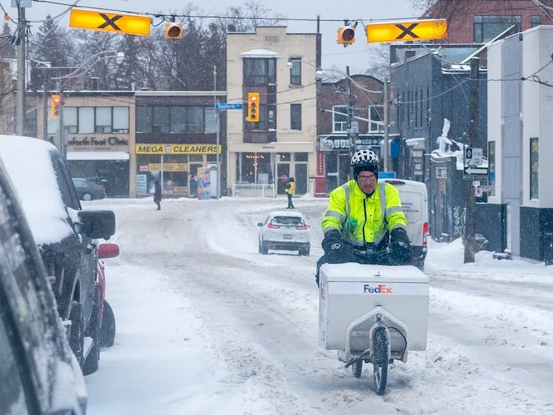
Snow falls in Toronto on Feb. 18, 2026. (Alan Habbick/CBC)
In a social media post Wednesday afternoon, the Durham Regional Police Service said the region will be under an extreme weather advisory due to whiteout conditions and heavy snowfall.
"Please be extra cautious if you are required to travel today," DRPS said. "These extreme weather conditions will result in low visibility and slippery, icy roadways which can lead to collisions."
In a post to social media Wednesday morning, Pearson International Airport said it is closely monitoring the forecasted "wintry storm."
"Our crews are standing by to treat runways, taxiways and the apron if ice develops and are ready to deploy plows to clear critical areas if freezing rain turns to snow," it said.
The airport said its deicing facility is fully operational and traffic management initiatives will be in place to ensure planes can move "safely and efficiently throughout the day." Pearson added travellers should check their flight status ahead of going to the airport and allow extra time for road conditions.
According to Pearson's flight statistics, 20 per cent of departing flights and 21 per cent of arriving flights have been cancelled. The airport also said on social media that a total of 1.4 centimetres of ice and snow has accumulated thus far.
Zan Munawar, who was walking in the rain along Dundas Street W. Wednesday, says it's surprising to wake up to this, especially considering the sunny and warm weather Toronto experienced Tuesday morning.
"It's quite intense and different," he said. "At least it's not freezing cold as it was a couple of weeks ago."
Commuter Bilal Muhammad said the weather is especially hard to deal with during transfers.
"It's grim," he said.
This article, written by Gabriela Silva Ponte, was originally published for CBC News