Buried: Why the Great Lakes produce some of the world’s heaviest snow

Cold winds blowing over a warm lake can produce some of the most dramatic and efficient snowstorms anywhere in the world.
Snow gushed from the sky for three days straight.
Cold winds blowing up the length of Lake Erie set in motion a catastrophe that would damage hundreds of homes and businesses, shut down entire cities for days on end, and even force a mother-to-be to give birth at a fire station because no vehicles could get her to a hospital.
A solid band of lake-effect snow rolled into western New York on November 17, 2014. This unwavering squall was as torrential as it was tenacious, producing whiteout conditions that wouldn’t finally cease until the 19th.
That days-long lake-effect snow event produced as much as 165 cm of snow near Buffalo, New York, burying some homes up to their second floors and immobilizing the area for days.
PODCAST: A state of emergency was called for the Great Buffalo Blizzard of 2014
Western New York’s lake-effect snow disaster underscored one basic fact of living near lakes during the cold season: snow squalls are nothing to sneeze at.
Lake-effect snow and summertime thunderstorms are cousins
Lake-effect snow lands its characteristic punch because it’s born from the same process that creates a towering thunderstorm on a humid summer afternoon.
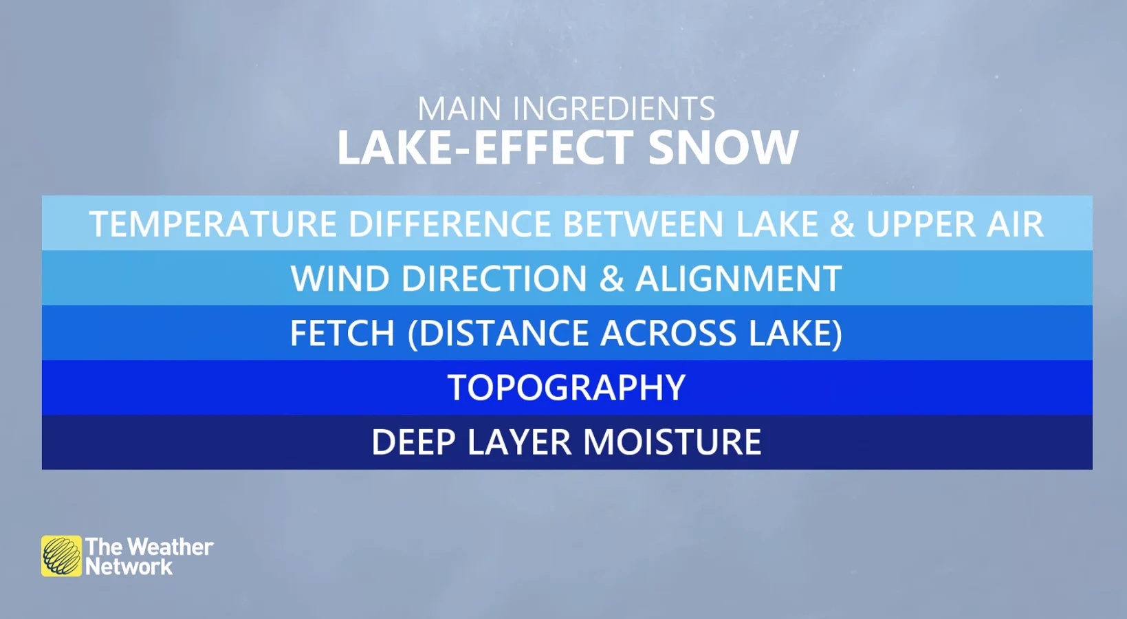
Snow squalls off the lakes are a product of convection. We experience most lake-effect snow during the fall and early winter months because there’s still a sharp temperature difference between the surface of the lakes and the much chillier winds blowing over the water.
DON'T MISS: Why does your long-range forecast change so often?
Some of that air comes in direct contact with those warmer waters, heating up that shallow layer of air like a camper holding their hands over a fire to stay warm. This air becomes warmer than its surroundings, allowing it to begin rising through the atmosphere.
A bigger difference between the temperature of the lake and the atmosphere above will cause the air to rise even more quickly, feeding the formation of snow showers similar to the way we’d see thunderstorms bubble up on a hot July day.
WATCH: How lake-effect snow forms over a warm lake
A dangerous game of fetch
If you can’t stand snow, you don’t want to make fetch happen.
Fetch is the distance that wind travels over open water. A longer fetch means that wind spends more time and travels more distance over the water, a key ingredient to the formation of lake-effect snow.
Stiff winds blowing across the water organize these snow showers into bands, blowing them over the lakeshores and bringing us the rounds of lake-effect that are so familiar during the leadup to the holiday season.
Meteorologists closely watch the direction of the wind for clues about where bands of snow will set up and how heavy they could grow.
A short fetch leads to multiple but narrow bands of snow that can cover a large area with a modest blanket of accumulation. A long fetch, on the other hand, leads to single, thick bands of snow.
The Great Lakes are king, but it’s a widespread problem
The size, depth, and location of the Great Lakes makes this region prime real estate for lake-effect snow, but this phenomenon is possible across Canada and around the world.

Lake-effect snow is common in southern Manitoba during the early fall before the lakes freeze over. Sea-effect snow—which forms through the same process, just over the ocean instead—is a regular sight throughout the cold season across the Atlantic provinces.
We even see lake- and sea-effect snow around the world. Sapporo, Japan, is one of the snowiest cities in the world due to sea-effect snow burying the city of nearly two million people with metre after metre of powder each season.
Prevailing winds make certain parts of the Great Lakes more prone to these blockbuster snow events than others. Northwesterly winds blowing across Lake Huron and Georgian Bay leave communities like Kincardine, Goderich, and Barrie open to heavy bands of snow.
Lake Erie and Lake Ontario are infamous for their firehose-like bands of snow dumping on the Niagara region, eastern Ontario, and western New York because southwesterly winds achieve an exceptionally long fetch along the entire length of these lakes, feeding intense bands of snow that can last for days.
WATCH: Why snow squalls are so difficult to predict
Frightening intensity meets a knife’s edge
Those legendary bands of snow can produce some of the most intense wintry conditions you’ll ever experience on the planet, akin to a vigorous wintertime thunderstorm.
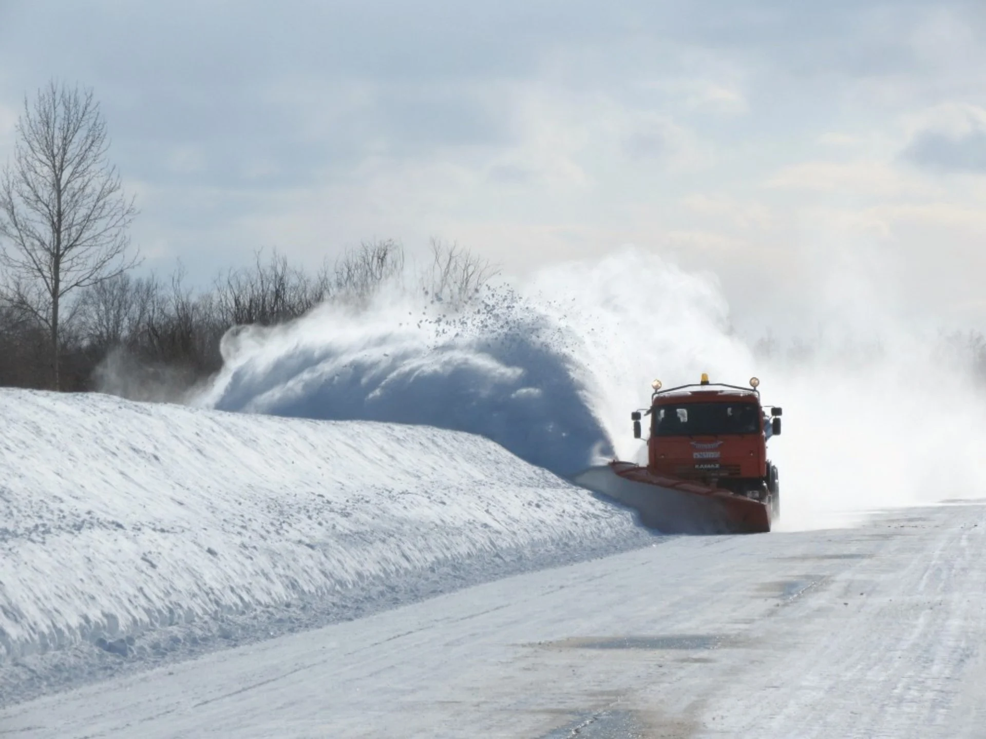
The most powerful lake-effect events can produce snowfall rates that exceed 10 cm of snow an hour, overwhelming the ability for plows to keep roads clear for more than a few minutes at a time. Convection strong enough to produce that kind of ripping snowfall often leads to vivid lightning and loud claps of thunder.

Multiple feet of snow cover the New York State Thruway near Buffalo, New York, during the lake-effect snowstorm in November 2014. (New York State Police/Facebook)
MUST SEE: Why Ontario’s ‘snow snake’ caught many–including forecasters–off guard
What’s scarier than the hours-long whiteouts and prolific thundersnow is the fact that these bands can be notoriously hard to predict.
Snow squalls are often so narrow that a couple of kilometres means the difference between a serene wintry scene and a nightmarish disaster that shuts down entire neighbourhoods for days at a time.
Just a tiny shift in wind direction or a tiny wobble in the band itself can shift those mammoth snow totals right along with it. The mounds of snow that fell south of Buffalo in 2014 would’ve hit the centre of the city itself if the band had wiggled just a few kilometres farther north.
Thumbnail image courtesy of Pixabay.