Atlantic Canada will watch for impactful storms this fall


Classic fall temperatures are in store across much of Eastern Canada, even as residents keep a weary eye toward the horizon for potential storms
This year’s exceptionally quiet hurricane season may soon break a long-standing record for a lack of hurricanes in the Atlantic Ocean.
But that doesn’t mean we can count the season out just yet. Autumn is a watchful time of year across Atlantic Canada, and this year is no exception.
Here’s what you can expect across the Atlantic provinces this season from Halifax to Nain.
Keeping a close watch for impactful storms
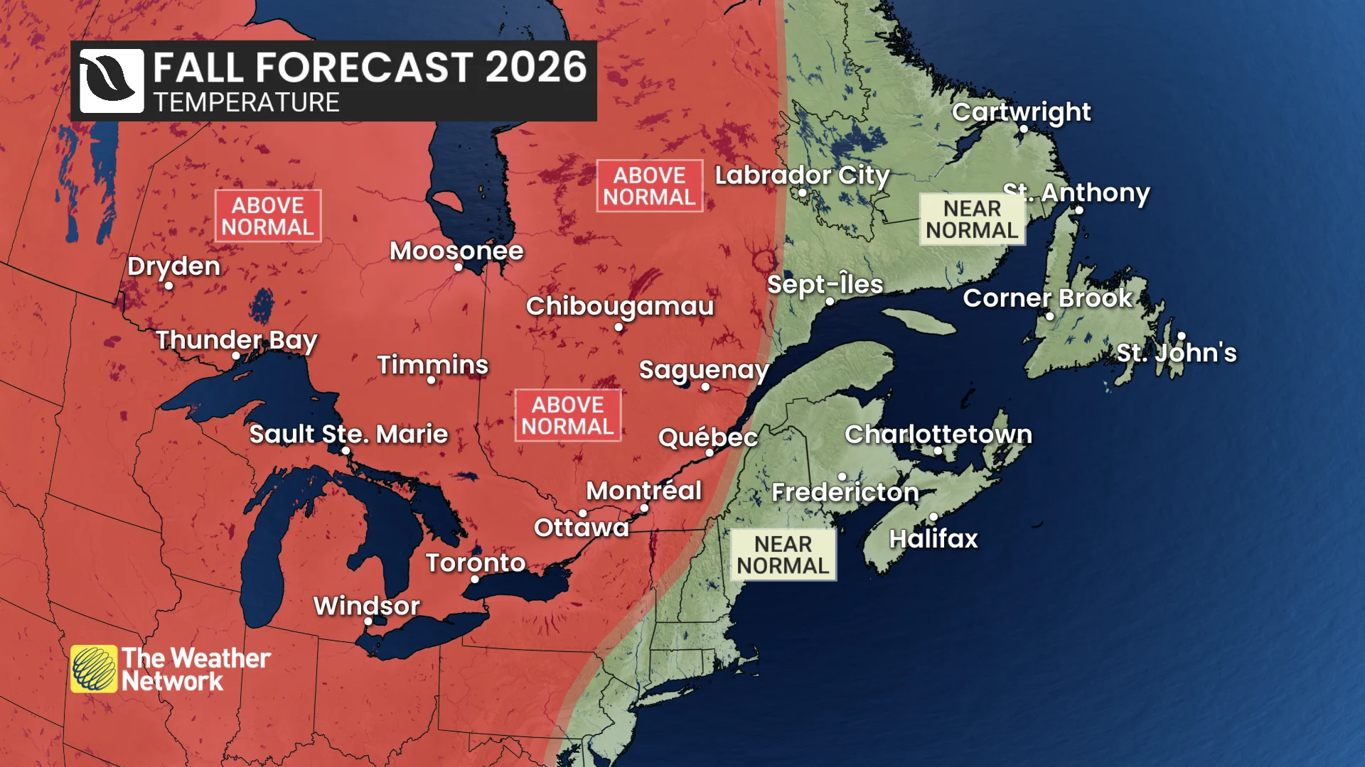
This fall should feel closer to normal in Atlantic Canada than just about anywhere else in the country. Overall, temperatures should finish close to the seasonal mark, though cooler interruptions may be more noticeable through early fall.
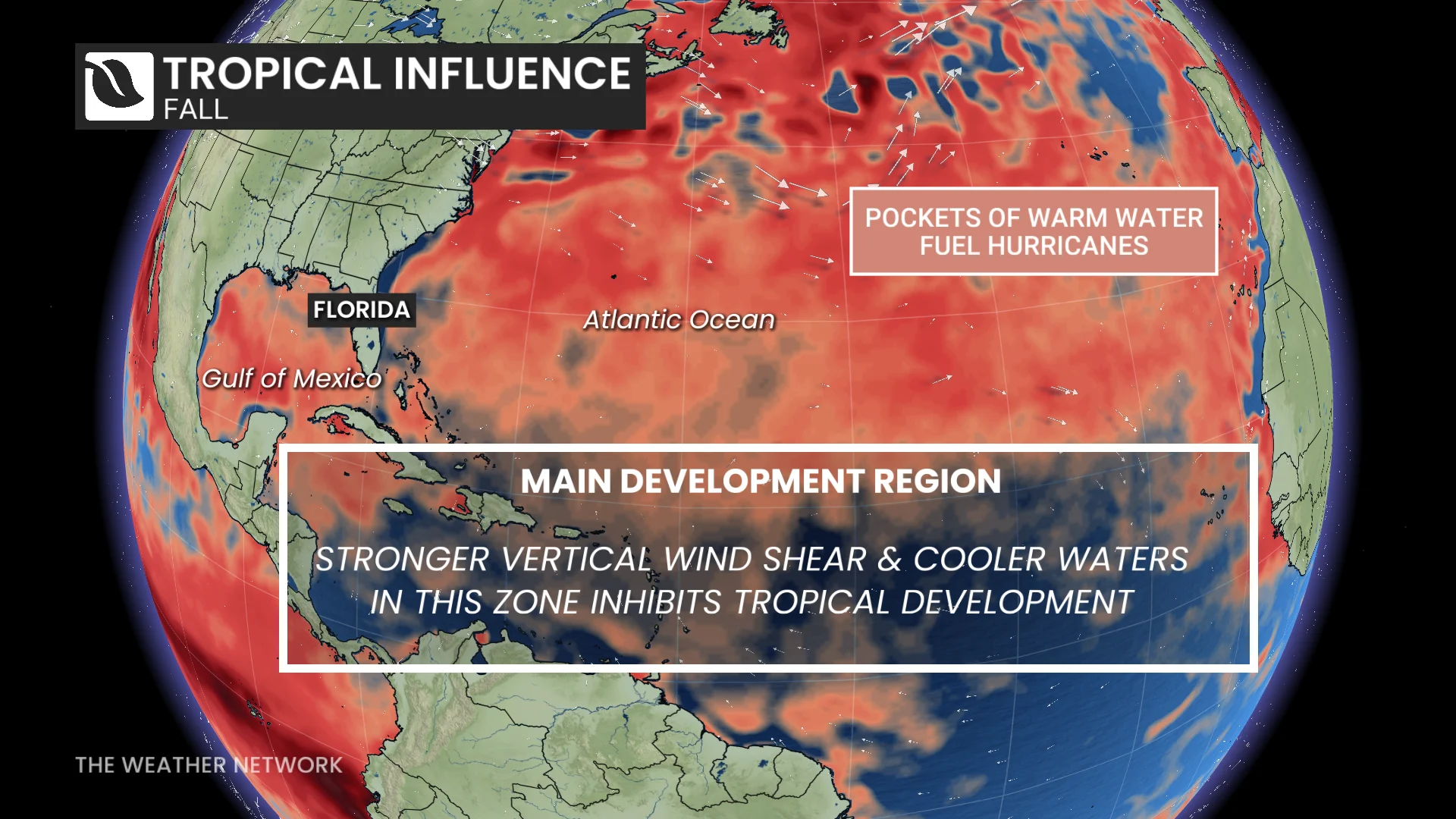
All eyes this season will remain on potential tropical activity. Hurricane activity here has been well below normal through early September, and the Atlantic basin is on the verge of breaking the record for the latest in the year we’ve gone without at least one hurricane.
Residents shouldn’t let their guards down yet. Exceptionally warm waters nearby mean that late-season systems may still pose a risk. Home-grown tropical systems closer to North America will remain an important wildcard in the forecast later this season.
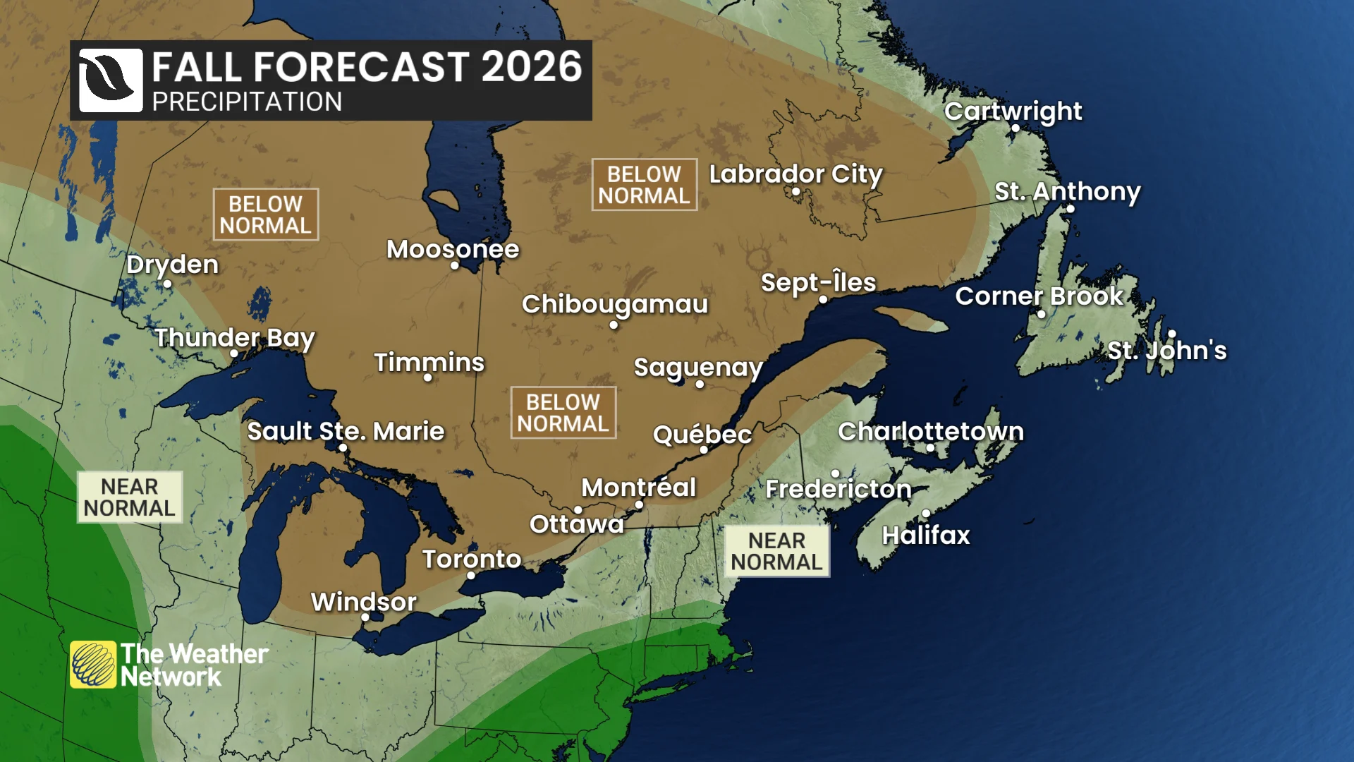
Beyond the tropical threat, an active storm track across the southern United States may occasionally feed moisture across the Atlantic provinces, boosting the potential for heavy rainfall at times.
Frequently asked questions
Q: Does a warmer fall mean we’ll coast through and winter weather won’t arrive until December?
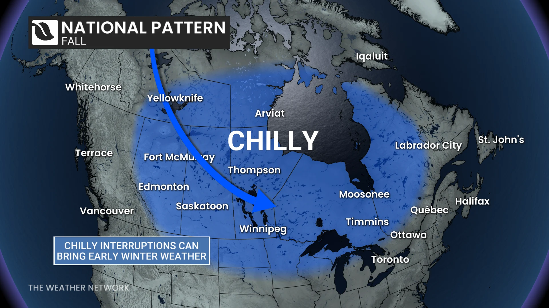
A: Hard no. Snow, hard freezes, and Arctic air are normal parts of the transition through fall. Our forecast is made to identify the dominant pattern, and cold spells are more likely to be interrupted by mild weather rather than becoming the permanent pattern.
Q: Will ski season be delayed?
A: We’re carefully watching central and eastern Canada, where there’s a real risk of delays, while western Canada looks more nuanced and will be elevation-dependent. Previous strong El Niños have even delivered above-average snowfall amounts to B.C.’s mountains.
Q: The fall forecast sounds kind of boring. Are we destined for a storm-free season?
A: No. Even if precipitation finishes below normal, the season can still produce a handful of memorable, major storms.
Q: Could Canada face a historic fall storm?
A: Yes. Fewer storms doesn’t mean weaker storms, and one major event can define how an entire season is remembered.
Q: Does El Niño mean a mild winter?
A: Keep an eye out for our Winter Sneak Peek release in the coming weeks. The winter forecast will depend on how El Niño evolves and several other atmospheric factors.
Q: Will we get an early snowstorm?
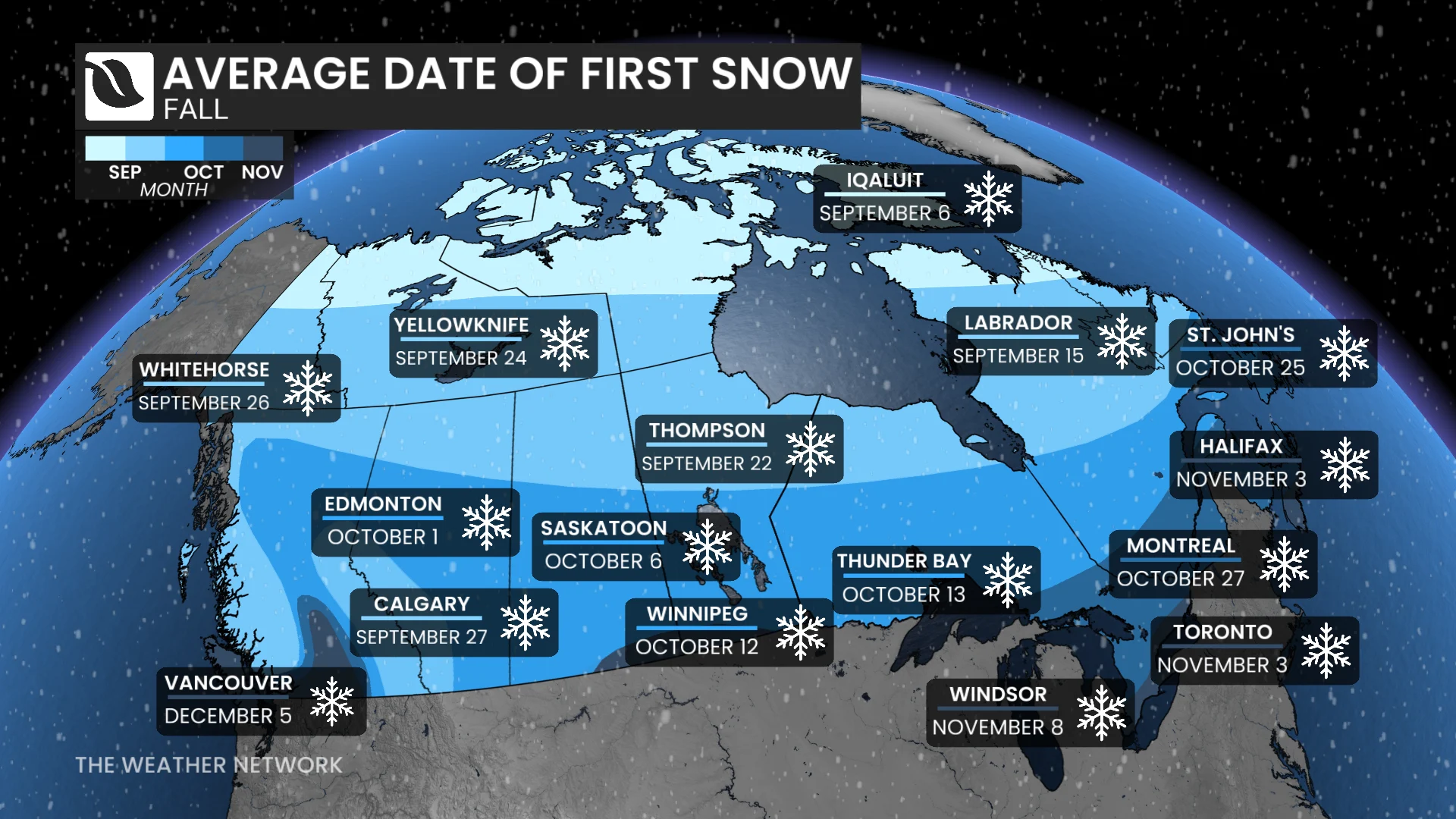
A: It depends where you reside. Victoria, B.C.: highly unlikely. Churchill, MB: count on it. All it takes is a sharp pattern disruption that would temporarily overwhelm the dominant pattern.
The most important question isn’t whether winter weather appears, but whether it sticks around.
Winter weather will knock at times. This year, don’t expect it to move in right away.
WATCH | Canada's 2026 Fall Forecast: El Niño could keep the cold at bay
This article was written with the guidance and expert forecasting of Dr. Doug Gillham, a senior meteorologist specializing in long-range forecasting at The Weather Network.