Alberta's 2026 Summer Forecast: Strong start, but with some concerns


Alberta will experience a strong start to summer, but a lack of moisture might eventually raise some concerns
Welcome to our official 2026 summer forecast for Alberta.
The sneak peek was all about the setup: the drivers, the mechanics, and the atmospheric forces beginning to shape the season ahead.
Now, it’s time to reveal what folks in Alberta will actually experience this summer.
Summer personality: warm, but watchful
Strong start, moisture concerns
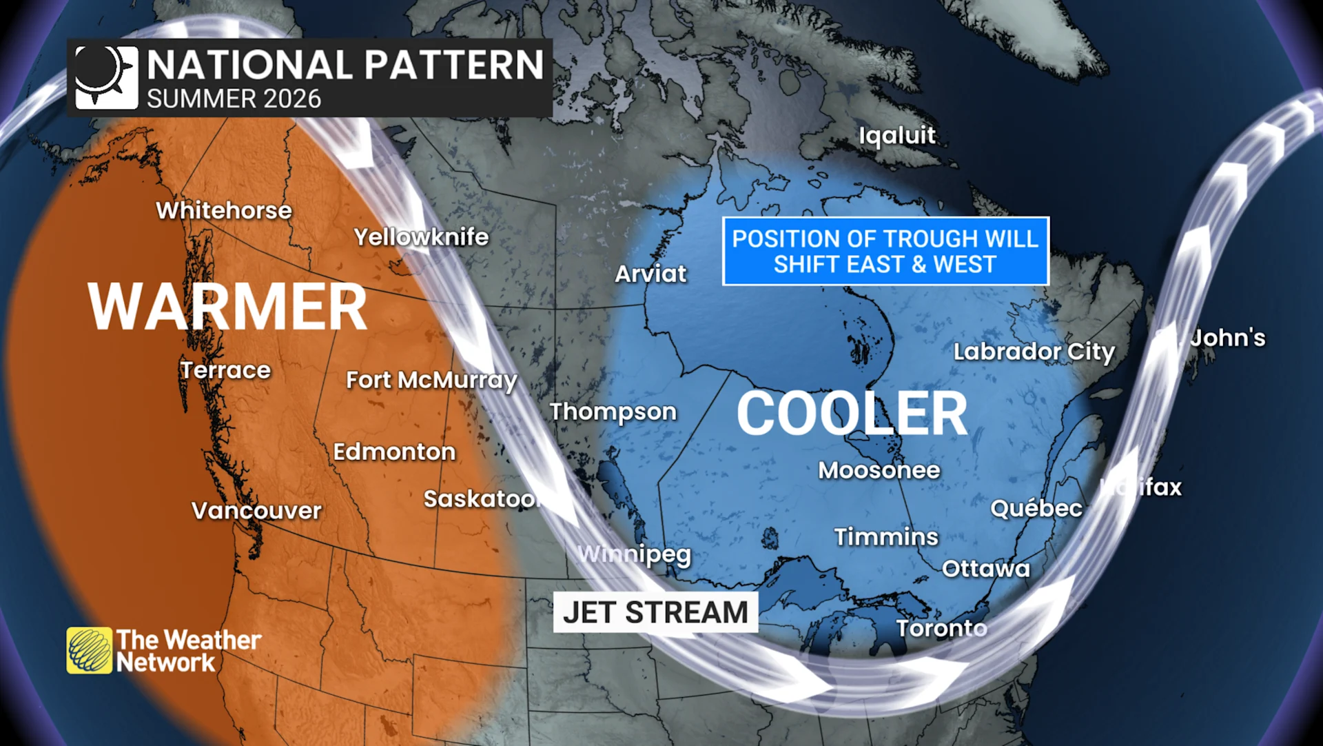
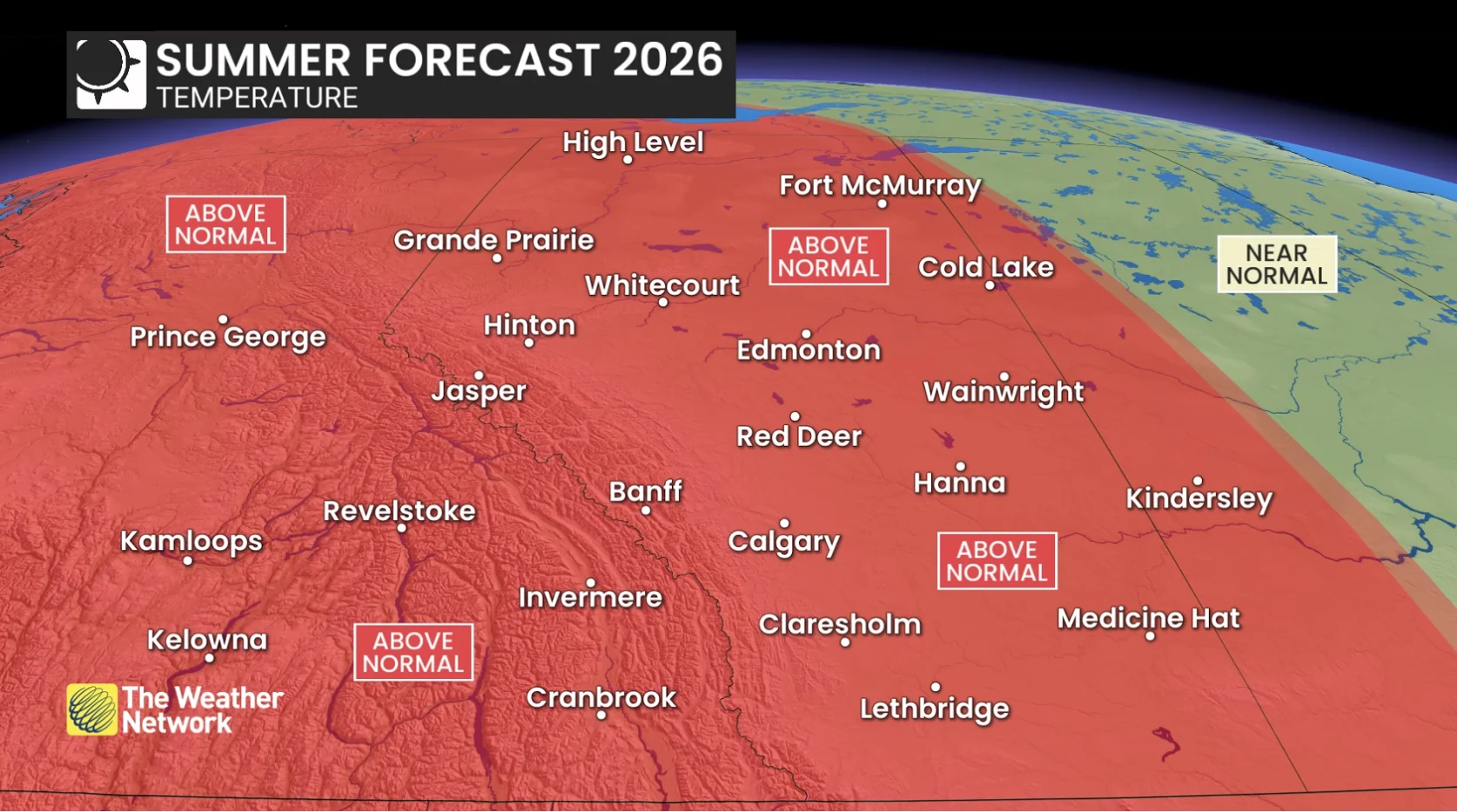
Alberta sits within the stronger warmth signal, especially early in the season
Periods of significant heat are likely, but timely pattern breaks could help prevent drought from escalating
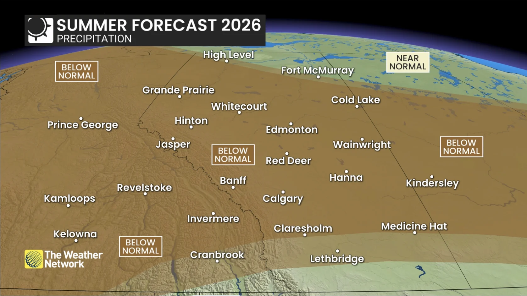
June moisture will be key, as missing out on that critical rainfall would raise concerns about drought in July and August
Your overall temperature outlook:
Your overall precipitation outlook:
Key message
The trough may decide Canada’s summer. The challenge is that it will be a moving target: oscillating, stretching, and occasionally anchoring in place.
A faster west-to-east flow lowers the odds of long-lasting, continent-wide extremes, but cut-off highs and lows can still detach from the main jet stream and create impactful stretches of heat.
We forecast the season and try to anticipate the broad patterns and themes, not the individual weekends and specific weather patterns ahead. We know one bad long weekend can reshape the reputation of an entire summer.
DON'T MISS: Visit our complete guide to Summer 2026 for an in-depth look at the Summer Forecast, tips to plan for it and much more!
THE BIG SUMMER QUESTIONS
Q: Will summer really lock in this year?
A: Blocking patterns are what typically create prolonged heat, drought, and persistent extremes. With El Niño, you get fewer of these patterns, a stronger jet and more west-to-east progression, favouring more simmer than full-on nationwide sizzle.
Q: Why doesn’t this summer look like recent summers?
A: This summer doesn’t appear to have the fingerprints of a coast-to-coast, locked-in heat dome year. A developing El Niño typically supports a stronger jet stream and more movement in the atmosphere, reducing the risk of prolonged extreme heat events.
Q: Is June still going to feel like spring?
A: In some parts of Canada, yes. June may very well carry traces of spring DNA this year, especially across Southern Ontario through Quebec and Atlantic Canada, where cooler interruptions and unsettled weather may show up more frequently. Further north and west, including parts of northern Ontario, the early-summer warmth signal is stronger.
Q: Could this summer feel cooler than the maps suggest?
A: Yes, and part of that comes down to psychology. Seasonal averages don’t fully capture how people emotionally experience summer weather.
We tend to remember standout events: the washed-out BBQ, the chilly cottage weekend, or the rainy long weekend. A few poorly timed cooler stretches can quickly tarnish the reputation of an entire summer. The reverse is also true: a perfectly timed vacation or several sunny weekends can make a summer feel much better than the map highlights.
Cooler-than-normal Great Lakes water temperatures may also create some early-season shoreline chills.
Q: Will Canada see a relentless heat dome summer?
A: A coast-to-coast heat dome pattern does not appear to be the dominant signal this year. A developing El Niño typically supports more west-to-east movement, which makes long-lasting extreme warmth less likely. That said, heat-dome-like setups cannot be ruled out. El Niño can also support split flow, which allows cut-off highs to become trapped outside the main jet stream. That means periods of significant heat are still possible, especially in the west.
Q: Will wildfire smoke become a major issue again this summer?
A: Wildfire smoke can always be a risk during the Canadian summer, but conditions heading into this season are generally less concerning than they were entering the previous few summers. For central and eastern Canada, air quality may improve compared to the past several years. British Columbia and northern Canada remain the key regions to watch for wildfire and smoke risk during hotter, drier stretches.
Q: Why are meteorologists watching the western Pacific typhoon season for clues about Canada’s summer?
A: If western Pacific typhoons recurve, they can inject energy into the jet stream and send ripple effects downstream across North America. At times, that energy can reinforce western ridging and deepen troughing farther east, including around the Great Lakes.
Q: Could this still become a historic summer weather-wise?
A: It’s possible. Seasonal forecasting focuses on broad patterns and tendencies, not individual severe thunderstorms or hurricanes.
Even quieter or cooler El Niño summers can still produce historic weather events and reshape how a season is remembered. The eerily quiet 1992 Atlantic hurricane season still produced Hurricane Andrew, one of the most destructive and costliest hurricanes in U.S history.
And, during the cooler summer of 2009, Ontario experienced the largest single-day tornado outbreak in Canadian history with 19 confirmed tornadoes. Lower overall risk never means zero risk.
To see what summer has in store for Canada as a whole, check out our national forecast here.
WATCH: Canada's overall 2026 Summer Forecast
This article was written with the guidance and forecasting of Dr. Doug Gillham, a senior meteorologist at The Weather Network.