Remarkable Hurricane Zeta makes landfall in U.S. as Category 2 storm

Zeta strengthened to Category 2 strength prior to making landfall in Louisiana early Wednesday evening.
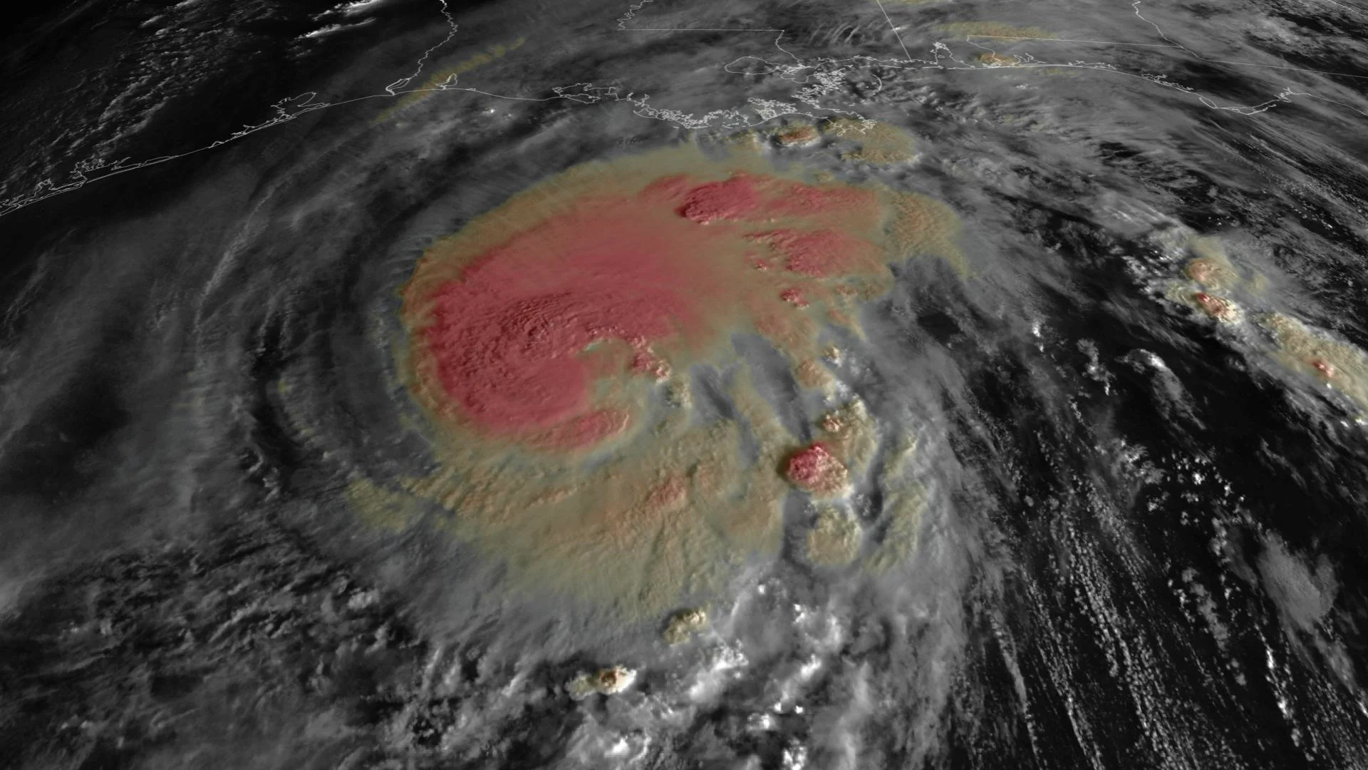
While Zeta lost some strength after making landfall in the Yucatan Peninsula Monday night, it slowly regained it after exiting back over the warm waters of the Gulf of Mexico, inching up past the Category 2 threshold early Wednesday afternoon.
By 5 p.m. EDT Wednesday, the storm had strengthened to around 175 km/h, a high-end Category 2, just as it began making landfall near Cocodrie, Louisiana, around 5:30 p.m. EDT.
"On the forecast track, the center of Zeta will make a second landfall along the Mississippi coast this evening, and then move across the southeastern and eastern United States on Thursday," the U.S. National Hurricane Center says.

Hurricane warnings extended Wednesday night from Morgan City, Louisiana, to the Mississippi-Alabama border, including Lake Pontchartrain, Lake Maurepas, and metropolitan New Orleans in advance of Zeta's expected landfall. A tropical storm warning also extended from the Mississippi-Alabama border to Okaloosa and Walton County Line, Florida.
The storm is expected to lose strength as it moves further inland Thursday.

Damaging winds will spread well inland across portions of southeast Mississippi and southern Alabama Wednesday night.
Dangerous storm surges from 1.52 metres to 2.43 metres are expected from the mouth of the Pearl River to Dauphin Island, Alabama.
Voluntary evacuations were issued for areas that fall outside the levee system in New Orleans. Louisiana Gov. John Bel Edwards issued an emergency declaration ahead of Zeta's arrival.
Residents in the warning areas have been urged to gather emergency supplies that include food, water and medications that could last for at least three days, and prepare for prolonged outages.
While an initial area of heavy rain began to impact the central Gulf Coast Tuesday night, the core of the downpours will spread north into the Ohio Valley and mid-Atlantic through Thursday, near and ahead of Zeta. Rainfall totals of 50-100 mm, with isolated amounts of 150 mm, are expected across these areas, resulting in flash, urban, small stream, and minor river flooding.
As well, a few tornadoes are expected Wednesday and Wednesday night over southeastern Mississippi, southern Alabama, and the western Panhandle of Florida.
All this while Winter Storm Billy has been affecting the southern Rockies and Southern Plains, bringing down trees and powerlines amid a significant and destructive ice storm in Texas and Oklahoma.
RECORD-SETTING YEAR
Zeta is only the second named storm in history to take on that moniker. As well, if it does make landfall onto the U.S. Gulf Coast as predicted, it will be the 11th named storm in 2020 to do so, tying a record. If it does come onshore in Louisiana, it will be the state's fifth landfalling storm this year.

In 2005, Tropical Storm Zeta was the capstone of that year's remarkable hurricane season, which remains the record for most named storms. That season was the first to exhaust the traditional hurricane name list, with subsequent storms being designated with letters from the Greek alphabet.
2020's Zeta not only ties the current season with 2005 for the most number of named storms, it may also be a stepping stone into uncharted territory.
2005's Zeta formed much later, in December, long after the "official" end of the Atlantic hurricane season at the end of November. It also lasted into 2006, only dissipating on January 6th. So there's a non-zero chance further named storms may beckon after this year's Zeta has died down.
Check back as we continue to monitor the track and status of Zeta.
With files from Reuters, CNN.


