
Wintry weather is showing up in Canada, but when is it Ontario's turn?

An 80-year-old, daily temperature record is at risk of being broken on Thursday for the Greater Toronto Area
Ontario will have to hand the keys over to winter eventually, especially southern Ontario.
Fall snow made a brief appearance in the snowbelts and across parts of northern Ontario earlier in October, but has failed to actually take hold long term. To be fair, this was expected in our fall forecast: a mild pattern with cold interruptions.
But other parts of Canada have already seen their fair share of wintry weather this fall, including major cities such as Calgary, Edmonton, Regina, and Saskatoon.
So, when will it be Ontario's turn? Well... it could be a while.
DON'T MISS: Canada's polar vortex wild card is waking up much earlier than expected
Brief burst of cold forecast in the north
Compared to southern Ontario, temperatures across northern Ontario are already fairly cool, with highs sitting in the single digits. However, northern Ontario has actually been experiencing slightly above-seasonal temperatures for this time of year.
The weekend and beginning of next week look to be much milder across the north, with highs in the low teens. But a couple of low-pressure systems in the forecast could bring widespread rain, wind, and a shot of chilly temperatures to the region by the late week.
It should only be brief, though, and the milder pattern should make a comeback heading into the second week of November.
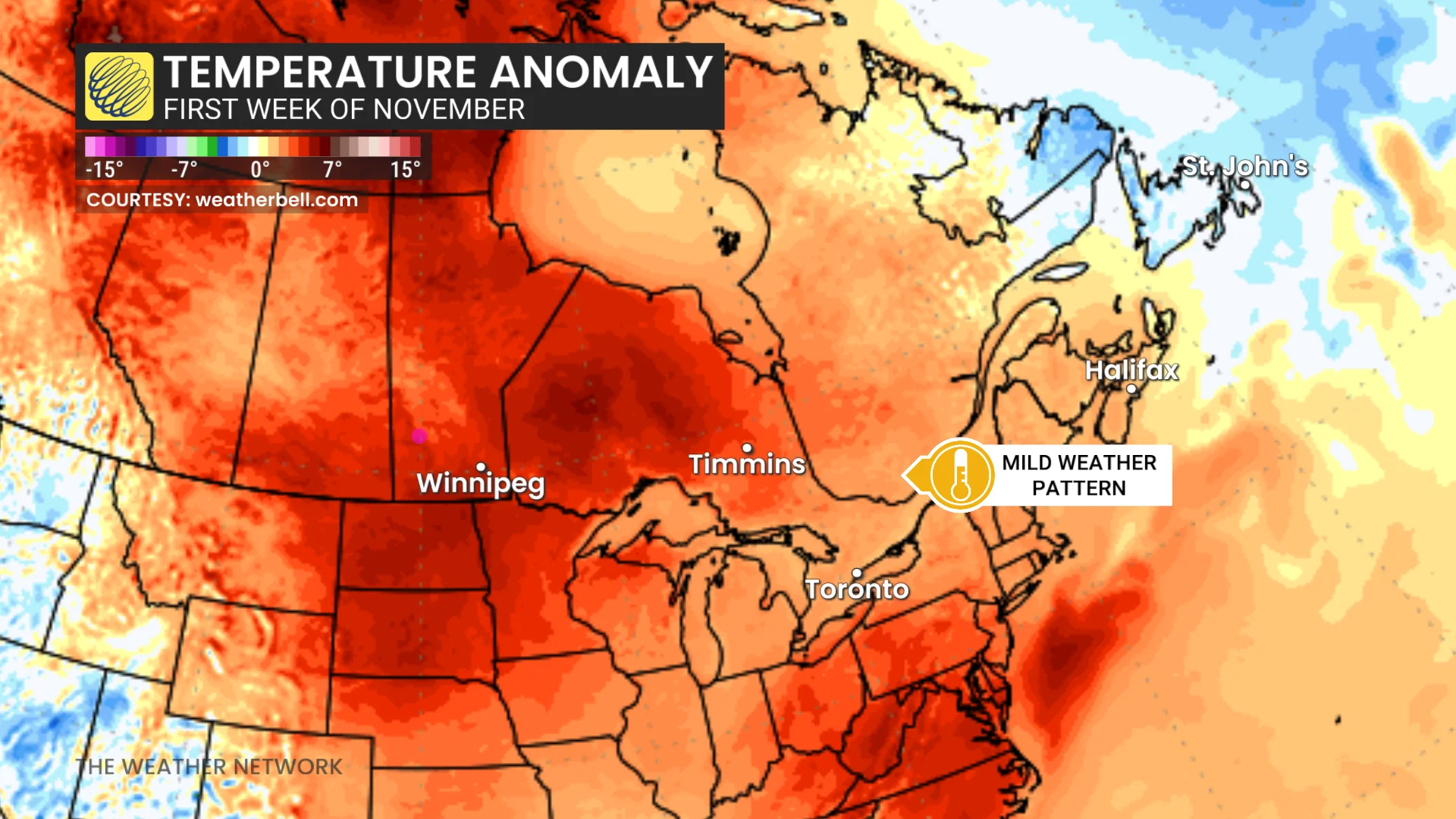
Toronto shows no signs of freezing; 80-year-old record at risk
Toronto still hasn't recorded any temperatures at or below freezing since May 3. On average, we expect to see the first 0°C reading of the season around Oct. 13, which is now well behind us.
With a mild pattern forecast to continue into the start of November, there are no signs of freezing in the near future. For reference, average daytime temperatures across southern Ontario are around 10-11°C, and overnight lows are 3-4°C this time of year.
SEE ALSO: Halloween forecast: Nothing scary, but your costume may need a jacket
A notable warm front with southwesterly winds over southern Ontario will raise the thermometer on Thursday, bringing daytime highs into the low 20s for many. Toronto could even see an 80-year-old daytime record broken if the temperature surpasses 21.7°C.
It’s not too unusual to experience temperatures at or above 20°C this late in the season. We’re closing in on the average date of the last 20°C reading in Toronto, Ottawa, and Windsor. However, conditions in the 20s can linger well into November.
A warm pattern in 2020 stands out, in particular, though Toronto did see accumulating snow just two weeks after that season’s final 20°C.
Stay with The Weather Network for more information and updates on your weather across Ontario.