Wintry system will quickly erase hopes of early spring in northern Ontario
After a brief fling with spring-like temperatures this week, a messy system infiltrating northern Ontario will remind residents in a hurry there is plenty of winter weather left
Ontario will be getting another pleasant, but short, preview of early spring this week.
Temperatures will see a nice boost courtesy of a southerly flow associated with a warm front, sending values into the teens for the south and almost reaching the double digits in northern sections.
SEE ALSO: Wild weather swing in Ontario with thunder threat followed by flash-freeze risk
However, it won't be staying long. The warmth will come to abrupt end as a cold front will send temperatures plummeting, increasing the chances of a flash freeze, alongside a bout of heavy snow, ice pellets and freezing rain.
Some areas could see up to 40 cm of snow. Needless to say, especially in areas that see the heaviest snowfall, travel along the Trans-Canada Highway, from Kapuskasing to Moosonee, won't be recommended.
Taste of spring in northern Ontario before winter weather returns
A significant warm-up is in store for southern and northern Ontario Tuesday, with temperatures nearly hitting the double digits for the latter –– not quite as high as the former.

Temperatures will extend into the upper single digits, above normal for this time of the year.
Don't get used to it, though. An abrupt switch back to winter weather will occur, including heavy snow, ice pellets and freezing rain.
The strong, southerly flow responsible for bringing in the above-seasonal temperatures will switch directions, allowing a cold, arctic air mass to take its place.

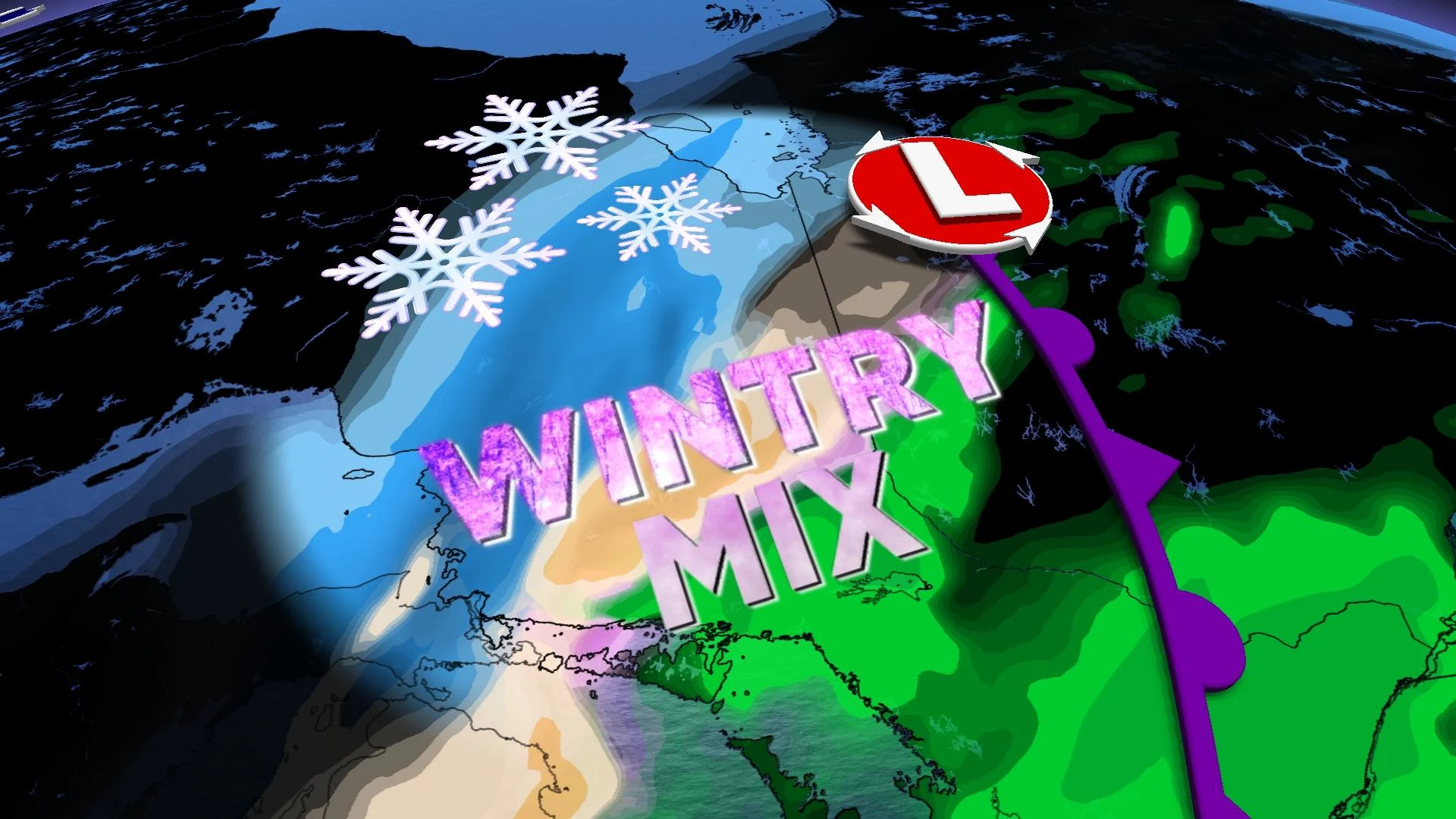
As a result, heavy snow will develop on the backside on Tuesday and into Wednesday. Courtesy of a low-pressure system, snow will move into northwestern Ontario Tuesday morning and continue to track northeast through the day towards James Bay, dropping 10-20 cm in its wake in the northwest and upwards to 40 cm in the northeast towards James Bay.
For areas near Timmins and south, milder temperatures will cause rain to fall in the region, as well as the threat of several hours of freezing rain.

A wintry mix will be possible along the warm and cold boundaries, so the potential for freezing rain and ice pellets will exist for Sault Ste. Marie, Timmins and New Liskeard, as well.
Areas between Timmins and Sudbury will need to be concerned about a flash-freeze risk with the sudden and sharp drop in temperatures. Drivers will need to be cautious on the roads during this time.

As for the snowfall accumulations, the heaviest snow will be north of the Trans-Canada Highway from Kapuskasing to Moosonee, where there could be 20-40 cm. If you have travel plans along Highway 1, you could see anywhere from 10-20 cm of snow in that area. Driving will be rather treacherous, so consider postponing non-essential travel.
Looking ahead further, there is some good news on the horizon. The quick blast of arctic air will be followed by much milder weather during the weekend and early next week. However, a spring storm is expected for early next week, associated with another strong Arctic front.
Stay tuned to The Weather Network for the latest forecast updates for northern Ontario.


