Snow, ice, and rain to sweep Atlantic Canada to end the weekend
Get ready for periods of snow, ice, and heavy rain across Atlantic Canada heading into the new workweek
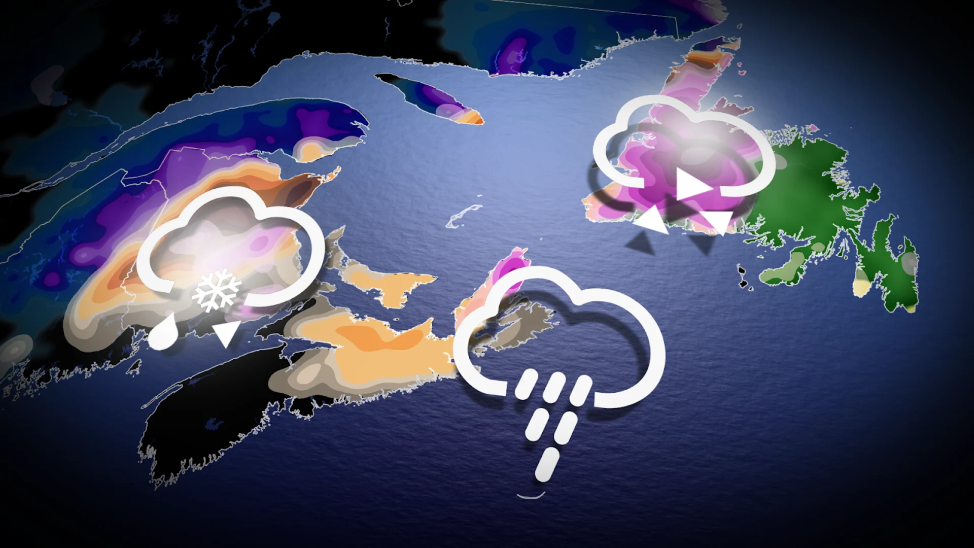
Wintry weather knows no calendar, and portions of Atlantic Canada will find themselves on the receiving end of snow and freezing rain as we crest the middle of April to start the week.
Expect potential travel issues across communities where snow and ice coat roadways and sidewalks.
DON'T MISS: Get to know the hidden gems across Canada
A low-pressure system developing off the coast of New England this weekend will lift waves of moisture north across the Maritimes.
Sunday will see the moisture first spill over the Maritimes before pushing into Newfoundland. A second wave of precipitation is likely for Newfoundland late Monday into Tuesday.
Wintry conditions for parts of Maritimes, Newfoundland
Pockets of cooler air will lead to a wintry mix throughout both New Brunswick and Newfoundland over the next couple of days.

A period of snow is likely across the northern half of New Brunswick, with 10-15 cm of accumulation in the forecast for many areas. Some areas—including Grand Falls, Campbellton, Bathurst, Miramichi, and Edmundston—are at risk for locally higher snowfall totals.

SEE ALSO: A major polar vortex disruption is influencing Canada’s weather
Sunday night will feature a higher risk for freezing rain across inland sections of New Brunswick. We’ll also see widespread freezing rain throughout the western half of Newfoundland, with significant totals possible for west-central portions of the island. Beware the risk for tree damage and power outages across communities that see significant ice accretion from freezing rain.
Rainy conditions expected for southern sections
Meanwhile, folks across southern New Brunswick, Nova Scotia, and southern Newfoundland can expect rain—heavy at times—as mild flow from the Atlantic Ocean dominates these regions.
Forecasters expect the heaviest rainfall totals in the Maritimes to focus on the Bay of Fundy shores, where 20-30+ could fall in the gauges through Tuesday morning. Folks down toward Halifax can expect lighter rainfall totals on the order of 5-10 mm.

The double-dose of moisture heading for Newfoundland will beef up totals throughout eastern portions of the island. Expect a widespread 30-50 mm of rain here, including Gander, while around 50 mm of rain is likely for most of the Avalon and Burin Peninsulas, including St. John’s.
Thankfully, winds will be a non-factor during this event, with most areas seeing gusts remain below 60 km/h.
Looking ahead, another system will sweep into the region, bringing the potential of more showers mid-week. Temperatures will be warmer than usual early next week, before a shot of cooler air sends temperatures tumbling below normal.
Stay with The Weather Network for more forecast updates across the Maritimes.