Messy mix of snow, rain will impact southern Ontario on Wednesday

A mid-week system will bring another round of snow and rain to southern Ontario, but it's New Year's Day that has forecasters' attention — with a potent Texas low threatening to bring a prolonged period of freezing rain.
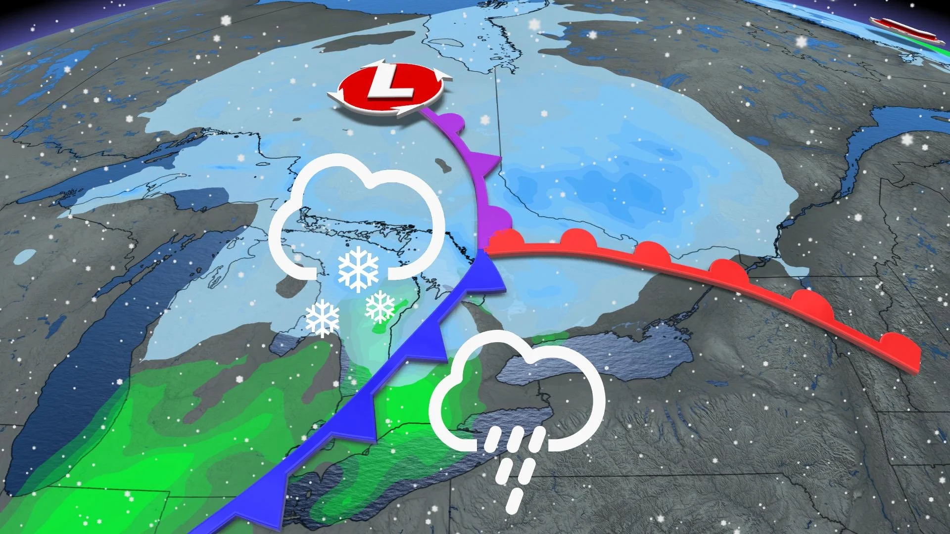
Many regions in southern Ontario will see a messy mix of snow and rain on Wednesday as a low pressure system tracks into the province. The weather will remain unsettled over the next few days due to another system, which will be more potent that the one on Wednesday, threatening a prolonged period of freezing rain across a large portion of southern Ontario. However, forecasters say that the exact timing and track of the system are currently uncertain. Details and timing,
WEATHER HIGHLIGHTS:
Low-pressure system bringing rain, snow in south for Wednesday
Texas low brings the potential for swath of freezing rain on New Year's Day
WEDNESDAY: MESSY MIX OF RAIN AND SNOW
A low pressure system that is tracking into southern Ontario will bring snow throughout the southwest and GTA, which will then transition to rain in the late morning and afternoon hours. Snow will continue for Dundalk Highlands, central and eastern Ontario through the day.

Environment Canada has issued a weather advisory for the Grey Bruce region and cottage country since the snow will be heavy at times throughout the day. “Travel is expected to be difficult due to accumulating snow and slippery conditions. Conditions should improve by Wednesday afternoon as a changeover to wet snow or rain is expected,” states Environment Canada.
Snowfall accumulations will remain highest in regions along northern Georgian Bay shores, where 10-15 cm is possible, while the Dundalk Highlands may see 5-10 cm. Less than 5 cm is expected elsewhere in southern Ontario including the GTA.
Rainfall amounts won't be too heavy, either, with 5-15 mm for most of southern Ontario.
Behind the system, a brief shot of lake-effect snow will occur in the overnight hours around lakes Huron and Superior, as well as Georgian Bay. The snow will taper off early Thursday morning, with the rest of the south experiencing fair conditions through the rest of the day.
LOOK AHEAD: FREEZING RAIN RISK FOR NEW YEAR'S DAY
Beyond, a second stateside system developing in Texas Thursday will trek in through the day on New Year’s Day, bringing a freezing rain potential for southern Ontario. With Arctic air to the north and temperatures plummeting, there will be the possibility of a prolonged period of freezing rain and ice accretion.

A more extended period of freezing rain with significant ice accretion is expected for the Dundalk and Haliburton Highlands. For the Ottawa Valley, the precipitation should begin as snow during Friday night and then change to ice pellets and freezing rain with significant ice accretion possible.
Because we’re still three days out, models will vary and there are a couple of scenarios that could play out. It is too early to discuss the exact impacts and track, but there is a possibility of freezing rain on New Year’s Day, depending on the eventual track of the low.


