Wintry encore for Alberta as coldest air since April arrives

Prepare for subfreezing high temperatures by the middle of the week
The recent burst of wintry weather in Alberta was a taste of the cold air and snow to come heading into the final week of October.
Expect the coldest temperatures in six months to descend on the province in the days ahead. Additional snowfall is also likely for some areas.
DON'T MISS: Canada's polar vortex wild card is waking up much earlier than expected
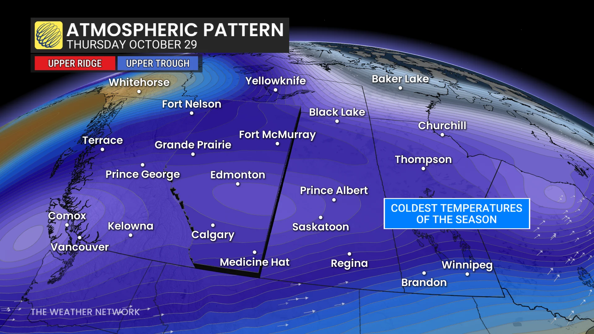
A robust upper-level trough will dip across Western Canada through the middle of the week. This pattern will help to funnel cold air south across Alberta.
How cold are we talking?
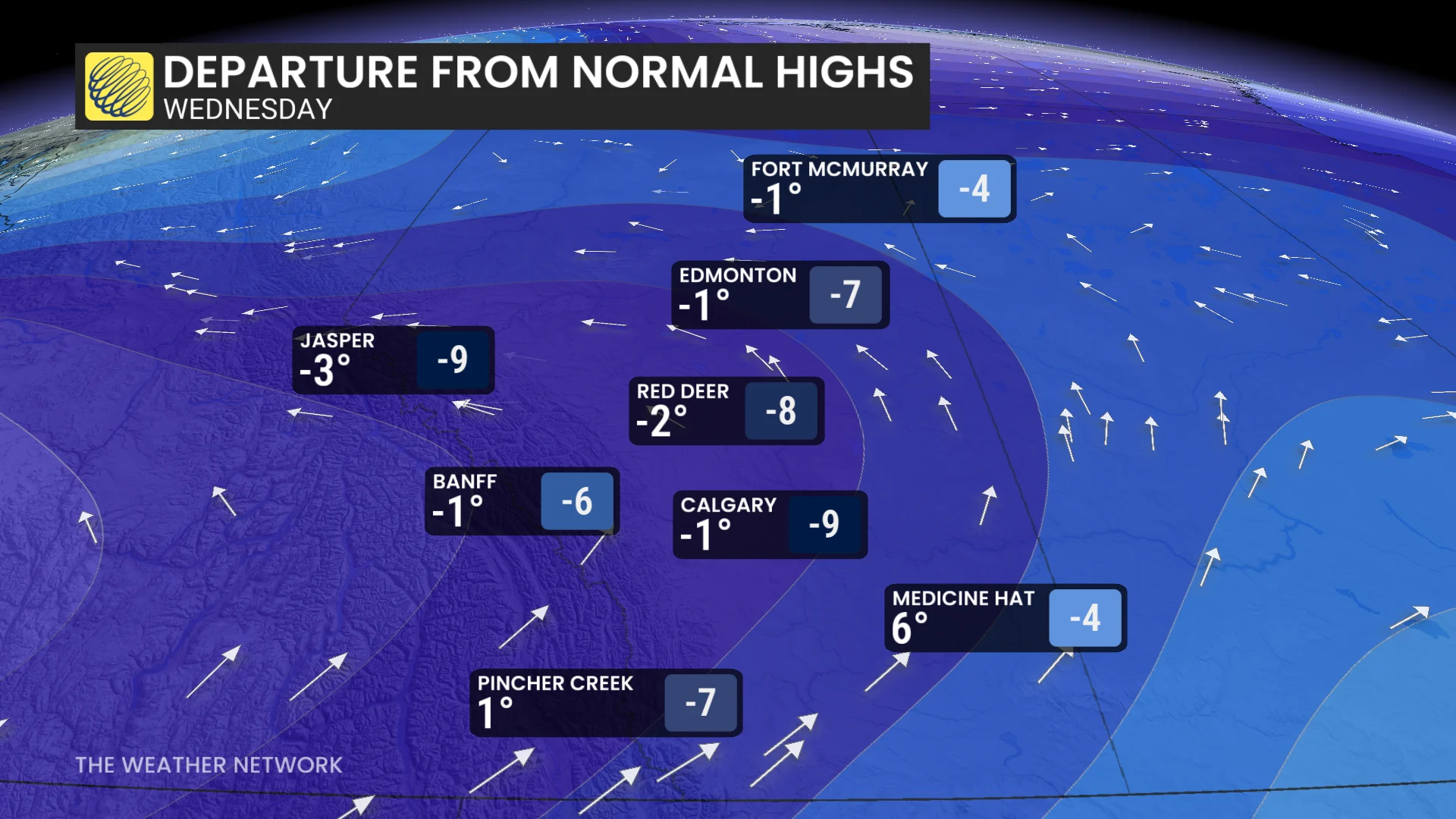
Daytime high temperatures will remain below the freezing mark for most of the province by Wednesday, with a forecast high of -1°C for Calgary, -2°C for Red Deer, and -1°C for Edmonton. These communities haven’t seen a subfreezing high temperature since the end of April.
Meanwhile, a centre of low pressure will develop at the surface as moisture streams over the Rockies and into the region during the day Tuesday.
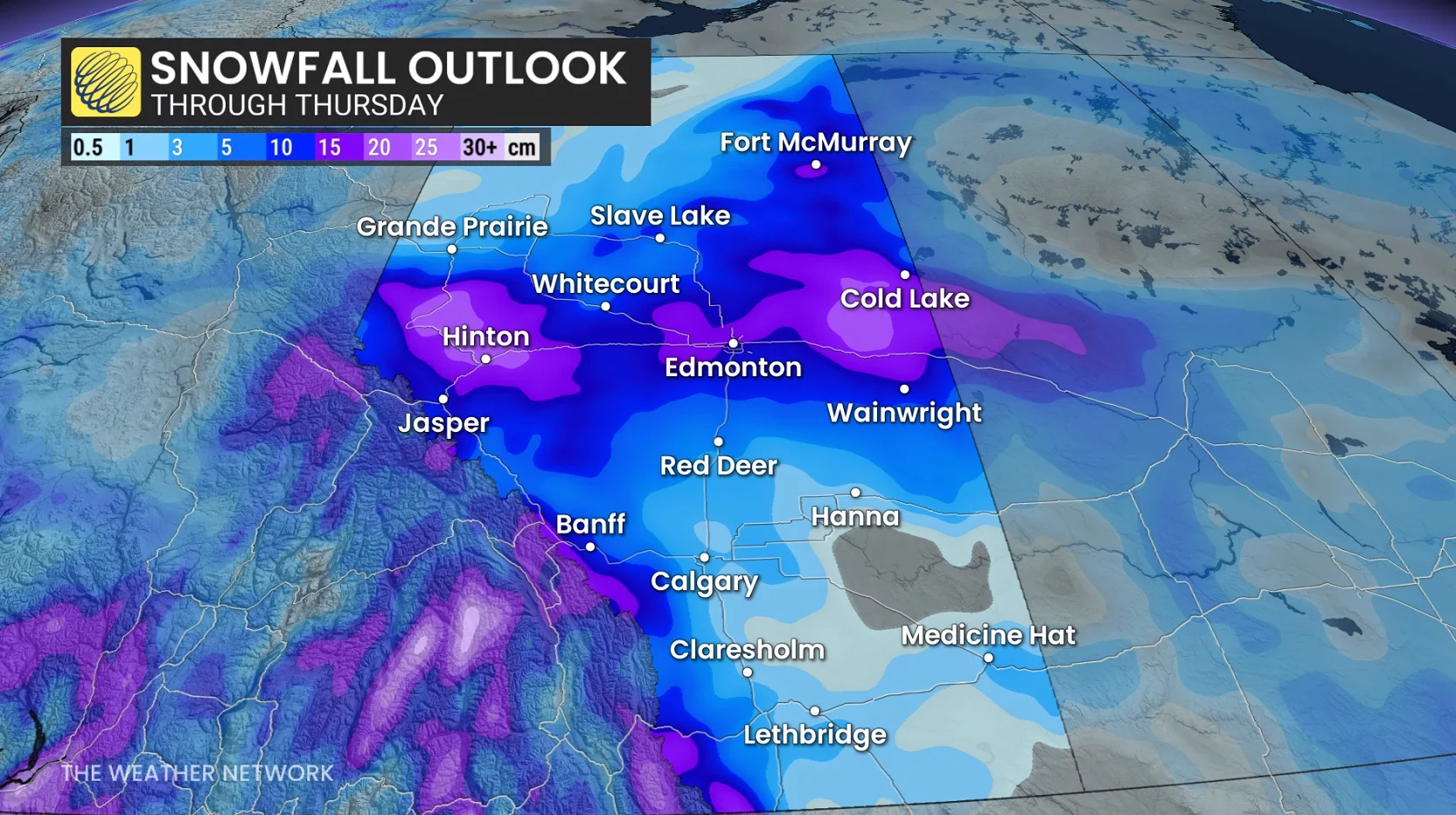
Widespread snow will begin filling in across central Alberta on Tuesday evening and continue into the nighttime hours. Periods of snow will persist throughout the day Wednesday before easing into Thursday.
Computer guidance still disagrees about precise snowfall totals, but higher amounts remain possible across central Alberta, near and north of Edmonton as well as along the Yellowhead corridor toward Saskatchewan.
Lower totals are expected in southern Alberta, where folks close to Calgary could see 3-5 cm of accumulation. Higher amounts are likely toward the foothills.
Stay with The Weather Network for all the latest on conditions across Alberta.