Snowstorm targets southern Ontario with poorly timed impacts to travel

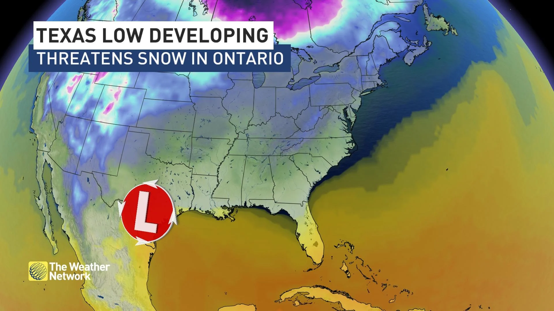
Texas low threatens 15+ cm of snow for some in southern Ontario on Wednesday, which could end up being the most impactful system of the year so far. Make your travel plans ahead
Those in southern Ontario will need to start rethinking or postponing their travel plans Wednesday evening and Thursday morning with a potent storm knocking on the doors, bringing the potential for 10-15+ cm of snow across the region. Forecast confidence is growing that the heaviest of the snow will blanket Highway 401 -- Canada's busiest traffic corridor.
"Cold air digging south will mix with ample warm and moist air from the Gulf, [which] will stir into a strong storm system that will climb north into southern Ontario for Wednesday," says Kelly Sonnenburg, a meteorologist at The Weather Network.
RELATED: What has derailed so many southern Ontario storms this winter
A weak clipper will bring light snowfall into eastern Ontario and parts of the Greater Toronto Area (GTA) into Tuesday morning, but this is just the tip of the iceberg for what's to come.
A snowstorm Wednesday is the main event, expected to bring a swath of heavy snow and will likely have an impact on multiple commute times. For some in southern Ontario, this could be the biggest snowfall event so far this season, if the higher totals pan out. There is however, still some uncertainty with the exact snowfall amounts.
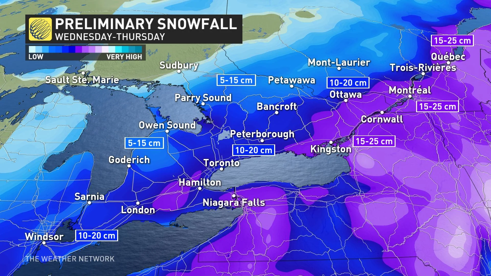
Snow will begin to spread across southwestern Ontario through the morning hours on Wednesday, with snowfall rates forecast to intensify through the late afternoon and evening hours, especially for the GTA.
"Snowfall rates of 1-3 cm an hour are possible through the evening for the GTA," Sonnenburg warns.
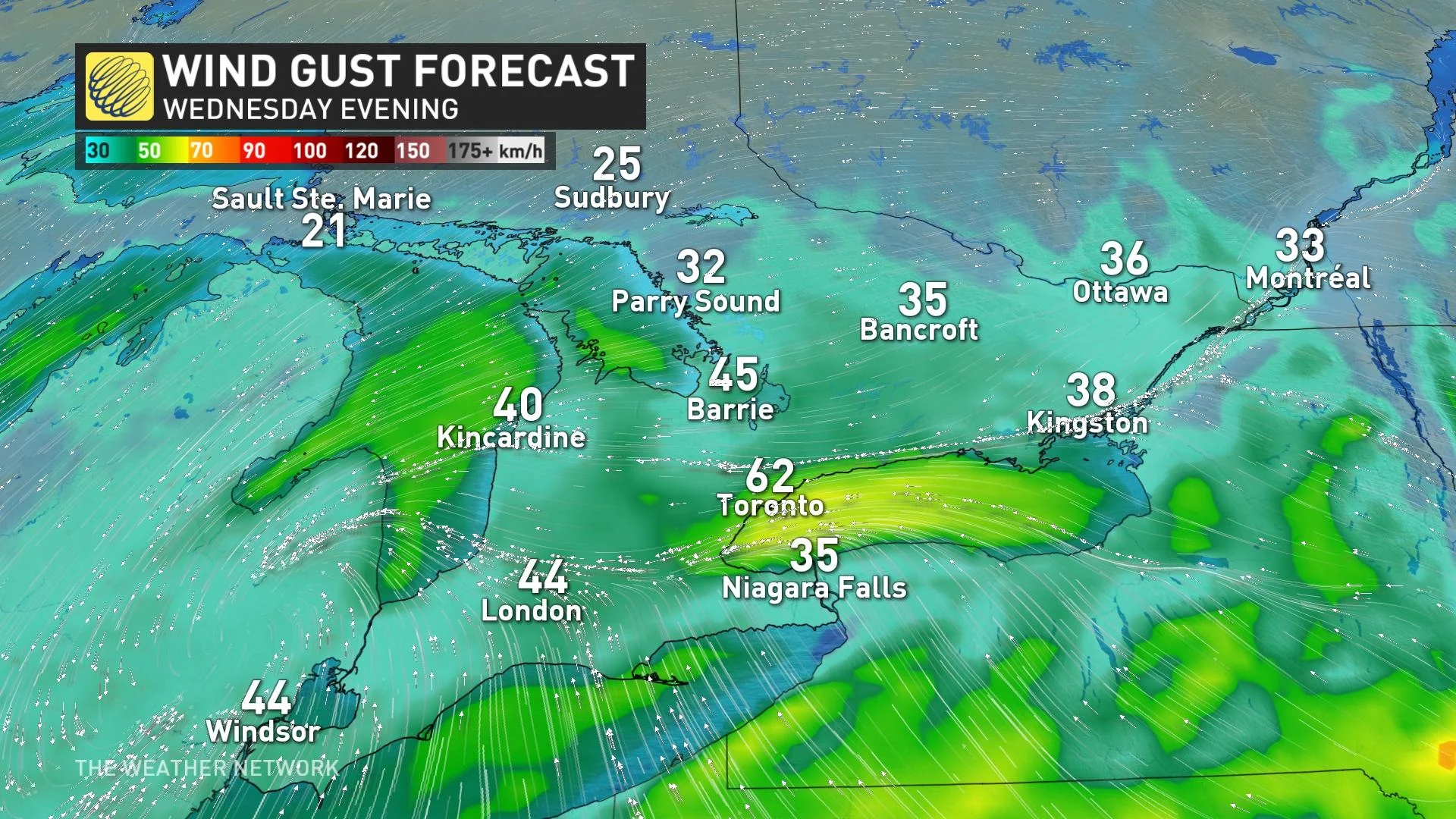
Wind gusts of 40-60+ km/h locally in combination with the snowfall will make for reduced visibility on the roads through the evening and overnight hours. Motorists should plan ahead and allow for extra time on the roads or postpone non-essential travel as delays are likely.
Whiteouts and blizzard-like conditions at times are possible for the western GTA, due to gusty, easterly winds. Areas just away from the lakeshores and in higher terrain such as Hamilton Mountain could overachieve in snowfall amounts.
The snow will arrive in eastern Ontario and the Ottawa area through the afternoon, with the greatest snowfall rates expected through the overnight and into early Thursday morning.
Some mixing or rain may nudge north into communities along the southern Great Lakes shoreline, but there is still uncertainty in this. There is also uncertainty in the snowfall totals, which are dependent on the track of the low and the temperatures associated with the storm system.
Snow will then depart the region through the day on Thursday as the system continues to make its way eastwards.
WATCH: Will Ontario storm finally bring 'winter,' or will it get derailed again?
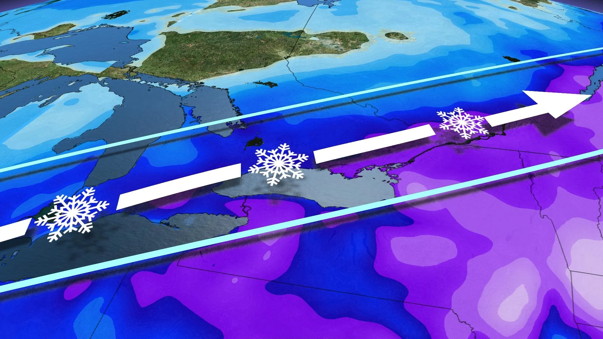
Active pattern stays locked in for the final days of January
While fairly far out, long-range forecast models are all hinting at the likelihood of some western clippers that could slide across Ontario in the final weekend of January. Snowfall totals are highly uncertain, but we do know clippers typically bring a quick burst of snow as they slip through an area, given their usual lack of moisture.
Due to the common uncertainty in long-range forecasts, these details are subject to change and only provide an early glance at what is possible ahead in the weather pattern.
WATCH: Is it a good idea to leave windshield wiper blades up before a snowfall?
Check back in with The Weather Network for updates on the forecast for Ontario.