Up to 30 cm of snow, heavy icing en route to Atlantic Canada
Wintry weather refuses to let go of its grip on Atlantic Canada as another round of snow, freezing rain and rain is on the way into this week
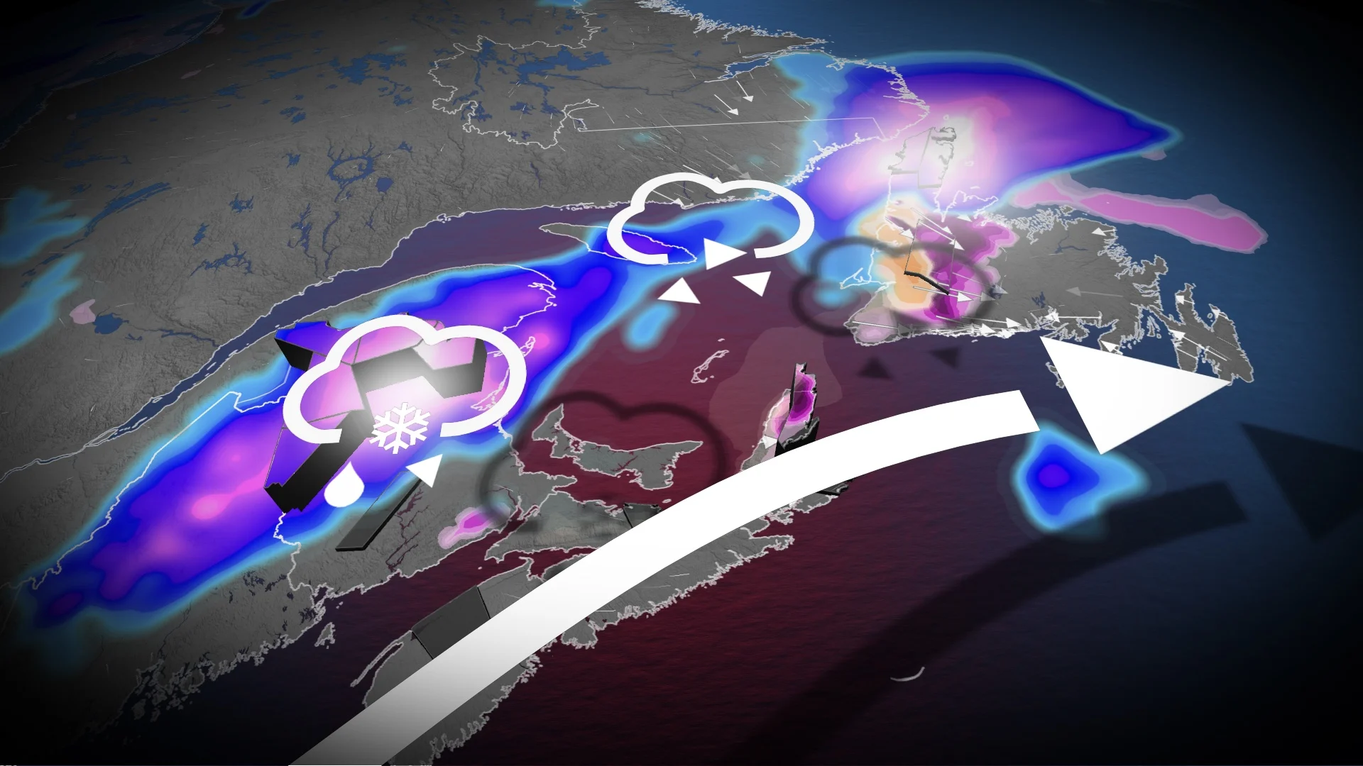
April's wintry side will extend its stay on the East Coast into this week, with a bout of heavy snow, rain, and freezing rain on tap for parts of the region.
The event could produce up to 30 cm of snow or 50 mm of rain, with a period of freezing rain thrown in for some areas.
DON'T MISS: Get to know the hidden gems across Canada
Expect potential travel and power issues across communities where snow and ice coat roadways and sidewalks, as well as trees and hydro poles. Motorists may also face hazardous driving conditions from water pooling on roadways.
Be sure to monitor local weather alerts and check highway conditions before heading out to start the week.
Wintry conditions for parts of Maritimes, Newfoundland
Pockets of cooler air will lead to a wintry mix throughout both New Brunswick and Newfoundland over the next couple of days.

A period of snow is likely across the northern half of New Brunswick and parts of Newfoundland. The model consensus is 5 cm to locally 15 cm of snowfall across the higher terrain of northern New Brunswick, but the highest snowfall forecast goes to St. Anthony, N.L., where up to 30 cm is possible.
SEE ALSO: A major polar vortex disruption is influencing Canada’s weather

New Brunswick cities at risk of heavy snowfall include Grand Falls, Campbellton, Bathurst, Miramichi and Edmundston.
Sunday night will feature a higher risk for freezing rain across inland sections of New Brunswick. Significant freezing rain is also predicted for western Newfoundland beginning Monday but becoming more widespread in the evening and overnight.
Beware the risk for tree damage and power outages across communities that see significant ice accretion from freezing rain.

Rainy conditions expected for southern sections
Meanwhile, folks across southern New Brunswick, Nova Scotia, and southern Newfoundland can expect rain—heavy at times—as mild flow from the Atlantic Ocean dominates these regions.
Forecasters expect the heaviest rainfall totals in the Maritimes to focus on the Bay of Fundy shores, where 20-40 mm could fall in the gauges through Tuesday morning. Folks down toward Halifax can expect lighter rainfall totals on the order of 5-10 mm, but as much as 30 mm is possible for Cape Breton.

The double-dose of moisture heading for Newfoundland will beef up totals throughout eastern portions of the island. Expect a widespread 30-50 mm of rain here, including Gander, while around 50 mm of rain is likely for most of the Avalon and Burin Peninsulas, including St. John’s.
Looking ahead, another system will sweep into the region, bringing the potential of more showers mid-week. Temperatures will be warmer than usual early next week, before a shot of cooler air sends temperatures tumbling below normal.
Stay with The Weather Network for more forecast updates across the Maritimes.