Up to 10 cm: Tricky travel Tuesday as southern Ontario sees next snow round
A persistent Alberta clipper will bring a burst of widespread snow across Ontario through Tuesday. Forecasters are also looking at a Cold Pattern set to sweep across Ontario and lower temperatures on Thursday.
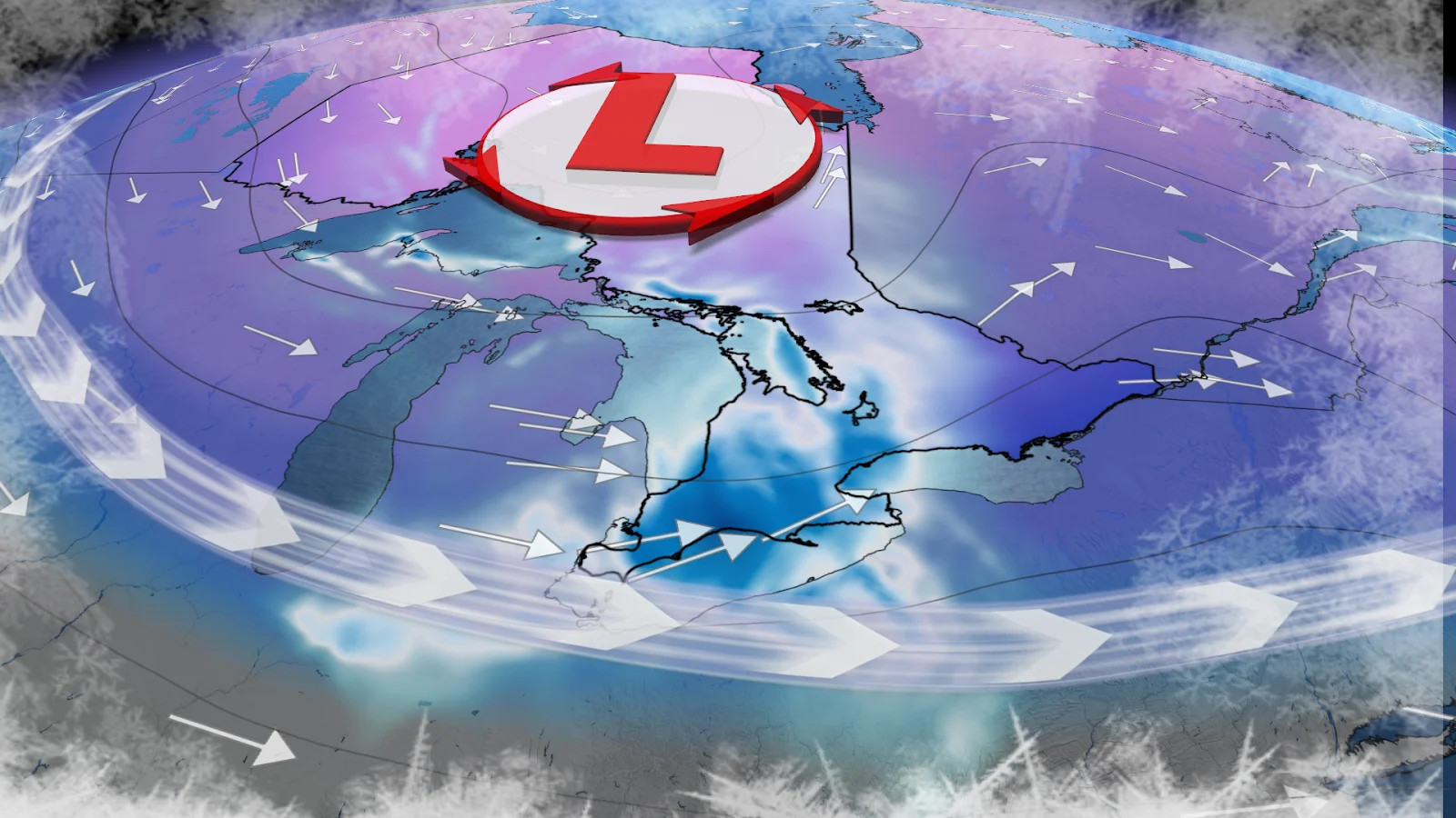
After another snowy week across Ontario last week, forecasters are looking at an incoming clipper system from the Prairies that is forecast to drop widespread snow across the entire province through Tuesday.
Forecasters are also looking ahead to the latter half of the week, when a cold pattern will bring deep temperature drops to Ontario, including the Greater Toronto Area (GTA).
SEE ALSO: Why salt may have caused that power outage
Snowy clipper moves through Ontario Tuesday
A snowy clipper making its way across the Prairies will track through northwestern Ontario Tuesday morning, bringing up to 10-15 cm around Lake Superior near Thunder Bay.
The system will continue to trek east over the rest of northern Ontario throughout the morning and afternoon, bringing 10-15 cm of snow to Sault Ste. Marie, which has already received more than 400 cm of snowfall so far this season.

The clipper will reach southern Ontario by the late evening hours, impacting post-dinner commutes across the GTA with bursts of heavy snow and near 50 km/h winds.
Flurries will then linger into Wednesday as the system moves into Quebec, but we could still see some lake-effect snow bring heavier totals to the snowbelts.
RELATED: A winter storm's track can make or break your forecast
Overall, southern Ontario is forecast to see a widespread 5-10 cm of snow by the end of the day on Wednesday. So you may need to shovel ahead of the Wednesday morning commute.
While this system may not bring a lot of snow this week, Toronto has seen some of its highest snow totals to start the year.

Between January and February Pearson airport has record 112 cm of snowfall, an amount not seen since 1939. This is thanks to the snowiest January on record and an active February, but the snow isn’t over for Toronto yet, more snowfall may be on the way.
Following the mid-week snowfall, there will be a below-normal drop in temperature across the province. Expect -5 to -15 °C all across Ontario on Thursday, going into the weekend.

This cold air is expected to bring temperatures 5 to 10 degrees below normal for the GTA by the upcoming weekend.
Stay with The Weather Network for more information and updates on your weather across Ontario.