Will a typhoon convince you to put your winter tires on?

It might sound implausible, but a distant storm thousands of kilometres away can, indeed, have an effect on Canada's weather.
The actions of a single storm over 10,000 kilometres away are about to influence your decisions on winter tire installation.
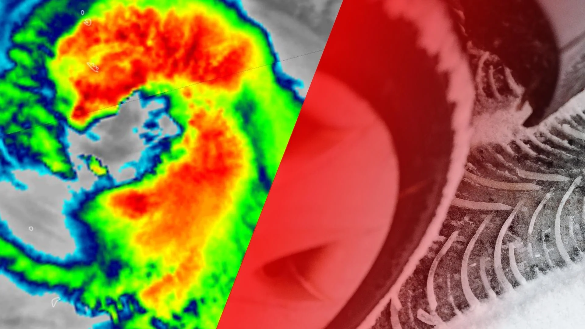
I'll prove it right here. The storm, none other than Typhoon Malou, brought gusts of 200 km/h over the open seas of the western Pacific Ocean. But the winds at the surface are not the problem. Rather, it's the Typhoon butterfly effect that'll amplify and enhance an impending pattern change across Canada.
Typhoon recurvature theory, in its essence, often beats a computer model for forecasting. It's a complicated dance: when remnant typhoon energy makes its way towards the top of the troposphere, the lowest layer of Earth's atmosphere, it alters the jet stream position.

The one perturbation, the typhoon energy, although seemingly just one chaotic ripple, can propagate and build downstream impacts, and that transformation takes centre stage across Canada.
THE WEST
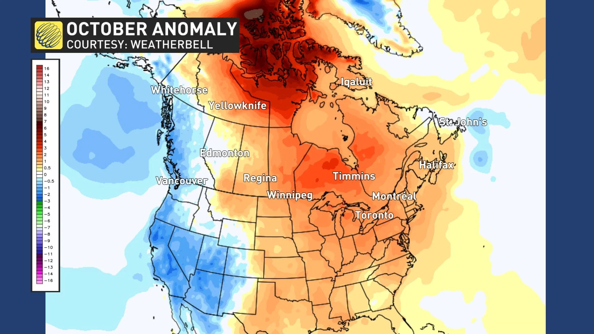
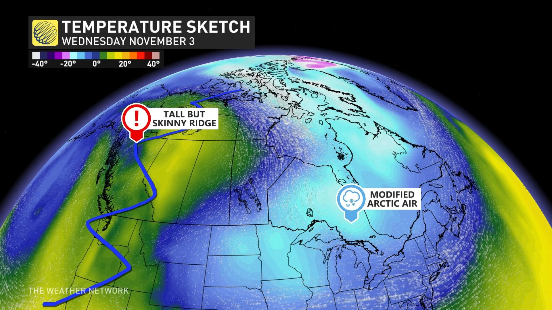
Some subtropical moisture makes for some early fanfare in the west, amplifying a skinny, albeit super-tall ridge of high pressure across British Columbia, extending into the Arctic. That will once again pump warm air across Nunavut, something that's been the trend since late September.
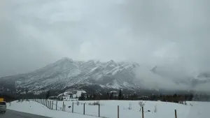
British Columbia, you'll have some dry, northerly flow – so pockets of chilly air will be lurking for Halloween, but things warm through the first week of November.
Since it’s a slender high-pressure ridge, the propensity will be for Pacific storms to make quick work of it, with a storm track bursting through into November.
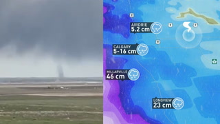
In the Prairies, you'll get a cocktail of some modified Siberian and Arctic air. Not nature's chilliest mix, but enough to remind us the coldest days of winter are around the corner. The cold air will not stay for a significant duration; we've pumped too much heat across northern Canada for that to become a reality.
THE EAST
The cold that oozes out of northern Canada – that'll slide further southeast towards the Great Lakes next week, helped by the enhanced amplification thanks to our typhoon energy.
During the first week of November, that cold air mass will migrate over the Great Lakes, triggering some lake-effect wet snow. And, with how warm the water temperatures are, that'll act as a fuse to fire off the necessary instability.
Quebec, colder air is also expected, with temperatures falling into the lower single digits, meeting the threshold to change over to the more reliable winter rubber.
Atlantic Canada, the warm Atlantic Ocean and mild southerly flow might have built a little complacency, and although November starts mild – the chiller air will press east at times.
We've depleted the arctic air availability across Northern Canada by late-next week, so no viciously cold air outbreaks are imminently looming after next week.
But may the seemingly innocuous typhoon in the Western Pacific be that gentle reminder to switch on your winter tires. It'll be the catalyst that helps bring the chilliest air mass of the season back home.