Far-reaching storm risk over B.C., the Prairies with risk to turn severe

Stay alert: Atmospheric instability and wind shear could lead to some stronger storm development and a supercell or two Wednesday afternoon and evening
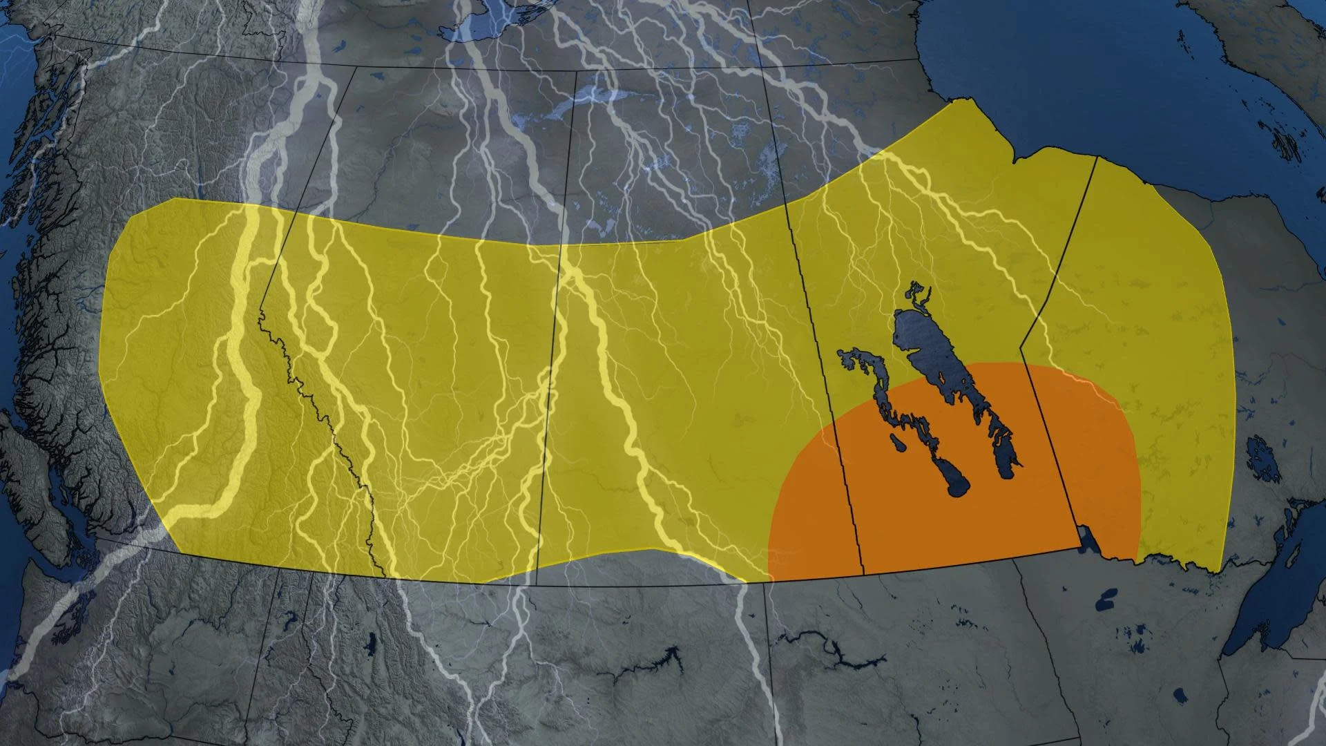
Widespread, scattered thunderstorms are forecast across much of the Prairies and Interior B.C. on Wednesday. Stronger atmospheric instability and wind shear present over southeastern Saskatchewan and southern Manitoba could lead to some stronger storm development, and even a supercell or two Wednesday afternoon and evening.
There is also the risk of new wildfire ignition across B.C. and Alberta.
It's a dire circumstance the latter province is facing, especially, with tens of thousands forced to flee as out-of-control wildfires continue.
MUST SEE: Destroyed homes, infrastructure among wildfire losses in Alberta communities
A broad upper-level trough in the jet stream, combined with mid-level troughs, are responsible for triggering these widespread thunderstorms across much of Western Canada this week.
Wednesday
Areas: Much of Western Canada from British Columbia through all three Prairie provinces are at risk, with a focus on southeastern Saskatchewan and southern Manitoba for possible severe thunderstorms
Timing: Afternoon and evening
Weather: A broad trough continues to bring widespread scattered thunderstorms and rain showers across Western Canada. Wednesday will be the final day of a widespread storm threat as a ridge in the jet stream is forecast to build by the end of the week bringing hot temperatures and an end to the active weather.
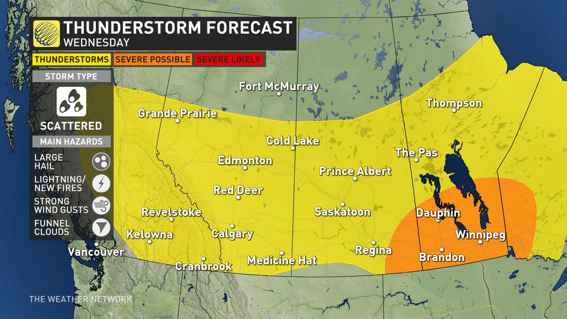
Stronger storm dynamics with increased instability and wind shear in the atmosphere could support stronger storms developing in southeastern Saskatchewan and southern Manitoba. A supercell or two is also possible.
Threats: Small hail, strong wind gusts and lightning that could ignite new wildfires. We also can’t rule out the risk of funnel clouds.
In southern Manitoba, if storms strengthen to severe warning criteria, large hail and wind gusts near 90 km/h would be possible.

RELATED: Smoky skies expected for swath of B.C. as fires burn in northeast and Alberta
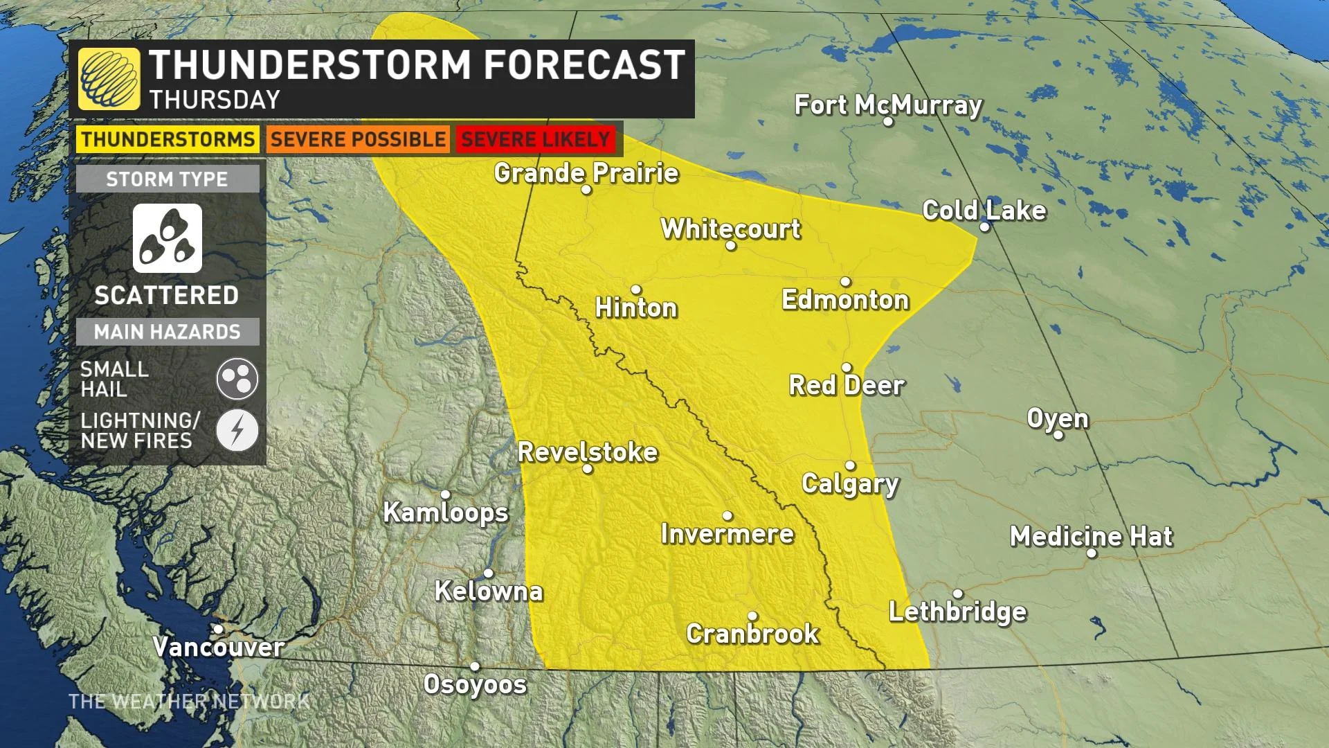
Thursday
Areas: Interior British Columbia and Alberta
Timing: Afternoon and evening
Weather: Thursday is the last day for more widespread, scattered thunderstorms across Western Canada before a ridge in the jet stream builds and a heat dome takes over the weather pattern. Small hail, and lightning would be the main threat with any storms that develop as most should stay non-severe in nature.
Prepare
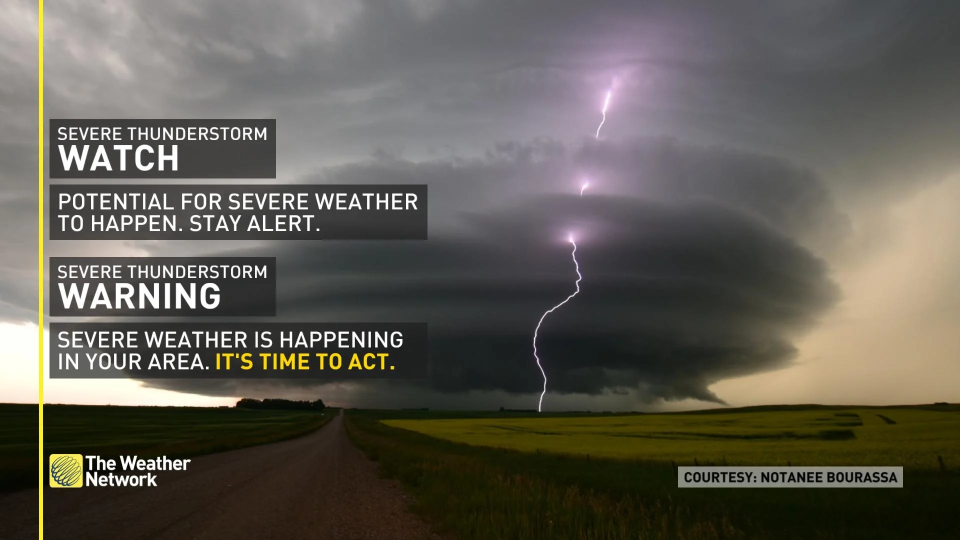
Stay alert and monitor the forecast for updates. Have a plan and a place to head indoors if the weather changes.
Watches mean conditions are favourable for the development of severe thunderstorms. Warnings mean they are imminent or are occurring in your area.
In communities with elevated or high wildfire danger ratings, or could be threatened by a blaze in the near future, residents should take time now to review emergency preparedness and evacuation plans in the event of a nearby fire. Individuals and families should be prepared to take care of themselves for at least 72 hours in case of evacuation due to wildfires.
Analysis
A broad upper-level trough in the jet stream, combined with mid-level troughs, are responsible for triggering widespread thunderstorms across Western Canada this week. Mild temperatures through peak daytime heating hours build atmospheric instability, sufficient enough for thunderstorm development. The pattern change will unfold across the west late week and into the weekend where an upper-level ridge and heat dome will take over the weather pattern, bringing an end to the thunderstorm risk and a return of the extreme summer-like heat.
The slow-moving nature of the thunderstorm activity and steeper topography in British Columbia pose a risk of flooding.
WATCH: Family 'shell-shocked' after losing home to wildfires
Stay with The Weather Network for the latest on conditions throughout the region.