Severe storm risk continues in northwest Ontario into Thursday night
Stay alert as storms traverse northwestern Ontario through Thursday evening
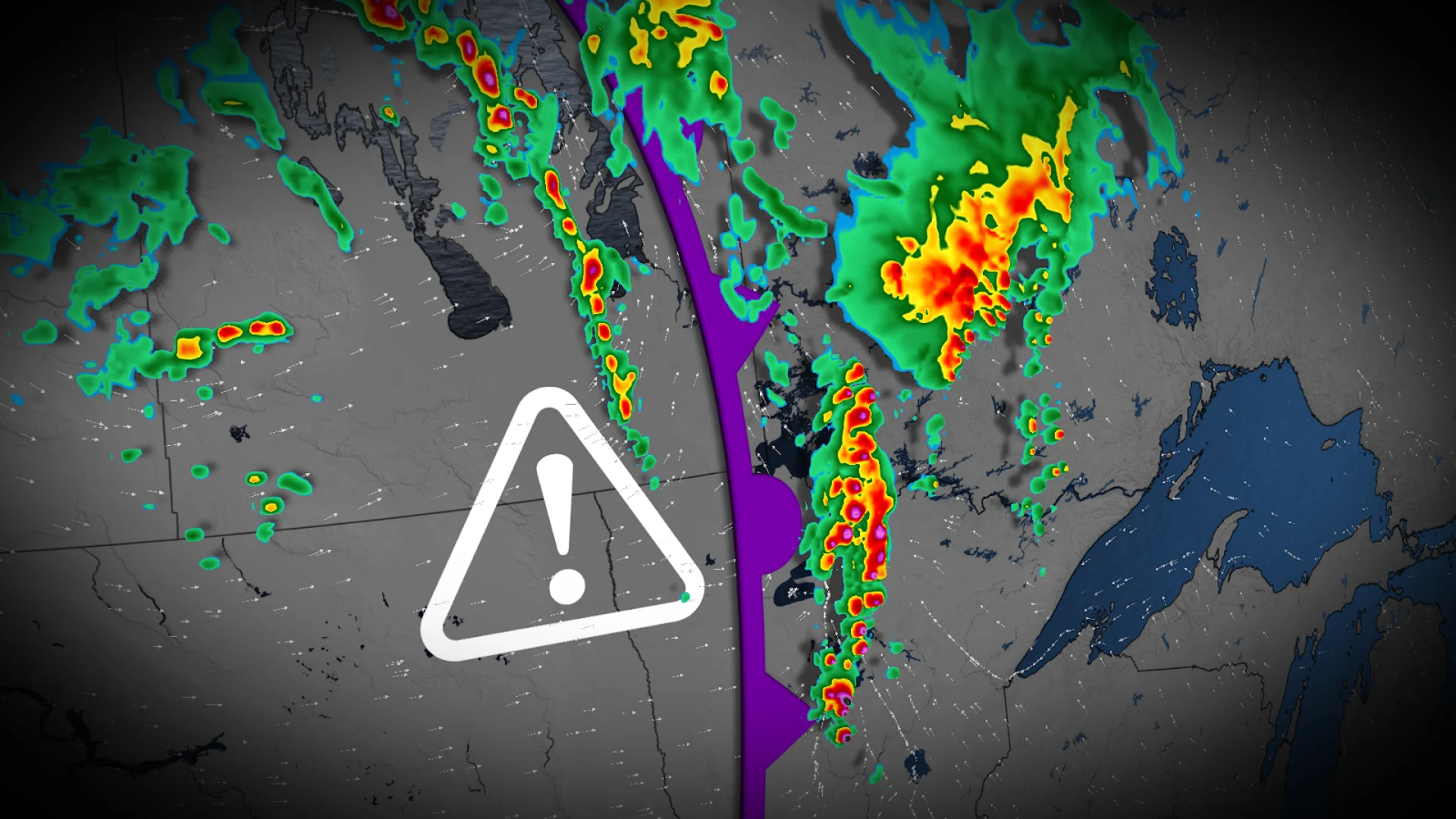
Remain alert for rapidly changing conditions Thursday evening as strong to severe thunderstorms move through northwestern Ontario.
The main threat with these storms will be an elevated risk for localized flooding from heavy rainfall. Remember: never try to drive across a flooded roadway. It’s impossible to tell how deep the water is until it’s too late.
DON'T MISS: Changeable mix of summer and fall will define Canada's Labour Day weekend
Through Thursday:
A potent low-pressure system trekking through the eastern Prairies is responsible for the active weather across the region on Thursday.
A slow-moving complex of thunderstorms pushing into northwestern Ontario will drop plenty of heavy rain as it meanders over the area. In addition to the risk for localized flooding, strong wind gusts and large hail are possible in the strongest storms.

Beyond, a quick shot of cooler, but near seasonal, weather will spread across the Prairies during the weekend, especially in eastern sections, but then temperatures will rebound. Turning hot for back to school as the heat spreads east.
There is the potential for more unsettled and stormy conditions for a couple days during the middle of next week. Warmer-than-normal temperatures should dominate for most of September.
Stay tuned to The Weather Network for the latest forecast updates for the eastern Prairies.