
Temperature roller-coaster continues next week, with cooler weather ahead

Forecasters are keeping a close eye on the potential for lake-effect rain and snow showers next week as a cooler pattern takes hold of Ontario.
The special weather statements for widespread powerful winds were dropped Thursday morning, likely sparing many parts of the region from power outages or disruptions to Halloween decor. Some lingering rain showers will continue to impact some areas through Thursday, however, with temperatures much cooler than recent days as well. Looking ahead, next week will bring more unsettled conditions and colder than normal temperatures, with daytime highs more typical of November. Forecasters will be closely watching the potential for lake-effect snow southeast of Georgian Bay and Lake Huron. See more on the long range pattern ahead, below.
Fall Forecast revisited: The good, the bad and the ugly
Thursday into Friday: Heavy rain pushes into eastern Ontario
Much of Wednesday ended up being a pleasant day across southern Ontario, with the winds and the rain mostly confined through the overnight hours. Locally, gusts between 50-70 km/h were reported in some areas, along with periods of heavy downpours.
We'll see the front push into eastern Ontario as the day progresses on Thursday.
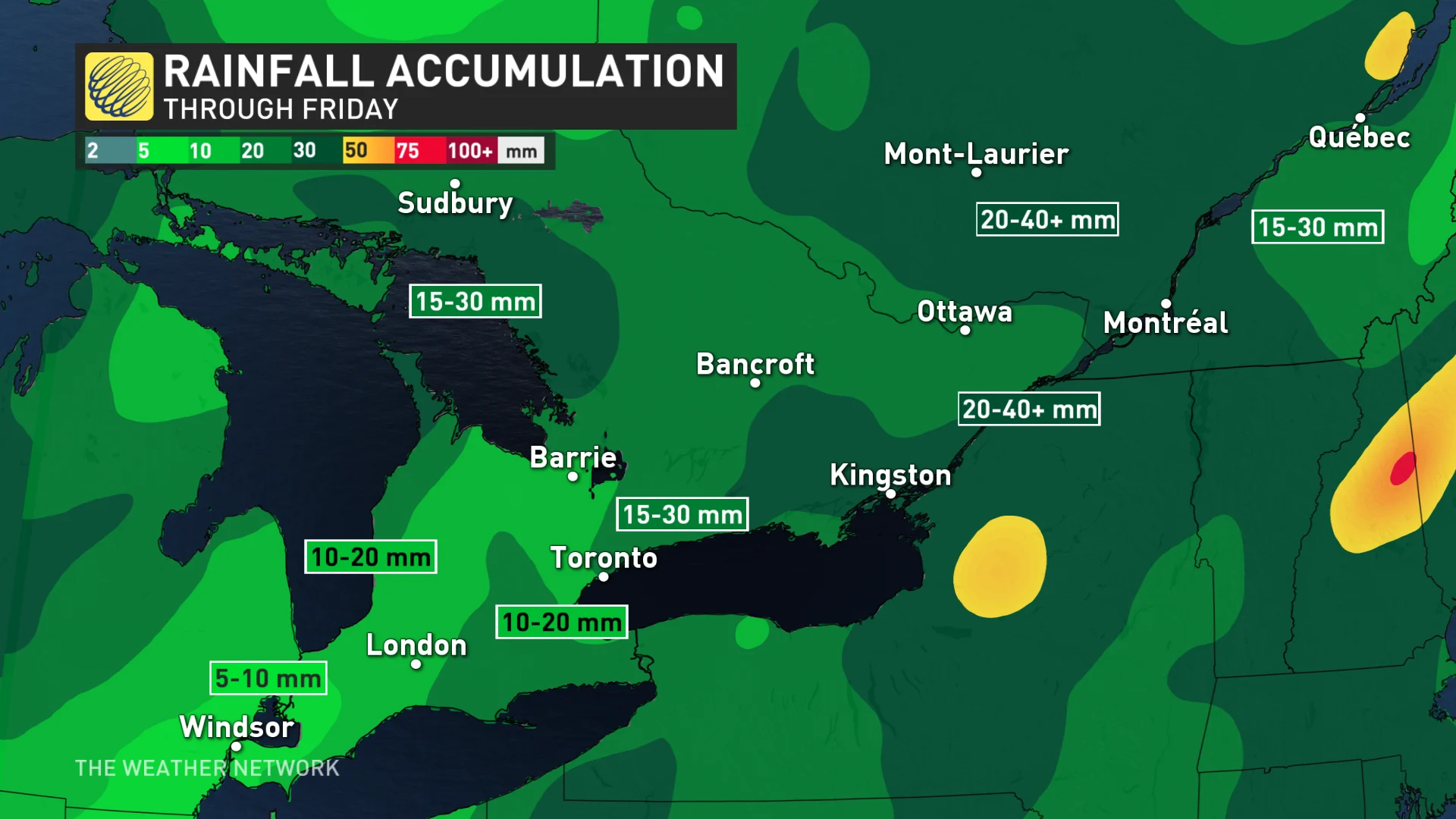
Elevated atmospheric moisture will allow for heavier rainfall totals across eastern Ontario around Kingston, for example, where we could see rainfall totals of 20-40 mm through the end of the week.
A special weather statement has been issued for the rain across the east.
"Heavy downpours can cause flash floods and water pooling on roads, especially in areas where leaves have settled over drains or gutters," warns Environment and Climate Change Canada (ECCC) in the statement. "Localized flooding in low-lying areas is possible."
WATCH: Fall storm for southern Ontario brings rain and strong winds
Look ahead: Temperatures cool with more unsettled weather at times
Temperature patterns across the southern and eastern sections will be an up-and-down affair heading into the weekend.
Highs will come in slightly below-normal for Friday. Warmer temperatures arrive on Saturday, with a steady cooldown beginning Sunday and continuing into next week. We could see high temperatures struggling to climb out of the single digits by the middle of next week.
RELATED: Don't be fooled by Canada's gentle start to fall, storms are on the way
The atmospheric setup responsible for that chillier air over the region could lead to decent snowfall totals across far northwestern Ontario through early next week.
Forecasters are also keeping a close eye on the lake-effect rain and snow showers as the cooler pattern takes hold, with the potential for some significant lake-effect snow for areas southeast of Lake Huron and Georgian Bay.
WATCH: Take in the spectacular fall colours at these popular GTA pumpkin patches
Be sure to check back for the latest weather updates across Ontario.
Thumbnail image courtesy: Pexels/Kristin Vogt.