Whiteouts, dangerous travel possible on the eastern Prairies Sunday

A clipper quickly zipping through the eastern Prairies will bring a fresh coat of snow Sunday, potentially bringing whiteout conditions for parts of Saskatchewan and Manitoba.
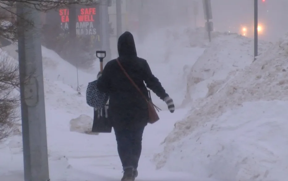
Those planning on hitting the roads in parts of southern Saskatchewan and Manitoba Sunday will want to rethink those plans. A fast-moving clipper will zip through the eastern Prairies with a burst of snow and strong winds, likely to bring whiteout conditions in the afternoon and evening, particularly in Winnipeg, Man. While the amounts won't be excessive by any means, it's the winds that will be the issue, with blowing snow likely to bring whiteout conditions as visibility will be reduced to near zero. Travel is not recommended. More on what to expect for Sunday and beyond, below.
SUNDAY: DANGEROUS TRAVEL LIKELY AS CLIPPER TO BRING WHITEOUT CONDITIONS
A clipper will move through southern Saskatchewan and Manitoba Sunday. Far from a potent snowmaker by any means, but communities from Fort McMurray, Alta., to Winnipeg, Man., can expect 5 or more cm of snow through Monday morning.

The threat for blowing snow is a bigger issue than the precipitation amounts. Whiteout conditions will be possible across parts of Saskatchewan and Manitoba Sunday afternoon and evening.
While we could see low visibility to near-whiteout conditions across parts of Saskatchewan and Manitoba, including the Manitoba lakes, the threat for whiteouts will be a particular problem around the Winnipeg area early Sunday afternoon.

If you’re planning to drive through the region on Sunday, especially along the Trans-Canada or along Highway 75 in Manitoba, you may want to consider postponing travel until conditions improve. Whiteouts can cause conditions to change rapidly, with visibility reducing to near-zero over short distances.
DON’T MISS: Here's how to stock your vehicle's emergency kit, BEFORE you get stranded
THE WEEK AHEAD: TEMPERATURE DIVIDE CONTINUES
A wavy upper-level pattern over the centre of the country has allowed a sharp temperature divide to set up across the Prairies in recent days. Pleasant temperatures in the west stand in stark contrast to the brutal winter chill lodged over the eastern half of the region.
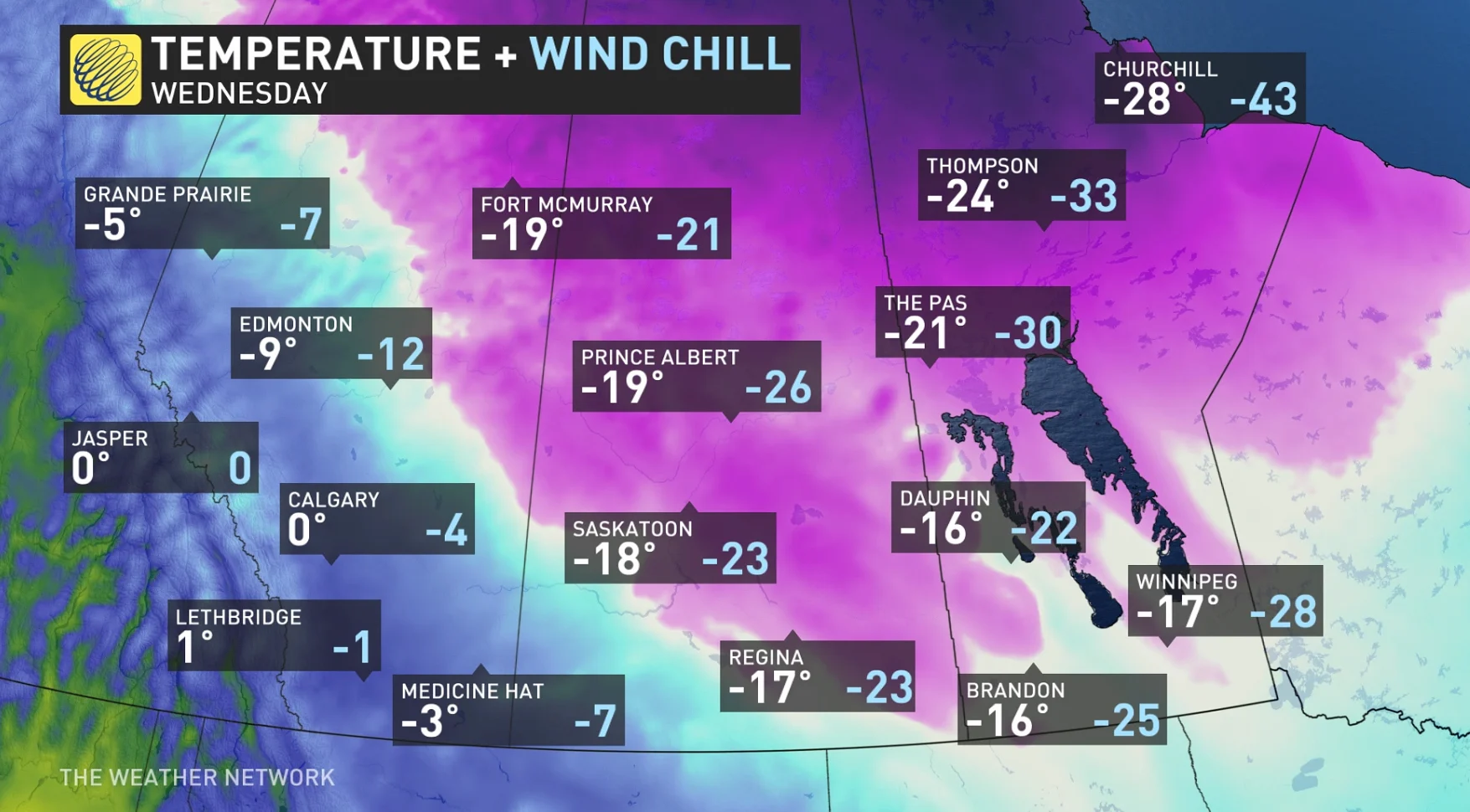
High temperatures in Calgary and Lethbridge will remain at or above freezing for the majority of the upcoming week. Over the same period, Regina and Winnipeg will have to deal with well below-seasonal temperatures. Regina’s forecast high of -17°C on Wednesday is one degree lower than the city’s seasonal low for the date.
The boundary that sets up between these two air masses will serve as an active storm track across the region. We could see several more weak clippers move along this boundary through the week ahead.
Thumbnail courtesy of Chris D./The Weather Network).
Stay tuned to The Weather Network for the latest conditions across the Prairies.