Where’s the snow? Eastern Canada delays dip into winter weather

Some areas have had to wait into December for their first measurable snowfall
The average date of the first snowfall in Toronto, Montreal, and Halifax has come and gone without a single flake piling up on the ground.
Generally warmer-than-normal conditions have kept the wintry weather at bay so far this season.
How much longer will it take for snow to arrive? Some cities have waited all the way into December without those inaugural flakes.
DON’T MISS: What’s the snowiest month in your corner of Canada?
A delayed start across Eastern Canada
We’ve already seen accumulating snow fall throughout parts of northern Ontario and into cottage country so far this season. But almost every major city in the eastern half of Canada has passed the date of its average first snowfall without recording any measurable accumulation.
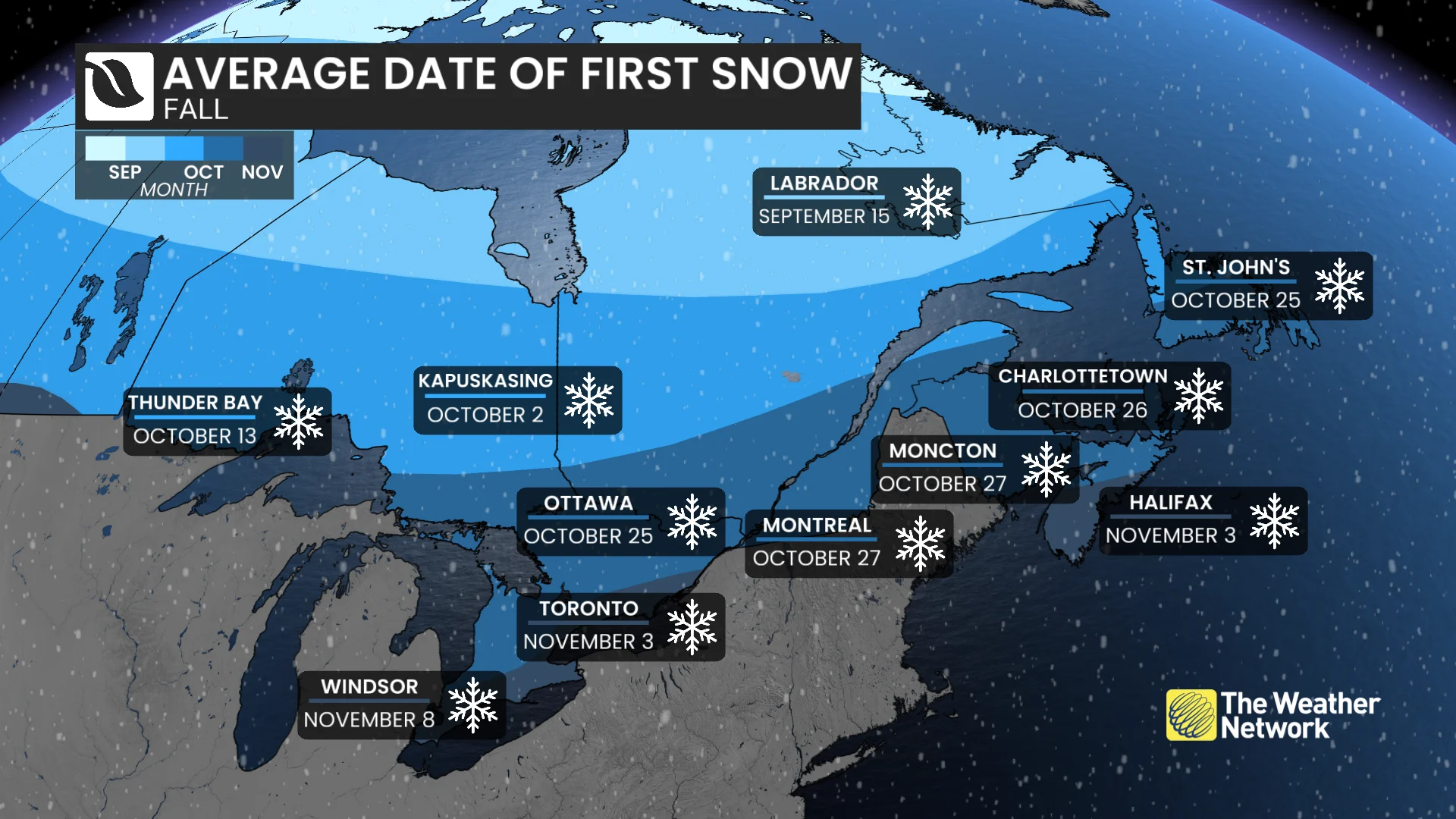
Ottawa and St. John’s typically see their first snows by Oct. 25, followed two days later by both Montreal and Moncton. Folks in Toronto and Halifax have to wait until Nov. 3 during a typical season, with Windsor following behind on or around Nov. 8.
Compare that with Western Canada, where most major cities (including Calgary and Edmonton) saw their first snowfalls on time this season.
When might we see the first flakes?
We’re going to have to wait a while longer for that first measurable snowfall in southern Ontario, southern Quebec, and throughout much of Atlantic Canada.
Above-seasonal temperatures are expected throughout the majority of November, a pattern which is consistent with the strong El Niño influencing conditions across the continent.
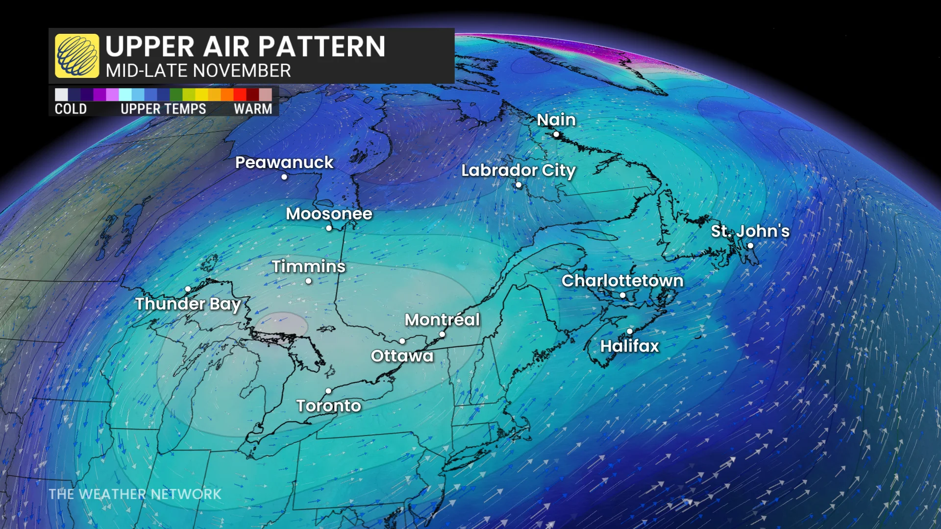
However, signs point toward a more unsettled pattern setting up by the middle of the month. This will bring spells of cooler temperatures with conditions falling back down near- or below-seasonal.
An active storm track is expected to set up over Atlantic Canada, with signals continuing to show dry conditions dominating in Ontario and Quebec.
Forecasters will continue to watch the unprecedented breakdown of the polar vortex. Cold air will dive south out of the Arctic during that time--but where in the northern hemisphere it goes still remains an unanswered question.
Some years featured very long waits
We’ve gone pretty deep into the year without any measurable snowfall in the recent past.
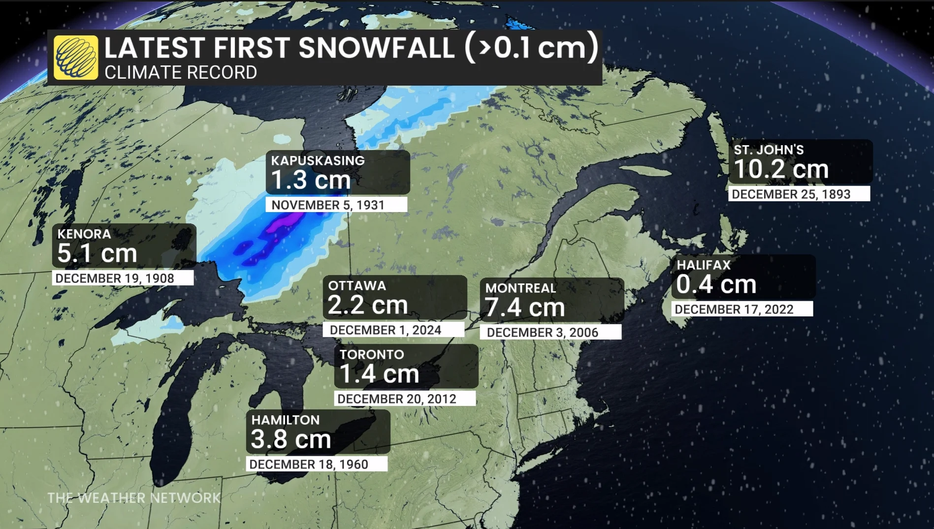
Ottawa’s longest wait for the season’s first snow took until Dec. 1 back in 2024. Halifax once had to wait until Dec. 17 to pick up their premiere dusting. Toronto didn’t see its first measurable accumulation in 2012 until days before Christmas.
Stay tuned for The Weather Network’s winter forecast on Wed., Nov. 25, for more on what you can expect during the season ahead.