What’s up with this winter so far, Canada? We have the answer

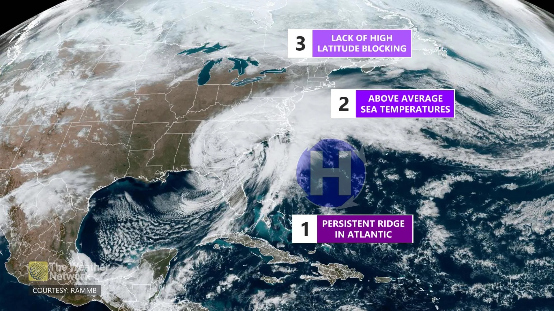
There are three major reasons for the lacklustre winter thus far, especially in Eastern Canada.
Winter has been an occasional visitor or completely absent this season for most of Canada.
There are three major reasons for the lacklustre winter thus far, especially in Eastern Canada.
EXCLUSIVE: Runaway February thaw threatens records across Ontario
It’s common to have high pressure near Bermuda, helping to direct storms up the Atlantic coast. However, this season has seen the ridge parked much closer to the Carolina coast, turning those Gulf and Texas lows northward, west of the Appalachian Mountains.

Any storm activity managing to sneak its way to the coast before heading to Atlantic Canada has had an abnormal amount of warm water to feed off of and carry into the region, converting most of those borderline rain-snow events into simple rain.
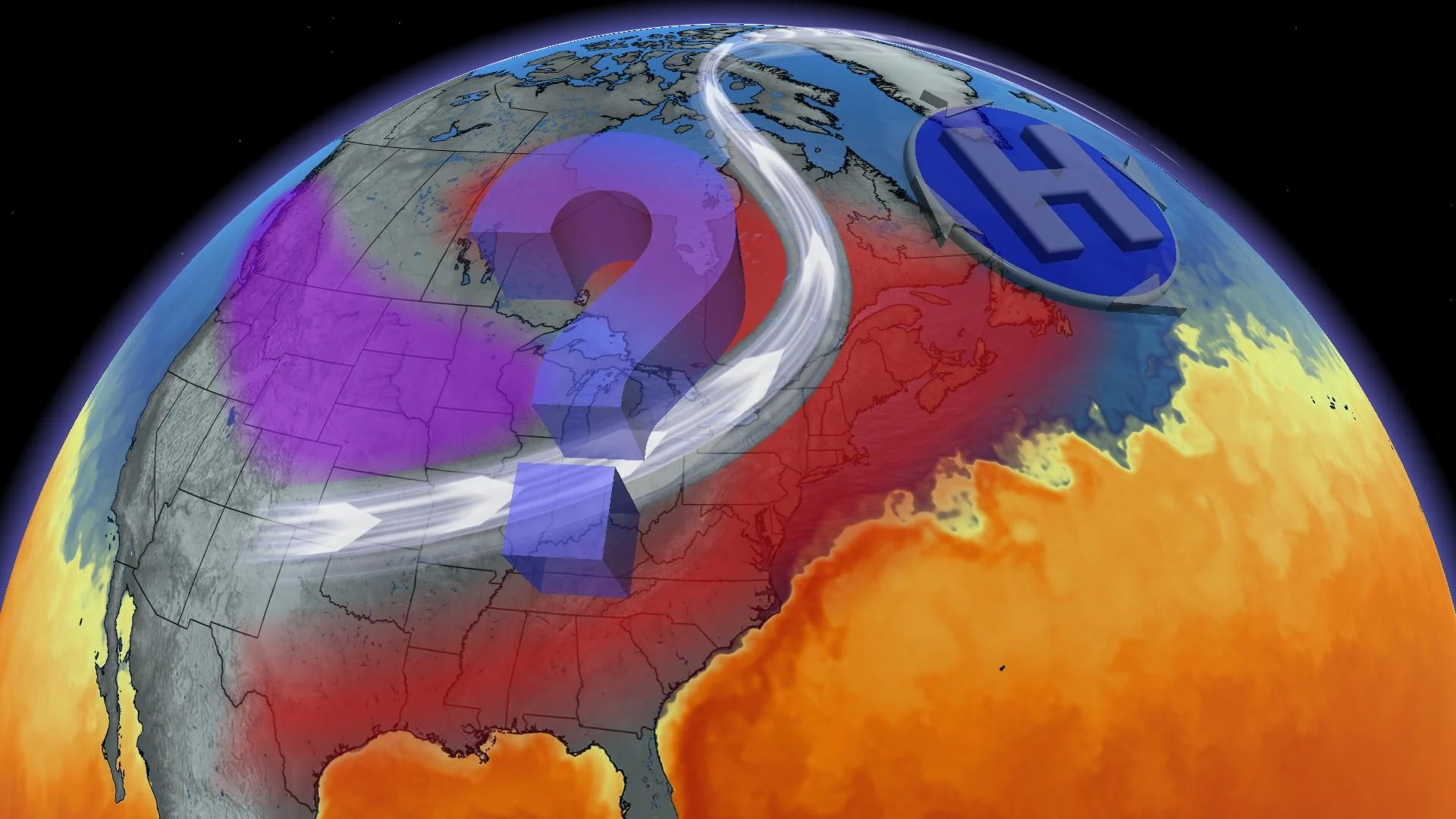
December saw prolonged record-breaking cold in Western Canada.
While temperatures dropped below -50°C, the bulk of the cold merely dissipated and retreated to Canada's North rather than migrating east of the Great Lakes. This Arctic air is essential for fuelling winter storms and turning the backside over to heavy snow.
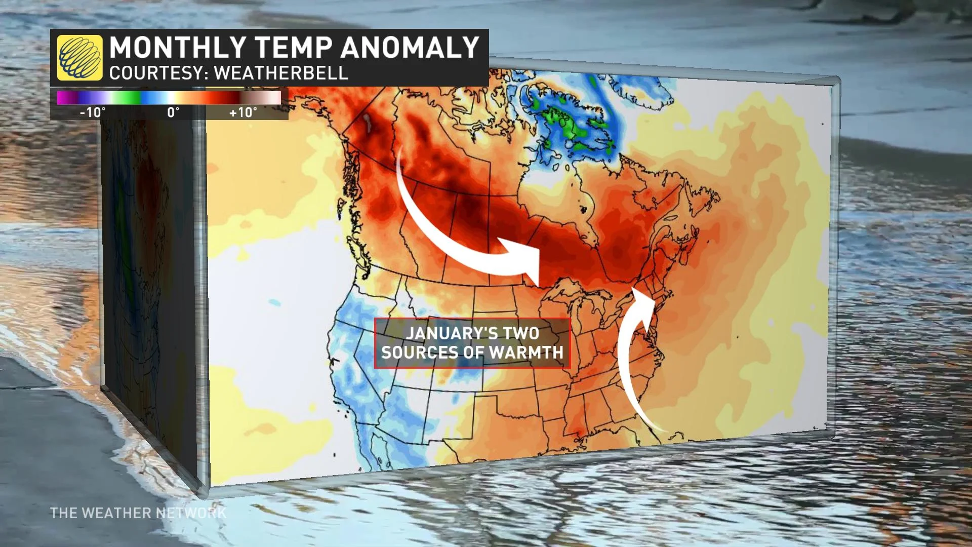
January saw warmth for most of North America, turning off the development of noteworthy winter wallops.
The Greenland ridge is important for blocking Arctic air over Central and Eastern Canada, increasing the odds and strength of storms. The ridge has set up camp farther south than normal, allowing Arctic air to move through Eastern Canada without staying for a visit.
A secondary impact is to the storm track, redirecting most storms into the Great Lakes and northern Quebec, resulting in additional warmth surging into Atlantic Canada.