What the rare ‘triple-dip’ La Niña could mean for winter

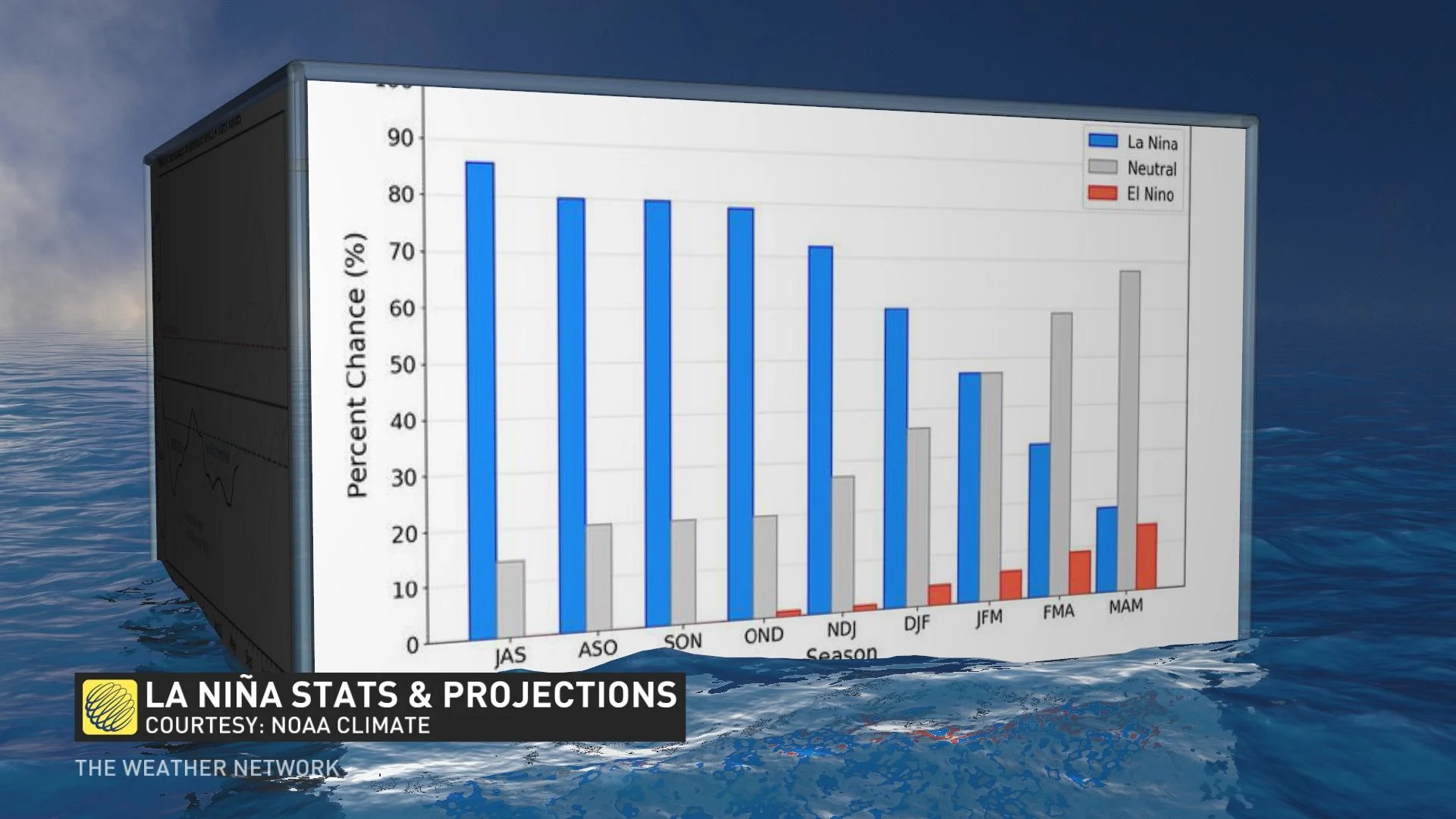
Experts predicted recently that La Niña has a high chance of continuing across the Pacific Ocean heading into this winter, becoming the third "triple-dip" winter La Niña since records began seven decades ago. This would be the third winter in a row with La Niña conditions in the Pacific, a pattern that can have far-reaching consequences for winter weather across Canada.
DON’T MISS: Hurricane experts still predict an active Atlantic season ahead
La Niña looks to continue into this winter
A mid-August forecast released by NOAA’s Climate Prediction Center (CPC) called for La Niña to continue across the eastern equatorial Pacific Ocean through at least the early winter months.
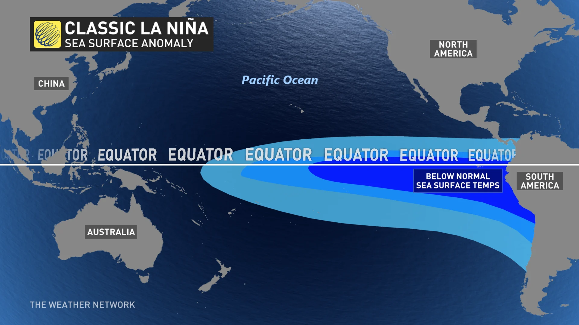
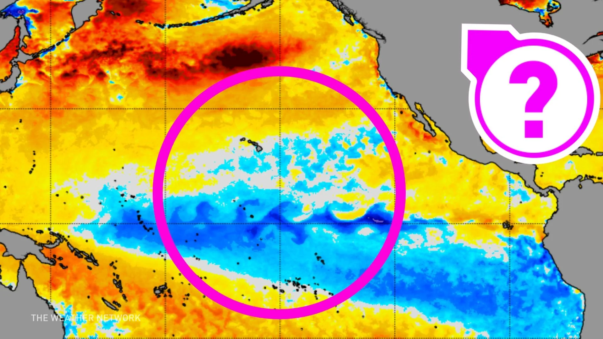
La Niña conditions exist when sea surface temperatures off the coast of South America around the equator come in 0.5°C below normal or cooler for several months at a time.
While these abnormally cool temperatures don’t seem like much of a deviation, these cooler-than-normal waters can have dramatic effects on weather patterns across the Northern Hemisphere, especially during the winter months.
The CPC wrote in its Aug. 11 discussion that there are better-than-ever odds of La Niña continuing through this upcoming winter, which would be the third consecutive winter we’ve seen these abnormally cool waters parked in the eastern equatorial Pacific.
Watch below: A 60 second explanation of El Niño and La Niña
What La Niña could mean for Canada this winter
Colder waters in the eastern Pacific Ocean have a ripple effect that reaches into the atmosphere above, altering the jet stream to allow for more active weather to sweep across North America during the heart of winter.
What that means for Canada, though, depends on which side of the country you live.
A typical La Niña pattern sees a ridge build over the northeastern Pacific, allowing troughs to swoop down over the Prairies. This could bring wetter-than-normal conditions to the Pacific coast, while allowing persistent bouts of cold air to rush south over the Prairies throughout the season.
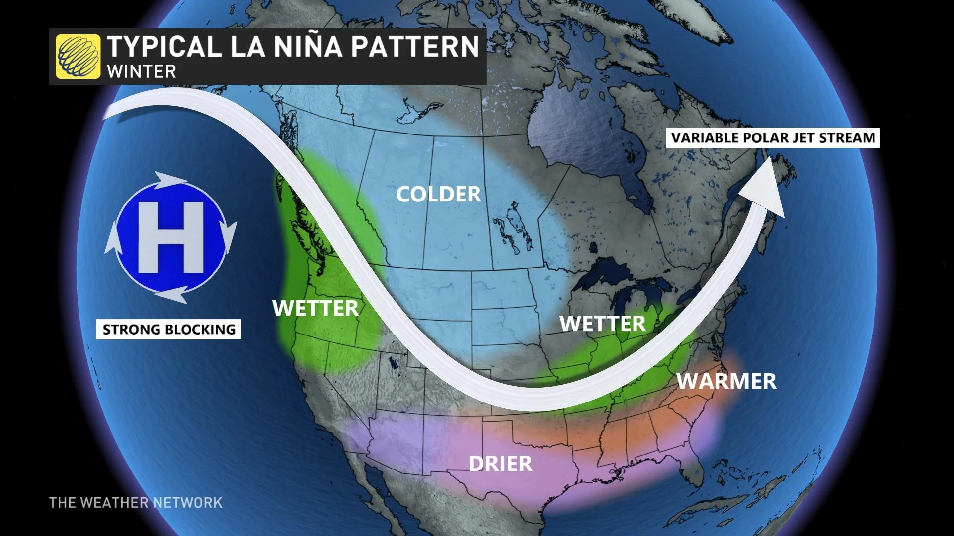
Farther east, the path of the jet stream during La Niña winters typically puts the Great Lakes region under an active storm track, potentially allowing for long periods of busy weather for folks across southern Ontario. A ridge tends to build across Eastern Canada when this pattern takes hold, allowing more comfortable temperatures to occasionally push over the region.
NOAA’s latest forecast calls for La Niña to subside through the winter, with decent odds of neutral conditions -- neither a La Niña nor an El Niño—building as we head into the spring of 2023.
Be sure to check back in the coming weeks as we look ahead to the fall and winter months.


