What is the polar vortex? How it’s responsible for dangerous cold

What is the polar vortex? It’s a wintertime mainstay capable of flooding Canada with some of the world’s coldest air
It’s a pattern responsible for holding back the coldest temperatures on the planet. The lowest readings ever recorded in Canada and around the northern hemisphere occurred when this Arctic feature crumpled like a leaky dam.
That frigid feature is the polar vortex, a critical piece of our wintry puzzle that plays a starring role in the heart of winter weather forecasts—and even larger-than-life winter weather myths.
DON'T MISS: How Colorado lows and Texas lows affect our weather in Canada
The polar vortex is nothing new
Few phrases in a weather forecast can send a chill down even the winter-hardiest spine quite like the polar vortex.
The polar vortex isn’t a storm, nor is it dangerous on its own. The only hazard associated with the polar vortex is the dangerously cold air that can spill out of the Arctic toward lower latitudes, which can last for long stretches in extreme cases.
Even though the phrase has been around for more than a century, the polar vortex only broke out of weather geek circles in the early 2010s.
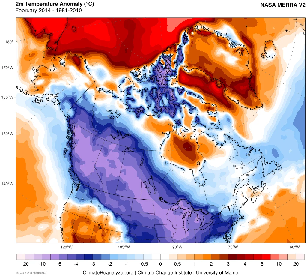
Temperature anomalies across Canada in February 2014. The abnormally warm temperatures in the Arctic show how the frigid air was dislodged south into Canada during the month. (Climate Reanalyzer via Climate Change Institute/University of Maine)
A particularly brutal cold snap in early 2014 sent Toronto’s nighttime lows plummeting below -15°C through much of January and February, with Calgary enduring nights colder than -20°C through half of February.
Record temperatures broken across the U.S. turned “polar vortex” into viral catnip on social media and thrusted it into our everyday vocabulary.
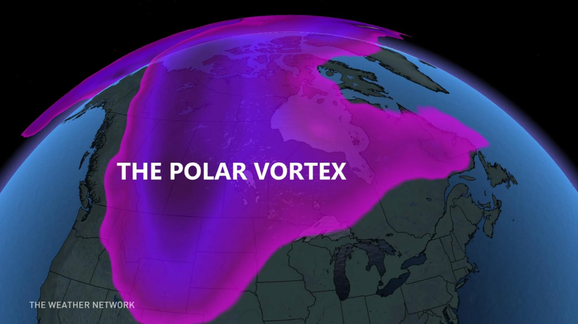
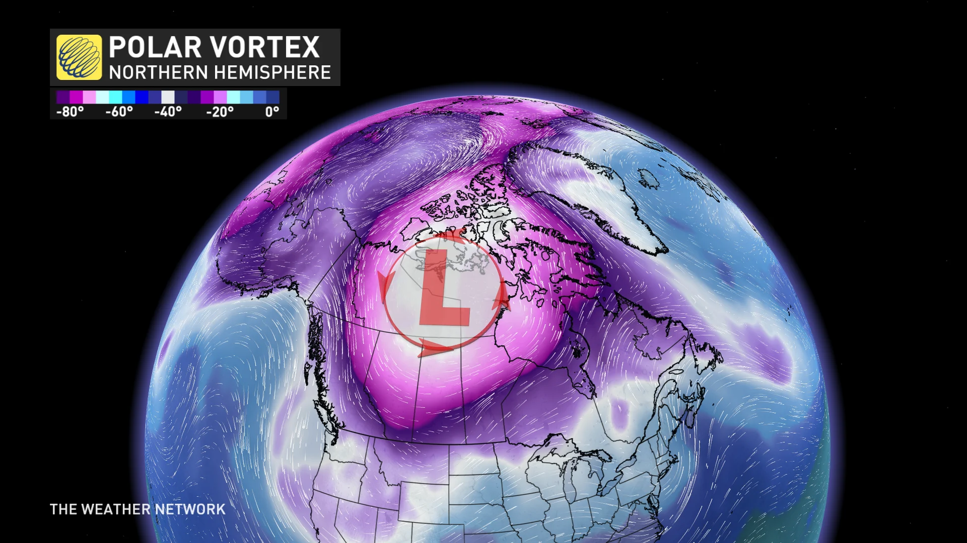
A polar vortex holds back frigid air like a dam
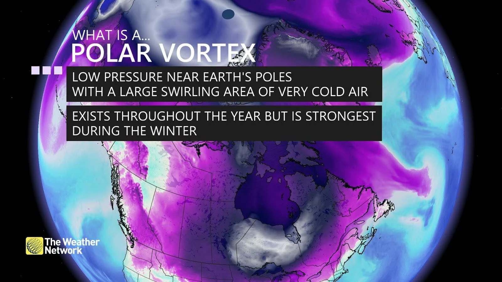
The polar vortex is a broad area of low pressure high in the atmosphere above the Arctic that strengthens in the winter and weakens in the summer.
This large-scale circulation of winds wraps around the higher latitudes like a wall, keeping the deepest chill of winter’s wrath confined to the far northern reaches of Canada, Scandinavia, and Siberia. Meteorologists call it a ‘vortex’ because of the winds swirling around the region.
LEARN MORE: The chilling truth behind wind chill and its impact on our well-being
Bitterly cold temperatures remain locked in place over northern Nunavut and the ice caps of Greenland when the polar vortex is strong and stable.
But if that circulation weakens, troughs and upper-level lows can dive toward lower latitudes and drag those brutally cold temperatures south with them.
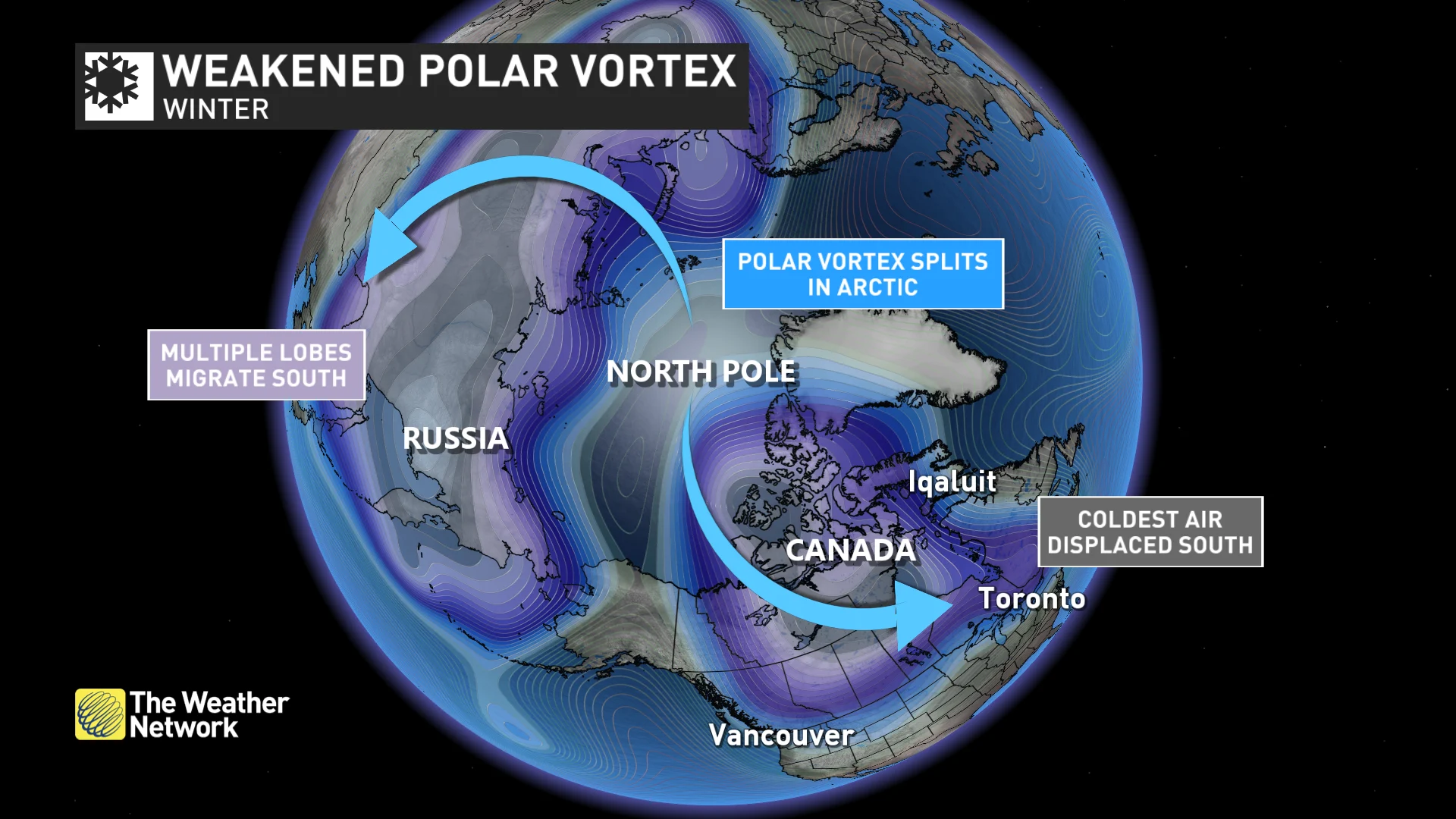
An unstable vortex can hit quick or linger for days
We can see two types of cold snaps when the polar vortex breaks down and starts sharing Arctic air with us down south.
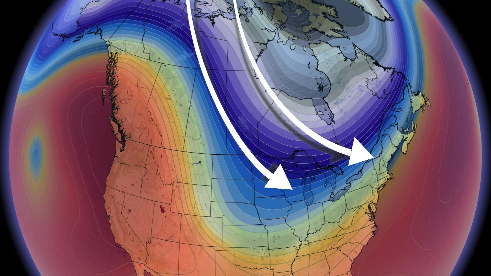
Troughs—sometimes called “lobes” of the polar vortex—are preferable if you’re not a fan of sustained frigid weather. These dips in upper-level winds tend to move along at a relatively steady clip, swooping in with cold temperatures for a day or two before the pattern readjusts and conditions moderate again.
There are also upper-level lows, which are essentially pieces of the polar vortex circulation that break off and spin over lower latitudes for days at a time. Sometimes called cutoff lows, these features are isolated from the overall flow, kind of like a leaf stuck meandering on the calm edge of a creek.
MUST SEE: Calgary was warmer than Miami the Christmas it snowed in Florida
Cutoff lows are responsible for some of the most brutal cold outbreaks in living memory, including the historic January 2014 cold snap, as well as Florida’s first and only white Christmas back in 1989.
The sheer extent of the cold air is a major concern on top of the duration of these frigid temperatures.
We can see Arctic air flood across almost all of Canada during a vigorous visit from the polar vortex. While the coldest temperatures usually stay along and east of the Rockies, strong outflow winds blowing toward British Columbia’s coast can send dangerously cold conditions racing into places like Vancouver and Victoria.