Severe storm and flood risks are making this a wet weekend for Ontario
Spring-like warmth brings strong winds, showers, and possible thunderstorms this weekend in Ontario, raising the risk of flooding from rain and snowmelt
This weekend in Ontario will bring windy conditions, showers, and even the potential for thunderstorms. Temperatures will continue to rise, and will feel more like late April or even early May, particularly in southwestern Ontario.
SEE ALSO: Alberta considers scrapping time change, but not Ontario
Highs may reach the mid-to-upper teens, with some areas, especially west of Toronto, possibly hitting 20°C! While a couple of rounds of showers and thunderstorms are likely, sunny breaks are also anticipated. Sunday will be cooler, but many places are still expected to stay about 10°C above normal.
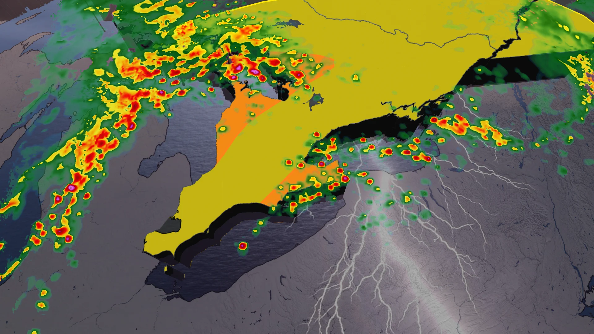
Floods and severe thunderstorm risks
Flood watches are in effect for all areas south of the French River due to the increasing temperatures and forecast rainfall. The combination of melting snow, rain, and frozen ground is contributing to heightened water levels, significantly raising the risk of ice jams along rivers in the region. Residents are advised to monitor local updates and exercise caution near waterways.

On top of potential flooding, there is a slight chance for severe thunderstorms to form off the shores of Lake Huron and Georgian Bay on Friday. This severe storm potential reaches over into Saturday, early afternoon, particularly near the Hamilton to Niagara region.

The possible chance that these storms may form comes from the timing of the current jet stream.
A mix of strong jet stream and decent mid-level CAPE/thunderstorm energy is perfect for elevated storms to tap into. While Saturday’s clear sky, mixing with the strong jet stream, could increase severe weather ingredients. Both severe thunderstorms carry the risk of strong to severe winds and small hail.

Rain, wind, and storms expected through the weekend
On Friday, a warm front will gradually move northward, passing over the Greater Toronto Area (GTA) and central Ontario overnight. Showers and non-severe thunderstorms are expected during the nighttime hours.

By Saturday morning, winds will strengthen as a cold front pushes into the region. The GTA could see a few rounds of showers and thunderstorms between noon and 8 p.m., with the strongest storm potential during early afternoon hours.
Wind gusts are forecast to peak at 60–80 km/h, particularly atop the escarpment in areas such as Niagara, Kitchener, and Dundalk.

Brief spikes to 20°C in southwestern Ontario are possible just ahead of the front, but shouldn’t stay for long.
Sunday will bring cooler, but sunnier conditions, with temperatures remaining around 10°C above seasonal norms.

DON'T MISS: Two oceans fuel Ontario's thaw, and there's 200 mm of water locked in snow
Flood watches are in effect for areas south of the French River due to rain, melting snow, and frozen ground contributing to swollen rivers. The risk of ice jams remains high.
WATCH: Rapid thaw could bring ice jams and flooding to the Greater Toronto Area
Additionally, there is a low chance of power outages from strong wind gusts and winter-related tree damage. Residents are encouraged to stay prepared and stay informed with the latest updates.

Can we officially say goodbye to the winter cold?
Late next week, temperatures are set to drop significantly, but the arrival of true Arctic air may be delayed until the following week. In the meantime, a couple of messy weather systems could impact the region late next week and into the weekend, bringing the potential for mixed precipitation.
RELATED: Canada to feel magnified March madness in the month ahead
The third week of March is shaping up to be wintry, with the possibility of significant snowfall in some areas. However, temperatures could begin to recover somewhat as the weekend approaches, providing a slight reprieve from the colder conditions.
WATCH: Freezing rain to thunderstorms: Ontario braces for wild weather swing
Stay with The Weather Network for more information and updates on your weather across Ontario.