
Winter storm eyes parts of the East Coast with significant snowfall
Forecasters are watching a potential winter storm take aim for parts of Atlantic Canada come early next week, with models showing more than 20 cm of snow is possible for some areas
Atlantic Canada had a chilly week with temperatures that plummeted into the minus double digits, but now attention turns to a possible snowy event come early next week.
Signs are pointing to a significant snowstorm developing by early Monday morning. Here’s what you need to know.
DON’T MISS: El Niño is hanging strong—but a big change is on the way
A system in the southern U.S. will develop and track northeast, and then move offshore. Meanwhile, a ridge of high pressure parked over Labrador and the Gaspesie will act like a guard rail forcing the system to remain south and avoid tracking directly over Atlantic Canada.

As the system tracks south of the Maritimes, colder air will persist, making the precipitation fall as snow. Snowfall rates look to be as high as 2-3 cm per hour Monday morning, making for extremely difficult driving conditions across the Halifax area.
The low-pressure reading is a relatively modest 990 hPA as it passes south, but it will punch above its weight in terms of gusty winds. A strong high across central Quebec will mean there’s an increased threat of strong winds and blowing snow.

Blizzard conditions are possible along exposed coastal sections and regions that attain a 40 km/h wind speed. This would mean travel would be near-impossible for several hours on Monday morning.
MUST SEE: All-time January heat records fall as astounding warmth hits North America
Snow begins to taper from west to east across Nova Scotia Monday afternoon and evening, before eventually tracking into southeastern Newfoundland by the evening.
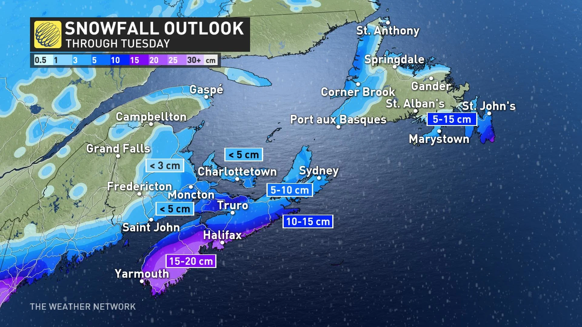
With the current track of the system, the heaviest snow is forecast to impact Nova Scotia and eastern Newfoundland. More than 20 cm is possible in some pockets across the South Shore in Nova Scotia, with even Halifax approaching that amount from this impending event.
The blowing snow and reduced visibility are the highest risks with this system.
Stay tuned through the weekend as forecasters continue to refine this storm’s track and nail down where the heaviest snowfall accumulations are possible.
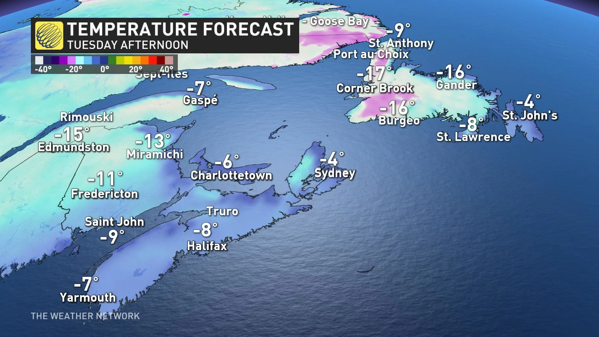
Temperatures will remain quite chilly in the wake of the storm, with daytime high temperatures remaining in the negative double digits for most of the region.
Be sure to check back for all the latest on your forecast across Atlantic Canada.