
Disruptive Prairies storm threatens more snow, winds and travel impacts

Snowfall continues on parts of the Prairies through Saturday, and when combined with high winds, significant travel interruptions can be expected
Steady snowfall will continue for a wide swath of the Prairies as a blustery, low-pressure system continues trekking across the region.
Calgary picked up measurable snowfall early Friday. Additional accumulations are likely toward the east, with some areas on the northern Prairies picking up as much as 50 cm of snow, or more.
Warnings remain in effect for high winds, snowfall and winter storm conditions. Travel will likely be challenging. Road closures are possible. Local utility outages are possible.
Disruptive storm impacts weekend travel
The large low-pressure system responsible for the early dose of wintry weather will continue lifting north as we head into Saturday, bringing heavy snowfall to the north and blowing snow to southern regions.
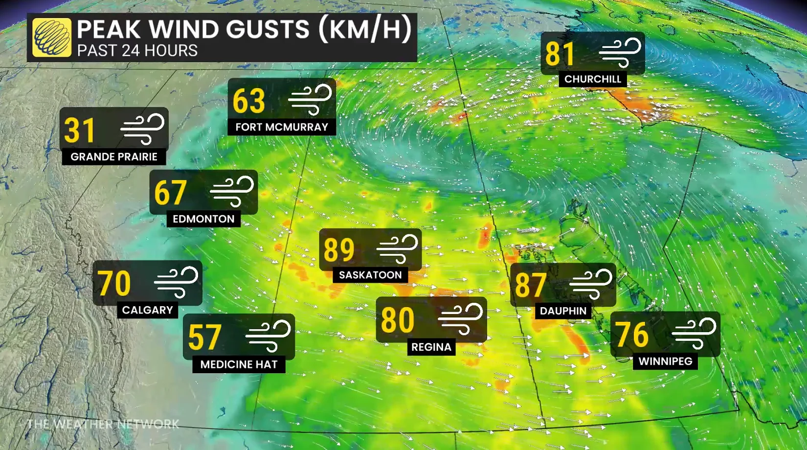
Saskatchewan peak winds:
Eastend (Friday) - 91 km/h
North Battleford (Saturday) - 91 km/h
Saskatoon Airport (Saturday) - 89 km/h
Kindersley Airport (Friday) - 87 km/h
Swift Current Airport (Friday) - 83 km/h
PHOTOS: Burst of October snow falls over major Canadian cities
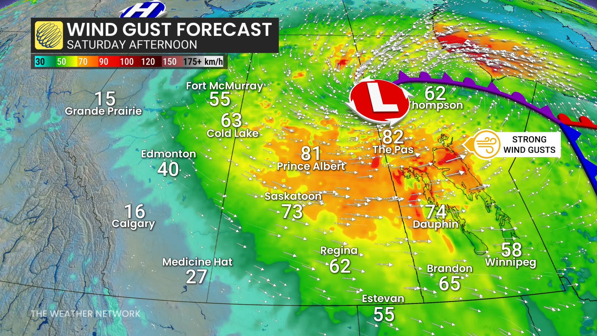
Wind gusts of 50-80+ km/h will persist through Saturday across Saskatchewan and Manitoba, easing into the overnight hours.
Sudden reductions in visibility were expected into early Saturday across southern Saskatchewan as brief but intense snowfall accompanies the gusty winds in the region.
RELATED: What’s the snowiest month in your corner of Canada?
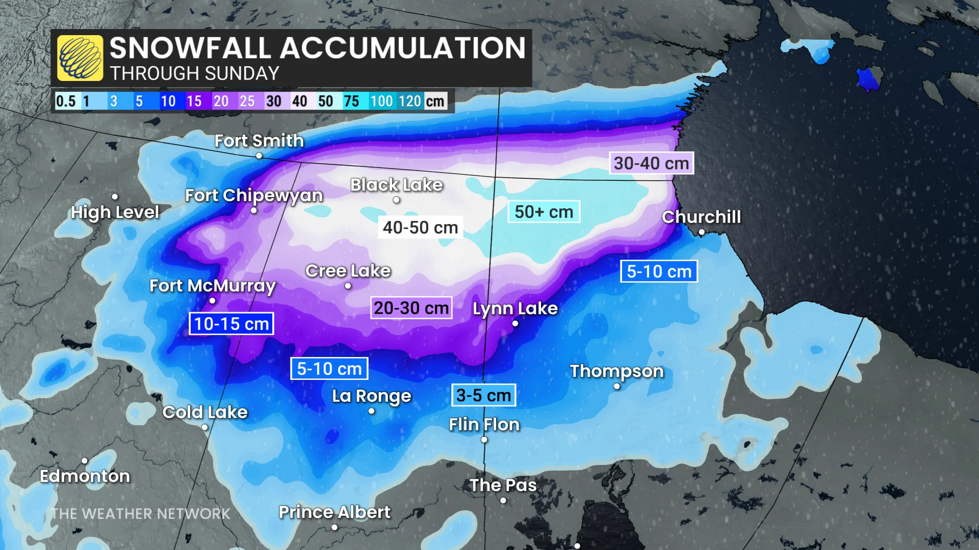
High snowfall rates will continue into the weekend across northern portions of Saskatchewan and Manitoba, including Cree Lake and Black Lake. These areas will likely see 20-50+ cm of accumulation by the end of the storm.
A dramatic temperature drop will follow the storm. Winnipeg will drop from readings in the lower 20s on Friday afternoon to below the freezing mark by Sunday evening.
Temperatures will come in 5-10 degrees below normal by Sunday, with Calgary expecting a daytime high temperature of just 0°C.
Additional snowfall is possible in Alberta on Sunday as moisture arrives from British Columbia and a favourable setup develops for upsloping snow. Accumulations will remain on the lighter side, and confined to the Rockies and foothills.
Potential for record rainfall in Churchill, Man.
Meanwhile, an anusual amount of rain for late October is coming to the shores of Hudson Bay as the low lifts moisture northward throughout the weekend.
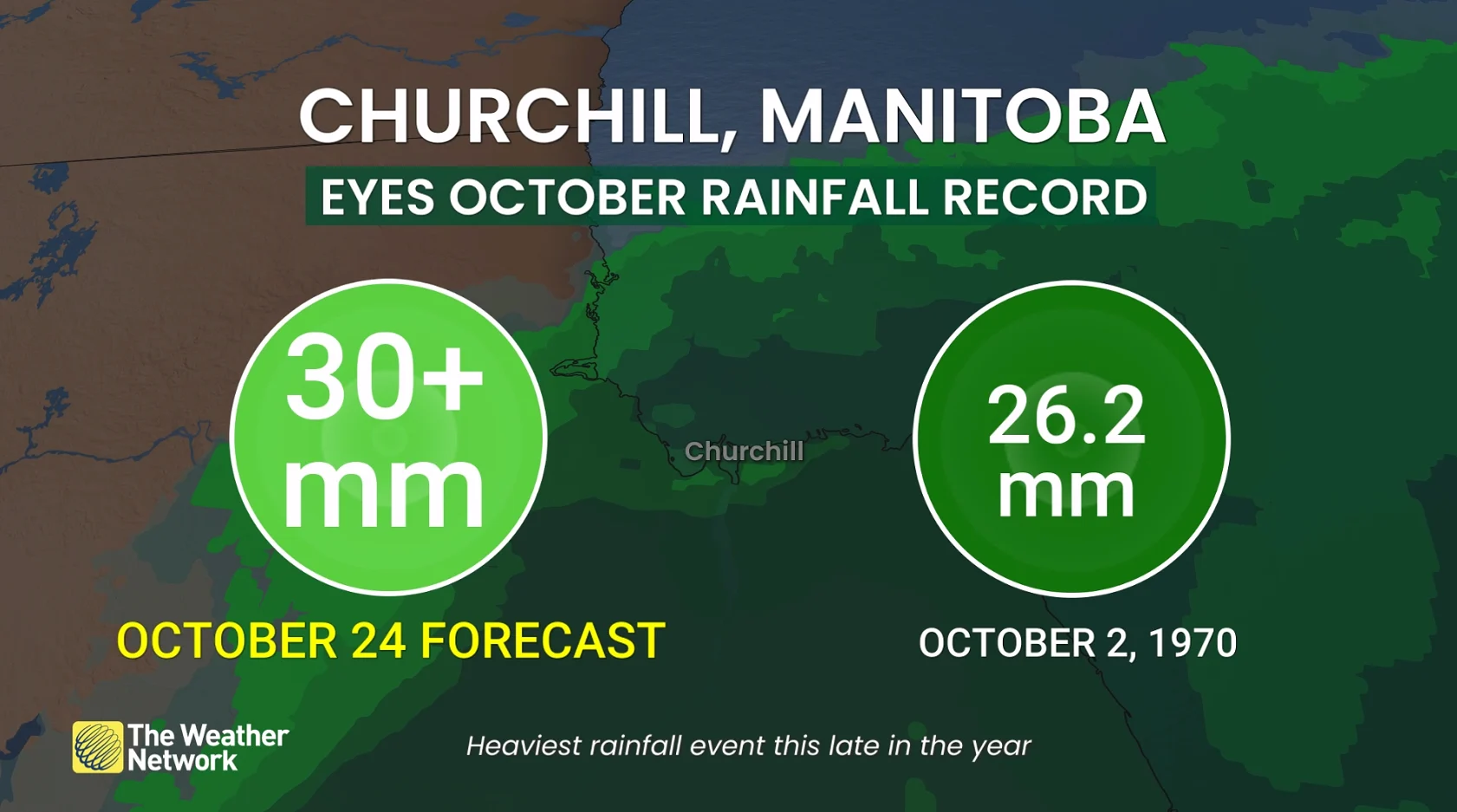
The all-time, rainiest day in Churchill, Man., in October is just 26.2 mm on Oct. 2, 1970, likely be broken on Saturday. That would make it the heaviest rainfall event this late in the season in history.
Stay with The Weather Network for all the latest on conditions across the Prairies.