Warnings issued for ice and snow, risk of dangerous travel in Ontario
Winter driving will be put to the test on Wednesday as periods of freezing rain and snow take aim at parts of Ontario
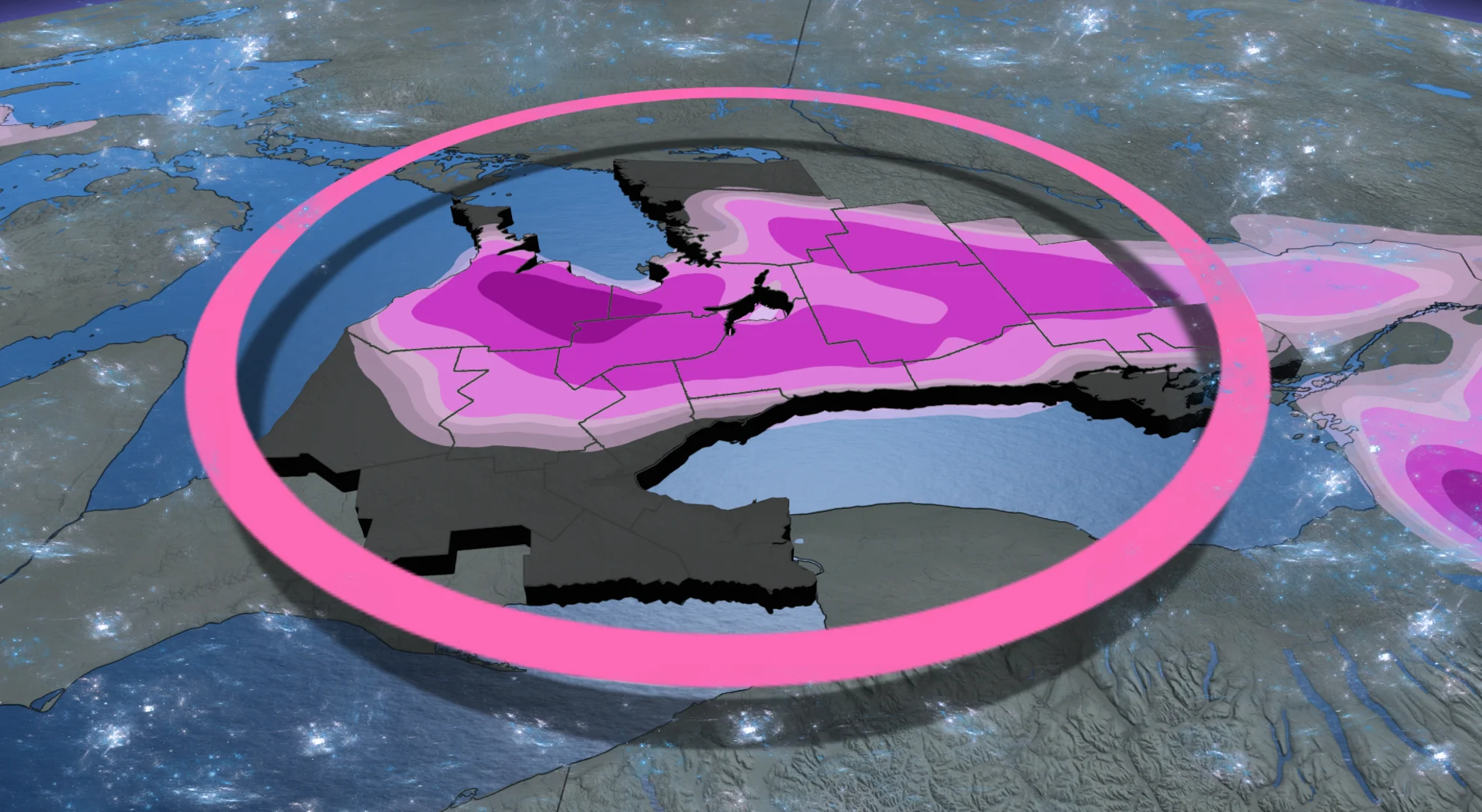
Much of southern Ontario will see multiple, if not all, winter weather precipitation types by Thursday.
Freezing rain warnings and winter travel advisories are in effect across parts of the region, as a complex storm system brings an icy mix through the day on Wednesday. The type of precipitation will depend on your exact location.
Slippery roads and isolated power outages are possible late Wednesday and Thursday, particularly where freezing rain and ice pellets develop.
Drivers are being warned of the potential for hazardous winter road conditions and should adjust their plans accordingly. Surfaces such as roads, streets, sidewalks and parking lots may become difficult to navigate due to the ice and accumulating snow. Delaying any non-essential travel until conditions improve may need to be taken into account.
LEARN MORE: Why freezing rain is the 'worst' precipitation type

Wednesday to Thursday
Computer models have struggled to decide which air mass will dominate, so the exact placement of the icy ingredients has continued to fluctuate. This will be southern Ontario's first freezing rain event of the season. However, heavy snow will fall in regions to the north.
Conditions will begin to deteriorate Wednesday afternoon and evening off of Lake Huron, with freezing rain and drizzle forecast. About 5 mm of ice accretion may build up on trees, power lines and other surfaces near highways 6 and 10, with the risk for isolated power outages across impacted areas.

Freezing rain warnings have been issued for the area, extending into sections of the 401, 400 and 404, as well. Northern sections of the Greater Toronto Area (GTA) are affected, but with lesser amounts.
The freezing precipitation will be the most intense during Wednesday's commute home.

Although Toronto and the Golden Horseshoe are expected to see mostly rainfall with this event, drivers should still prepare for changing weather conditions and slick travel out of the city. Remember, many folks have not switched over to winter tires just yet.
Ice accretion will be taken over with straight rainfall and above freezing temperatures by Thursday morning in the south, with improvements to the driving conditions expected. But, the icy ingredients will linger for the Thursday morning commute into work across sections of eastern Ontario.
WATCH: Wintry weather heading to Ottawa
Ottawa will most likely remain as snow throughout the storm system, but we can’t rule out the chance for some ice pellets, as well.
The setup is a complicated one, which could have an effect on snowfall totals in eastern Ontario.
MUST SEE: Canada's November outlook: A smooth transition or a free fall into winter?
Ottawa timing
Wednesday afternoon will see cloud clover start to thicken. As we get into the overnight hours, the first flakes will fall. It will begin falling lightly and then intensifying as time wears on, making for a tricky, early-morning commute around Ottawa.

On Thursday, snow will continue into around the noon hour for the city. There could be a brief switch over to ice pellets and mixed precipitation into the afternoon hours. Temperatures will warm up into the single digits.
Even heavier snowfall amounts are expected for areas across the north, where a winter road conditions advisory is in effect. In all, between 10-15 cm could fall in the hardest hit areas of northern Ontario through Thursday.

WATCH: Tracking the first wintry-mix of the season across Ontario
Stay with The Weather Network and check back frequently for the latest on this mid-week system and how it may affect your community and your travels.