
Soaring temperatures give the Prairies an early taste of summer

A significant warm-up is on tap for the Prairies this week, giving them a glimpse of summer-like warmth, but it won't be staying long.
May is getting off to a warm start on the Prairies, with temperatures climbing from west to east as the week progresses. Major populated centres that haven't hit the 20-degree mark, yet, including Saskatoon, Regina and Winnpeg, are set to do so for the first time Wednesday and Thursday. But don't get your hopes up, as much cooler weather and even wet snow returns to the picture for the weekend into next week. More on what to expect in the week ahead, and why the warmth won’t last, below.
Canada’s May Outlook: Longing for consistent warmth? You may have to wait until June
THIS WEEK: PLEASANT WEATHER ARRIVES WITH POTENTIALLY WARMEST AIR OF 2022
A strong ridge of high pressure is taking up a comfortable spot over the Prairies Wednesday. The combination of high pressure aloft and southerly winds will allow most communities to possibly notch their warmest stretch of temperatures recorded so far this year.
It’s been a relatively cool start to spring, especially in Saskatchewan and Manitoba, which have found themselves stuck under the path of one troublesome Colorado low after another.

Winnipeg has yet to crack the 20-degree mark; in fact, the city had only managed to hit 12°C by the end of April. However, Winnipeg is now forecast to possibly hit 20°C on Thursday, Friday and Saturday.
Neither Saskatoon nor Regina have hit 20°C this year, either, but that will change as soon as Wednesday with the ridge strengthening and pushing east.
Wednesday afternoon highs in the 20s will filter deep into Saskatchewan, with Saskatoon and Regina expected to bask in the comfort beneath pleasant skies and warm temperatures.

Our warmest day promises to arrive on Thursday, with 20-degree warmth spanning the region from Calgary to Brandon. Afternoon highs will plant firmly in the mid-20s for the southern half of Saskatchewan. Saskatoon and Regina have the chance to hit 27°C and 25°C on Thursday afternoon, respectively.
We’ll see the ridge and its accompanying warmth start to nudge east by Friday, with the magical 20-degree temperatures finally reaching Winnipeg in time to start the weekend.
Beyond, an active pattern is expected to return this weekend and into next week as a couple of systems are expected to bring a risk for more heavy rain for parts of the eastern parts of the Prairies. Sunday through Tuesday will feature the threat of rain transitioning to wet snow through the evening, overnight and early-morning hours across Alberta and Saskatchewan.
There is also potential for much-needed rain for southern Alberta and southwestern Saskatchewan, but it is too early to get their hopes up.
NEXT WEEKEND AND BEYOND: A TASTE OF SUMMER MAY HAVE BEEN A TEASE
This sample of summer-like warmth isn’t long for the world. Make sure you get out and enjoy it while it lasts, because it looks like the pattern will start to flip toward the cooler side of seasonal heading into the middle of the month.
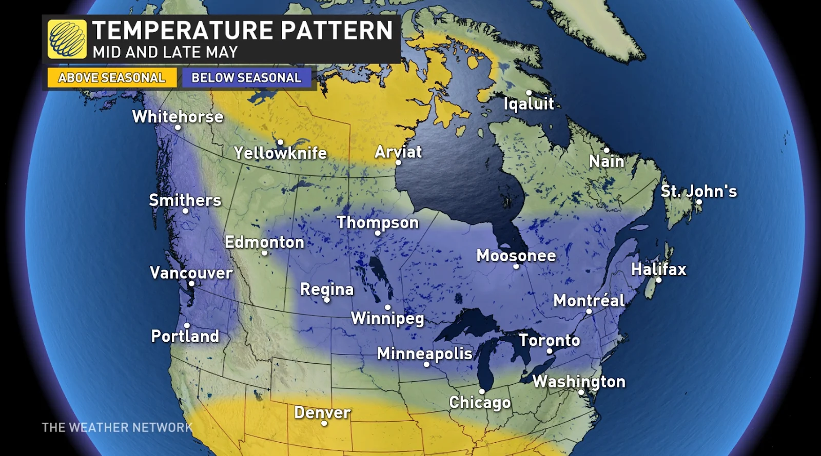
“Our forecast for mid- and late May calls for temperatures to be near or slightly cooler than normal across most of Canada,” according to Dr. Doug Gillham in his exclusive May outlook for The Weather Network.
It’s not all bad news, he adds.
“However, while there is a lot of blue on the map, we don’t expect that temperatures will be far off of seasonal across these regions. Also, keep in mind that ‘seasonal’ steadily climbs through the month. Even a cool May will include many days of pleasant spring weather.”
Stay tuned to The Weather Network for the latest updates across the Prairies.