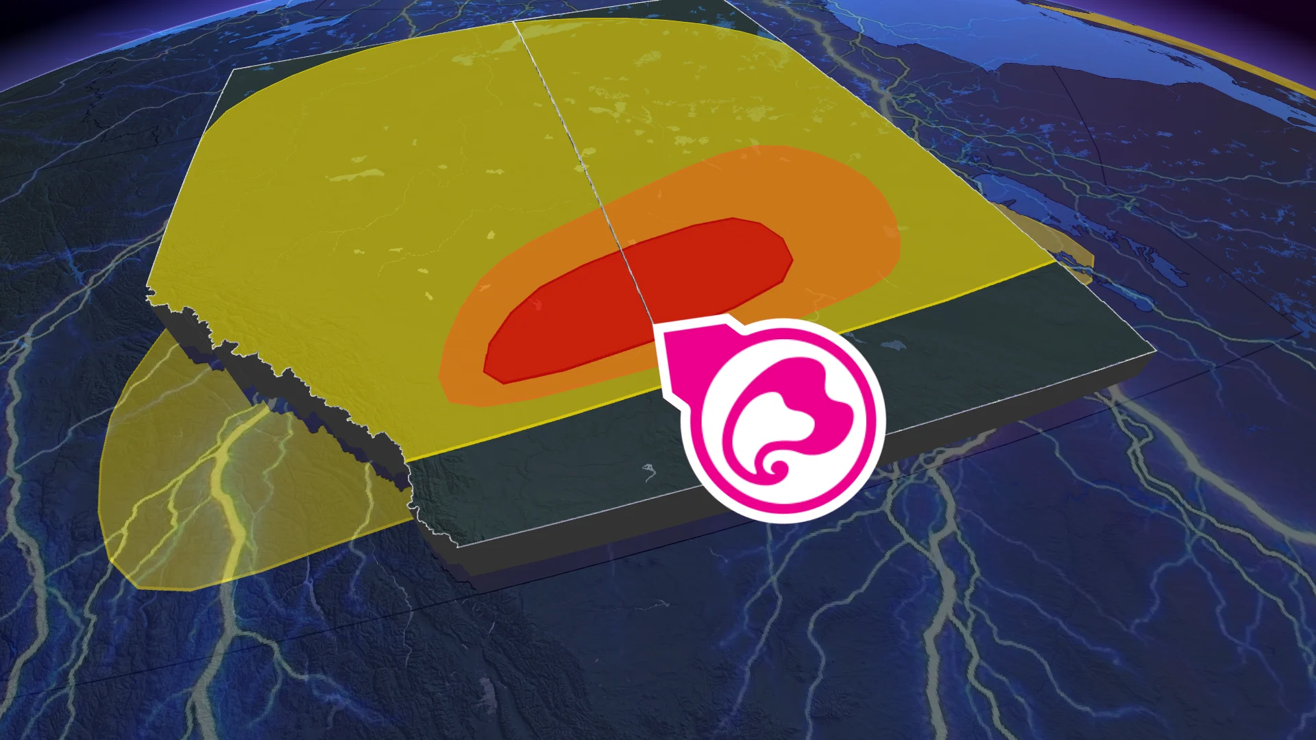
Volatile tornadic threat continues in Alberta, Saskatchewan Saturday night

A tornado was confirmed outside of Rocky Mountain House around 6:30 p.m. MT on Saturday
Tornado warnings may continue to be issued across the Prairies through Saturday night as severe thunderstorms develop in the ample instability parked over Alberta and Saskatchewan.
Please keep up with the latest watches and warnings in your area. Take immediate action if a tornado warning is issued for your location.
The original article with the full forecast for Alberta and Saskatchewan continues below.
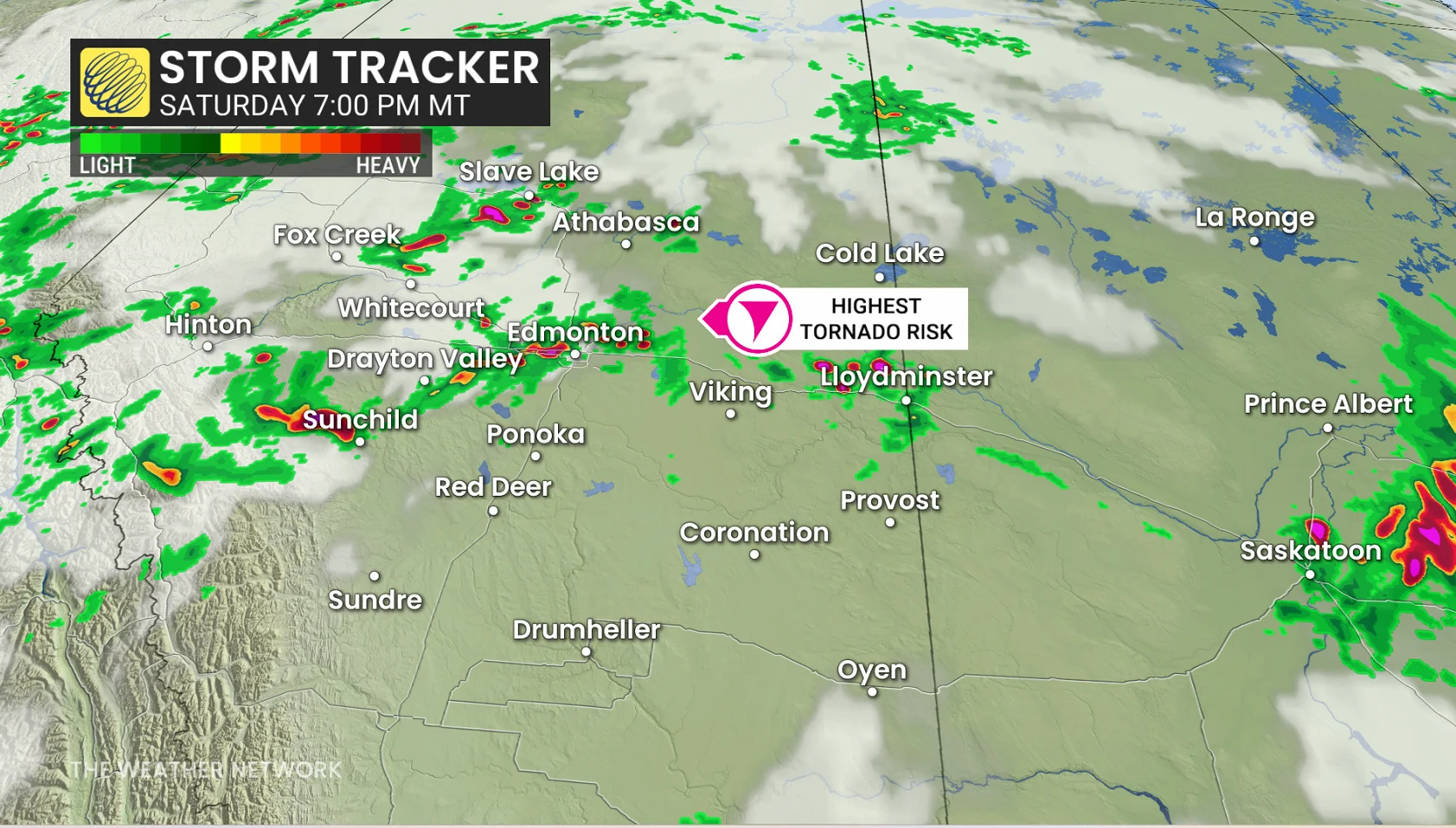
This summer has been nothing short of busy in terms of weather on the Prairies, and Saturday's storm threat will be no exception. Ingredients are coming together over central Alberta, including Edmonton, and western Saskatchewan to create a volatile environment rarely seen on our side of the border.
Stay alert for rapidly changing weather conditions and warnings throughout the evening and overnight. Have a plan in place in case severe weather watches and warnings are issued for your location, including if a tornado warning is issued while you’re in a vehicle.
DON'T MISS: Tornado warning safety: Here’s what you should do
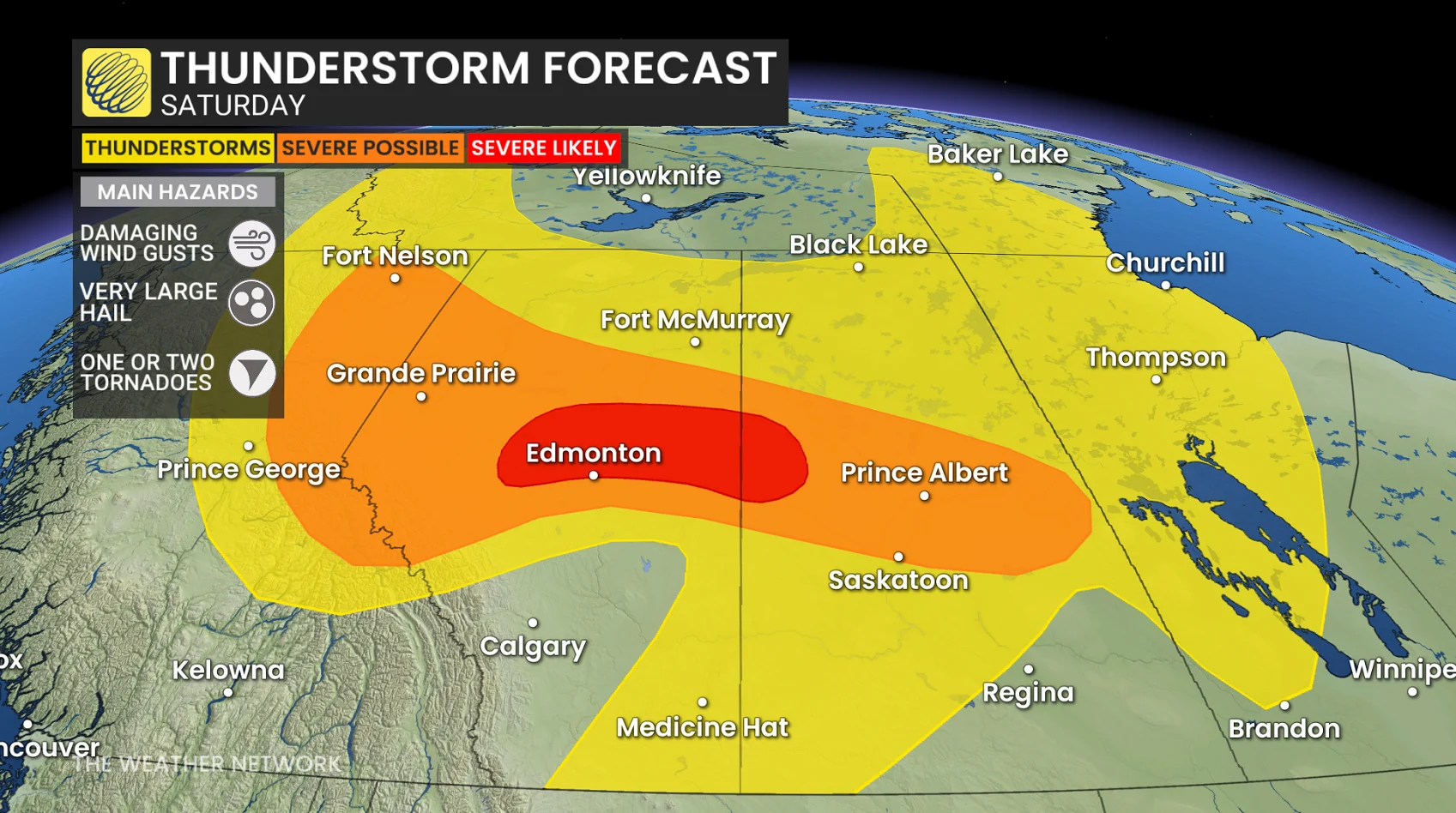
Not everyone in the risk area will see a storm on Saturday, but any storm that does develop has the potential to become dangerous very quickly.
The Edmonton-North Battleford corridor will be at the greatest risk of seeing severe weather into the overnight as the slow-moving supercell storms could produce flash-flooding.
A tornado was reported on the ground west of Rocky Mountain House Saturday evening. The reports were corroborated with visual footage from a highway camera looking west of the community.
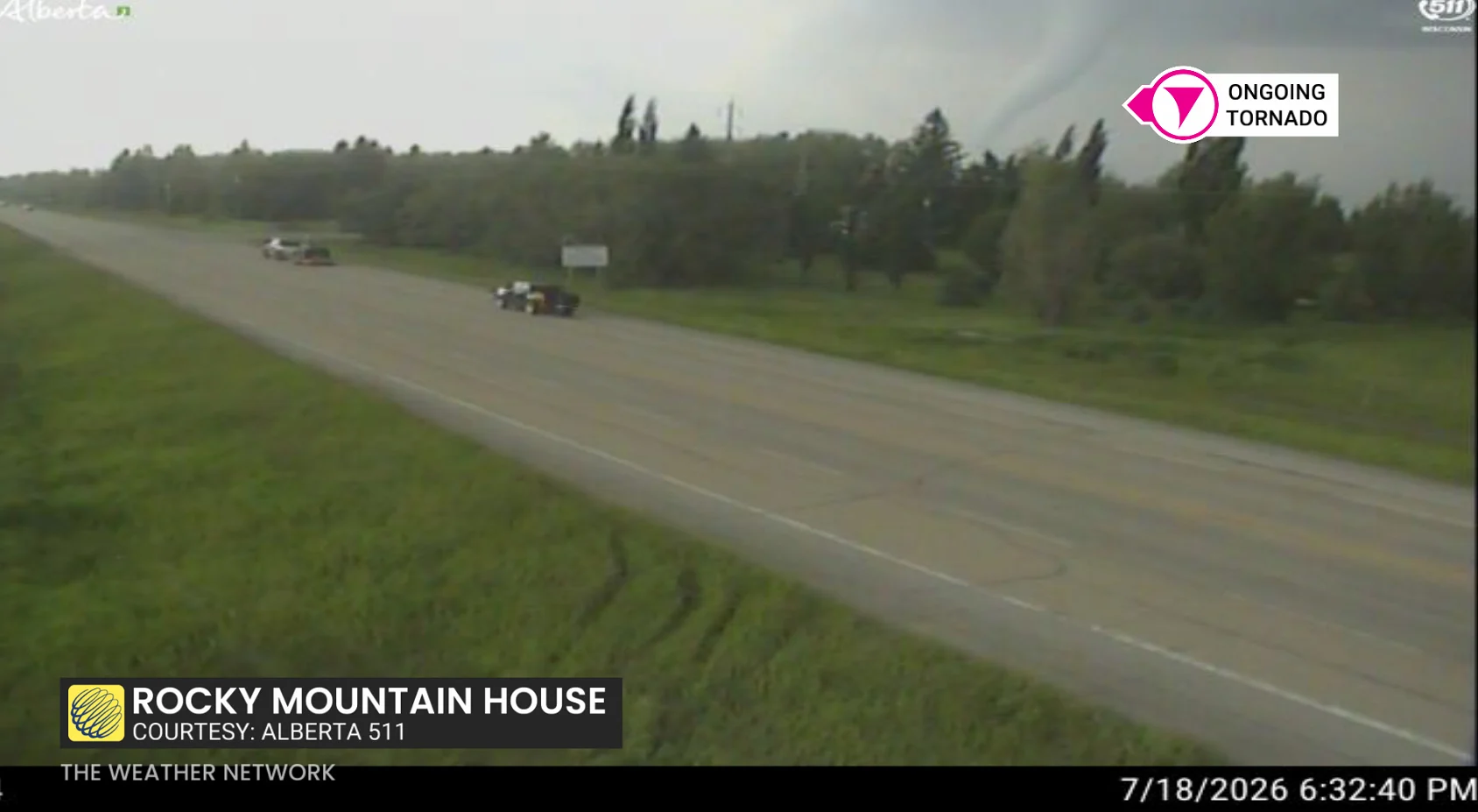
Highway camera picture of a tornado outside of Rocky Mountain House, Alta., at 6:32 p.m. MT on Saturday, July 18, 2026. (511 Alberta)
Rare, volatile storm environment building
High levels of energy in the atmosphere, as well as high moisture, atmospheric spin, and a strong jet stream over the Prairies, have created an environment that we would typically see in the United States' infamous tornado alley. It's quite rare for conditions to come together like this in Canada, where cold, dry air is typically available to limit storm severity.
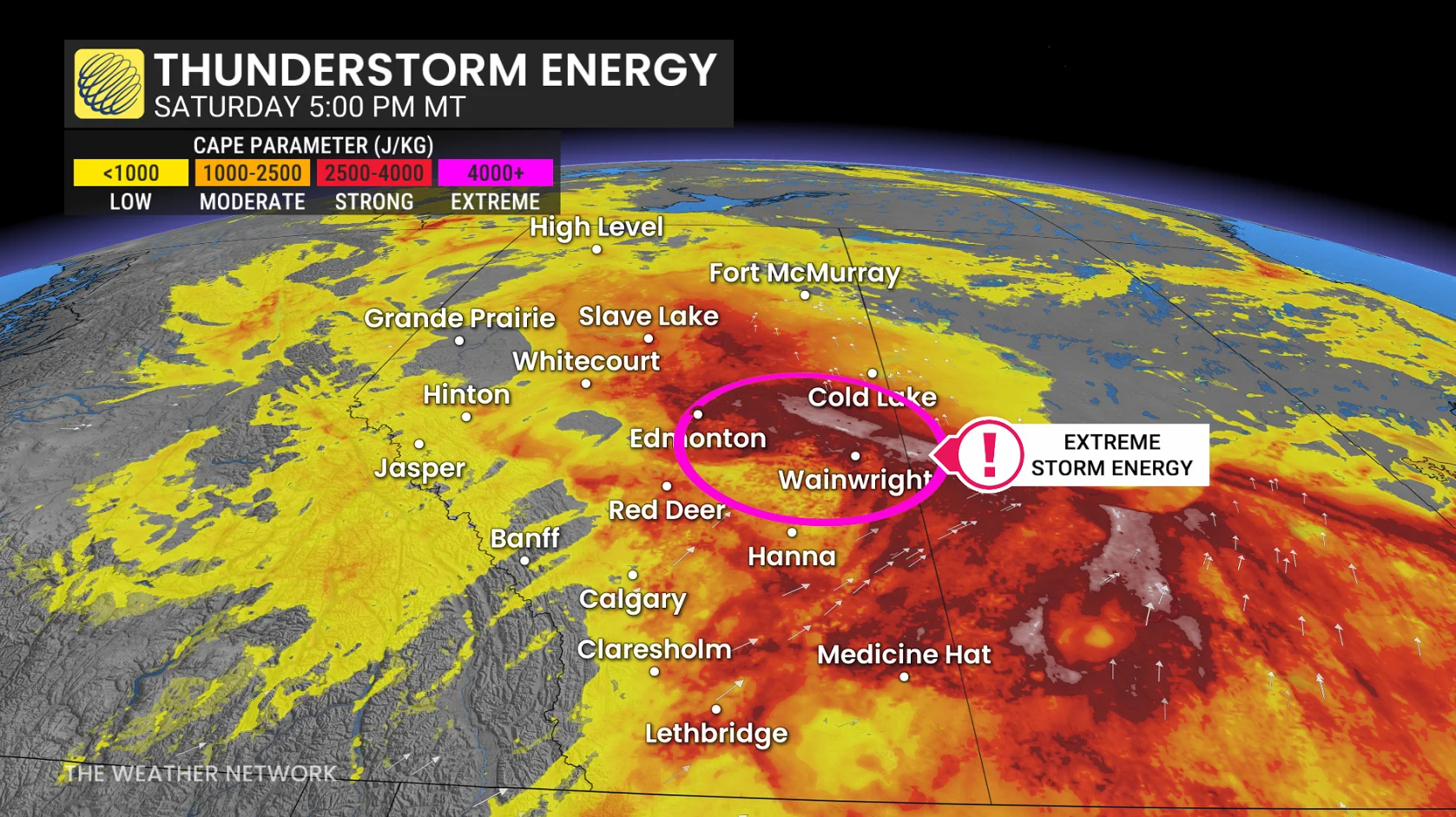
Forecasters are closely monitoring for the potential of strong supercell thunderstorms that could produce long-lived tornadoes. Typically in Canada, a tornado on the ground lasts only a few minutes at most. With Saturday's environment, however, we could see any tornadoes that touch down stay on the ground for upwards of half an hour.
In addition to the tornadic threat, storms could produce damaging winds up to 120 km/h and large hail.
Wildfire smoke may hinder storms
With so many wildfires burning across Northern Canada and British Columbia, we could see the smoke in the atmosphere actually act as a cap for some of the storm development.
RELATED: From flames to forecasts: How wildfire smoke affects your weather
Essentially, the smoke in the upper atmosphere may push back against the growing storms, preventing them from reaching their full potential despite the volatile environment.
Conversely, the smoke could serve to delay any storm development until later in the evening when there is less atmospheric energy available for storms to tap into. This could also lower the tornadic threat.
However, there is significant uncertainty as to whether or not we will see this happen on Saturday. Forecasters will be closely monitoring the situation into the overnight hours as the storms unfold.
Stay with The Weather Network for the latest updates and information on your weather in Alberta and Saskatchewan.