U.S. heat dome is problematic for Canada's long weekend forecast

As we gear up for the final long weekend of the summer, what will Mother Nature have in store for Canada on Labour Day? We have the full details on what to expect for the September holiday weekend
The end of summer is certainly in sight now, with Labour Day just around the corner. As the final long weekend of the season approaches, people may be wondering what kind of weather to expect in their part of the country.
SEE ALSO: Powerful 'gigantic jet' seen over Oklahoma isn't what you think
On paper, the long weekend forecast is deceivingly easy. Two major weather players are impacting North America. For the full details, read below.
Factors at play for Labour Day weekend
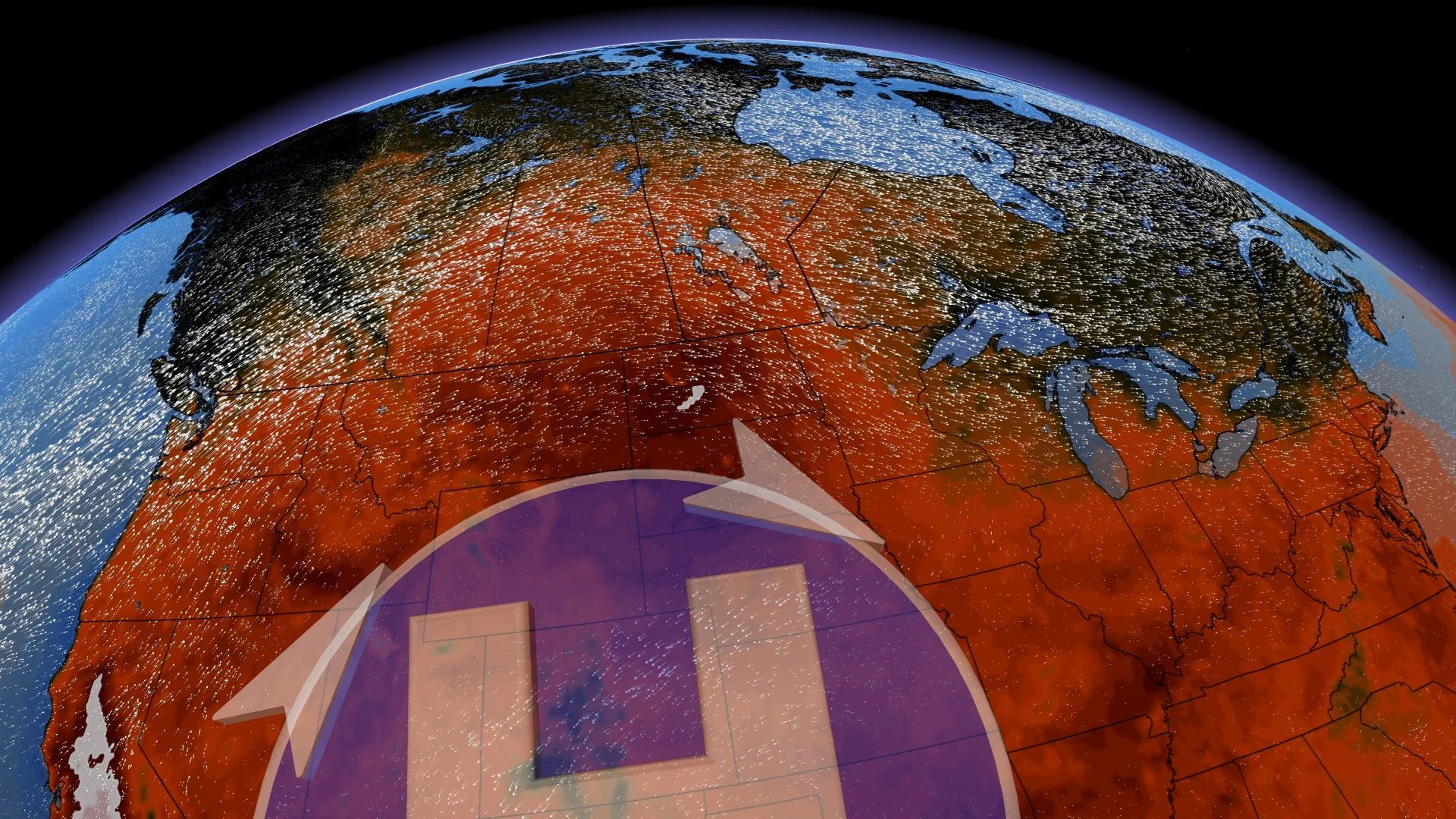
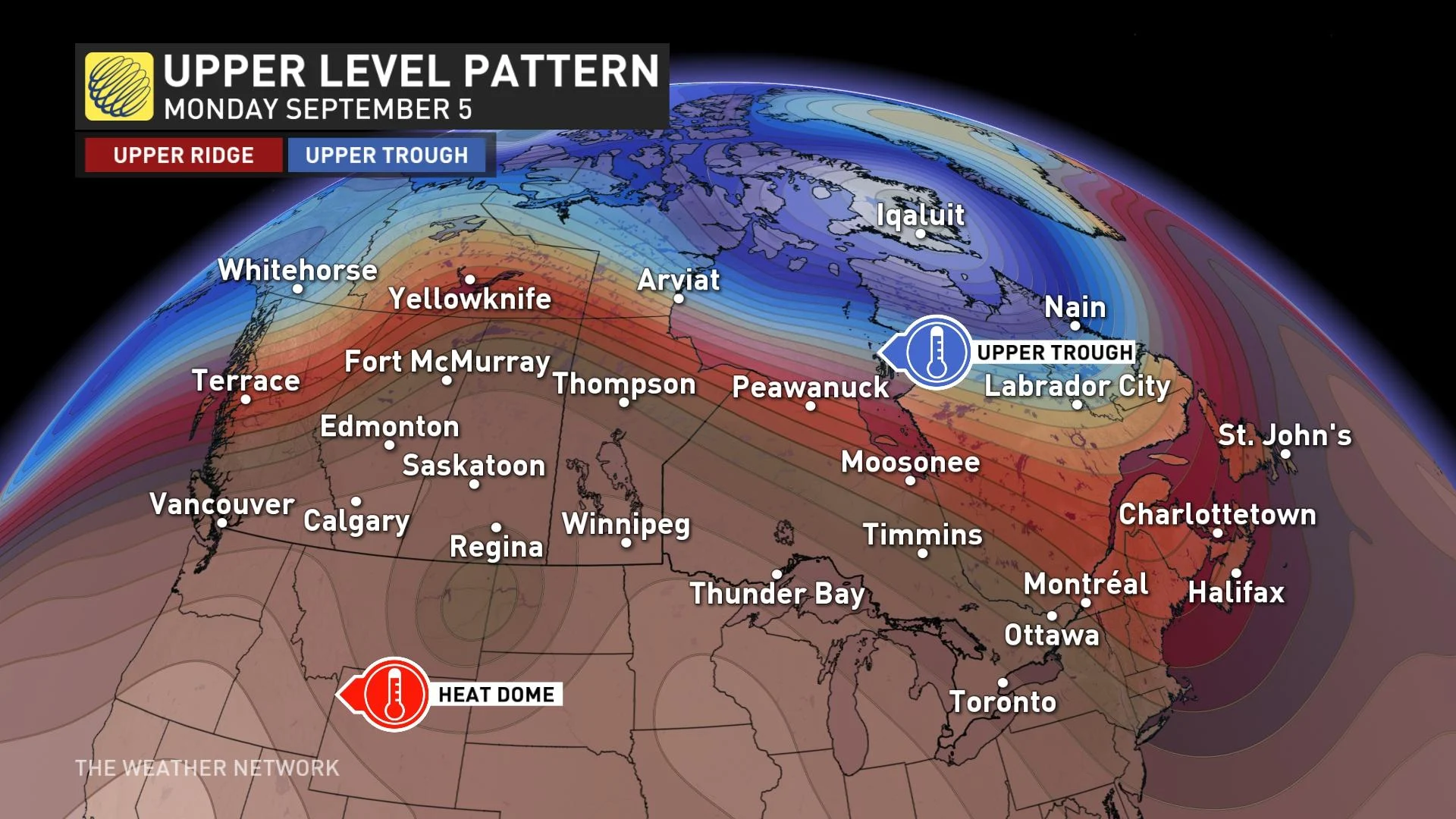
The most obvious is significant heat across the southwestern United States. It will be the warmest stretch of weather for the entire year in California, but its influence will extend north.
West
Trace the ridge northwards and there will also be significant impacts in Western Canada, bringing the warmest Labour Day long weekend to the region since 2006. Perhaps one or two all-time September records might be challenged since most of them top out in the mid-30s, near the warmest temperatures we could expect in early September.
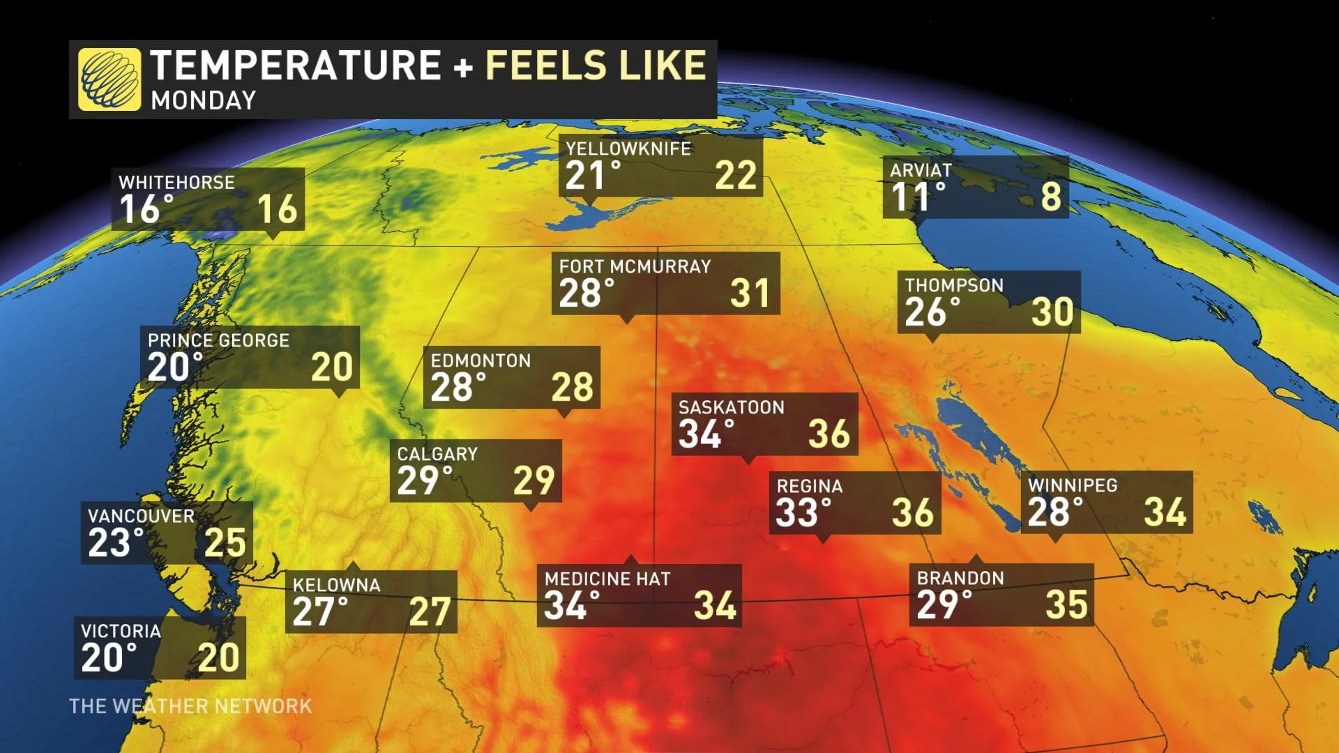
The exception will be B.C.'s North Coast, which is the target for active weather as the South Coast generally remains dry and warm. Even before the weekend, Prince Rupert racked up more than 140 mm of precipitation. A stronger onshore flow and upper trough does drift towards the B.C. coast come Labour Day, so we are teetering with the threat of showers -- depending on how that system plays out. Thunderstorm activity across Western Canada looks muted and isolated, with a hot and stable ridge running the long weekend show.
SEE ALSO: PHOTOS: Wild storms with ferocious 100 km/h winds sweep through Ontario
East
The median temperatures will be within a couple of degrees of seasonal when you average out the weekend. A trough over Hudson Bay will at times limit the potential warmth you will experience across much of the East.
As we kick-start the long weekend, Newfoundland might nab a round of convection, including some heavy downpours. Think of these as some natural fireworks to kick off your long weekend.
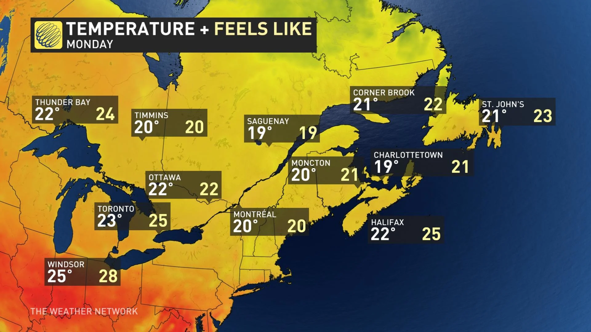
The front will trigger a round of periodic showers and thunderstorms across Ontario and Quebec. This journey starts on Friday afternoon across northern Ontario, then spilling across the south by Saturday. On Labour Day Monday, the front stalls out across New England, giving the Maritime provinces the risk of scattered showers.
With files from Tyler Hamilton, a meteorologist at The Weather Network, and Nathan Howes, digital reporter at The Weather Network.