
Heavy rain, gusty winds, and snow: Back-to-back storms hit Atlantic Canada

Colliding air masses bring rain and cooler temperatures to Canada’s East Coast this week
Clashing Arctic and Gulf air masses are set to put Atlantic Canada in the path of multiple rounds of rain this week.
This wet pattern will develop as a result of a stalled hot and humid high-pressure system over the southeastern U.S., bringing daytime highs in the 30s, while a cold high-pressure system lingers over Hudson Bay, driving an active storm track from the Prairies to Atlantic Canada.
DON'T MISS: Canada's Winter Sneak Peek: El Niño puts record warmth in play
A widespread 20-40 mm of rainfall is forecast across the Maritimes and Newfoundland through the week, with locally higher amounts possible across southern Nova Scotia and along Newfoundland's coast.
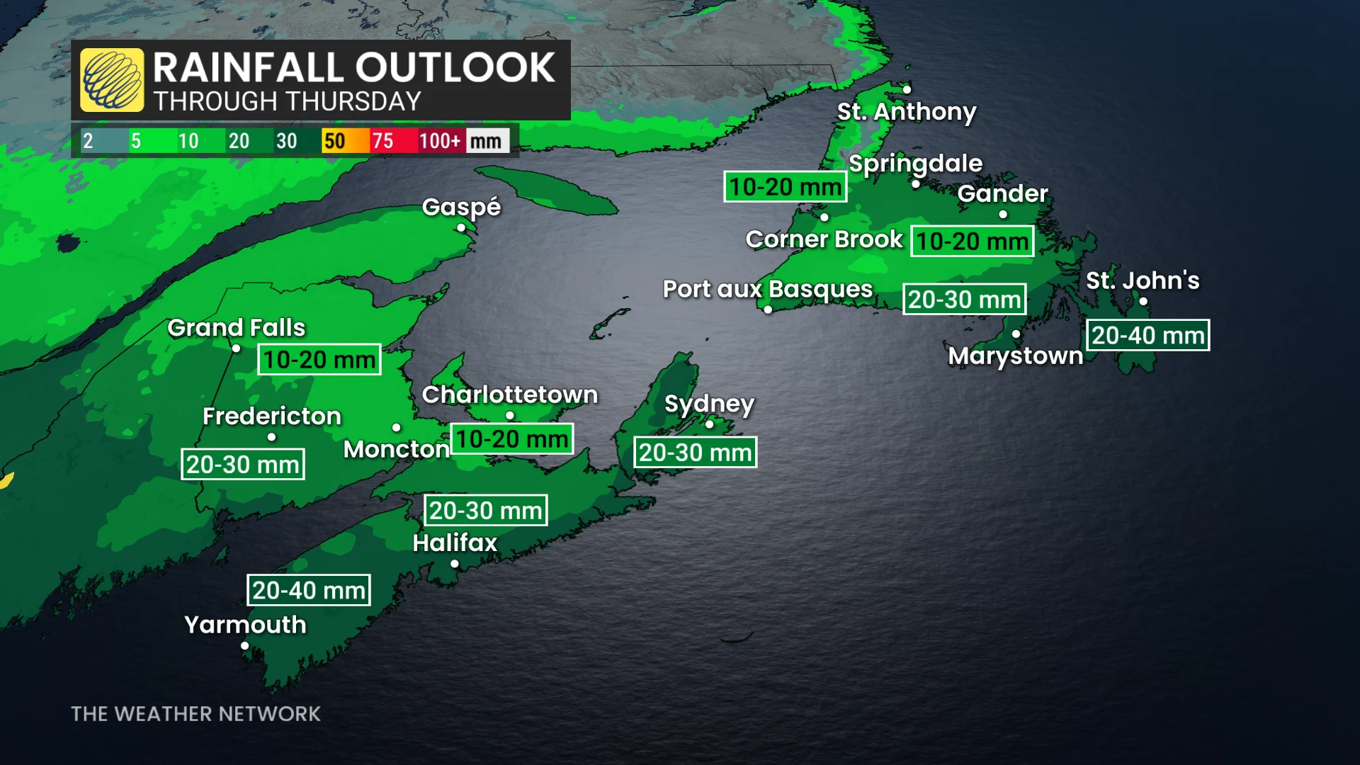
Wednesday: Heavy rain and the risk for thunderstorms
Moderate to heavy rainfall will spread across the Maritimes through Wednesday morning as a system advances eastward. Isolated, non-severe thunderstorms are possible in Nova Scotia—west of Halifax in the morning and east of Halifax by the afternoon.
Steady rain will clear from west to east through the afternoon, although showers may linger into the overnight hours. The system will move into Newfoundland late Wednesday, spreading moderate rainfall overnight from west to east.
DON'T MISS: Winter has a few tricks up its sleeve for Eastern Canada this year
Thursday: Gusty northerly winds and the chance for snow
On Thursday, steady rain will clear Newfoundland west to east by the afternoon.
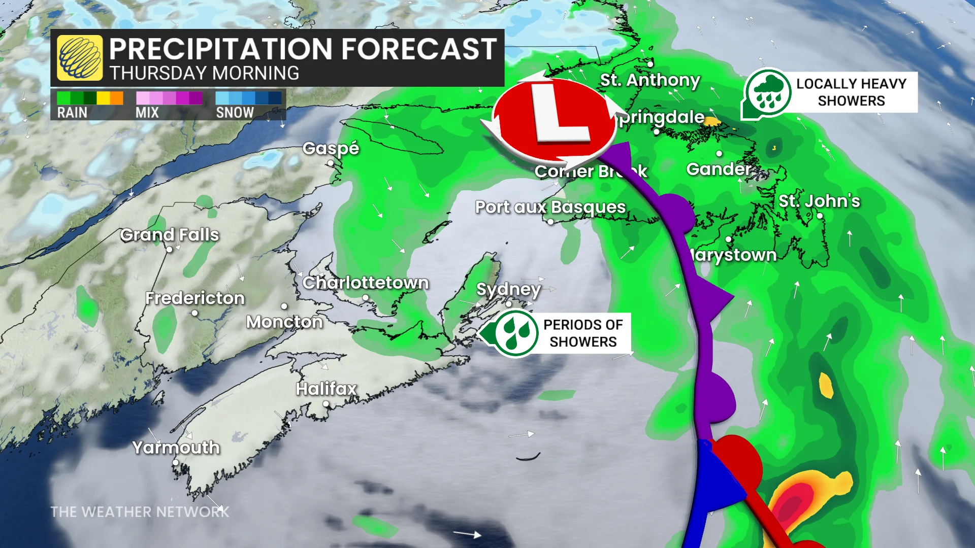
Colder air trailing the low may mix with residual moisture, producing snow in western and interior Newfoundland before tapering off by Thursday evening.
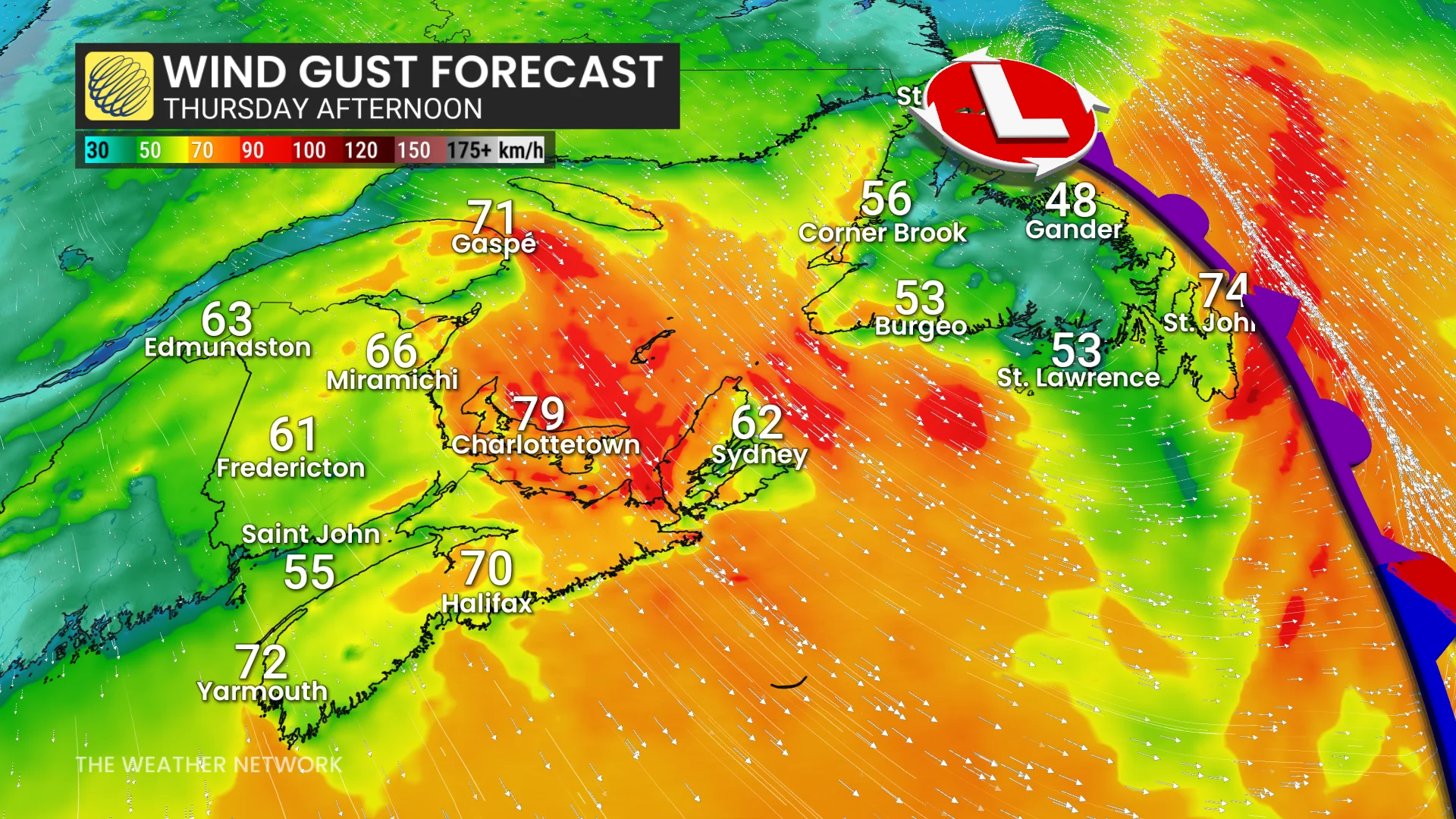
Gusty northwesterly winds will develop across Newfoundland and along the eastern shores of the Maritimes.
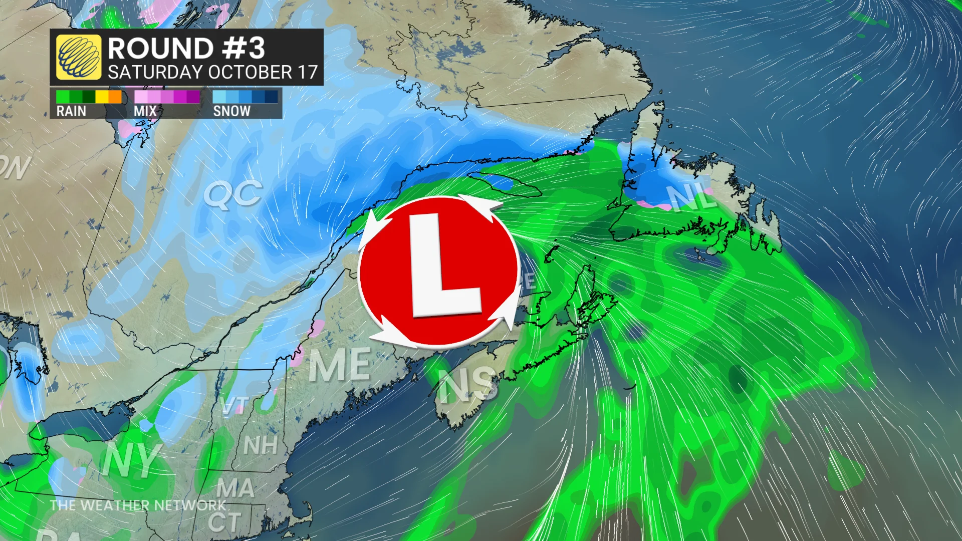
Weekend: Wintry precipitation with the strongest of the storms
Another low pressure system is expected to impact the region Friday into Saturday.
This system could bring widespread rain, strong winds, and potentially some wintry precipitation on its backside. It may be the strongest system in the recent series of storms.
Stay with The Weather Network for the latest updates and information on your forecast across Atlantic Canada.