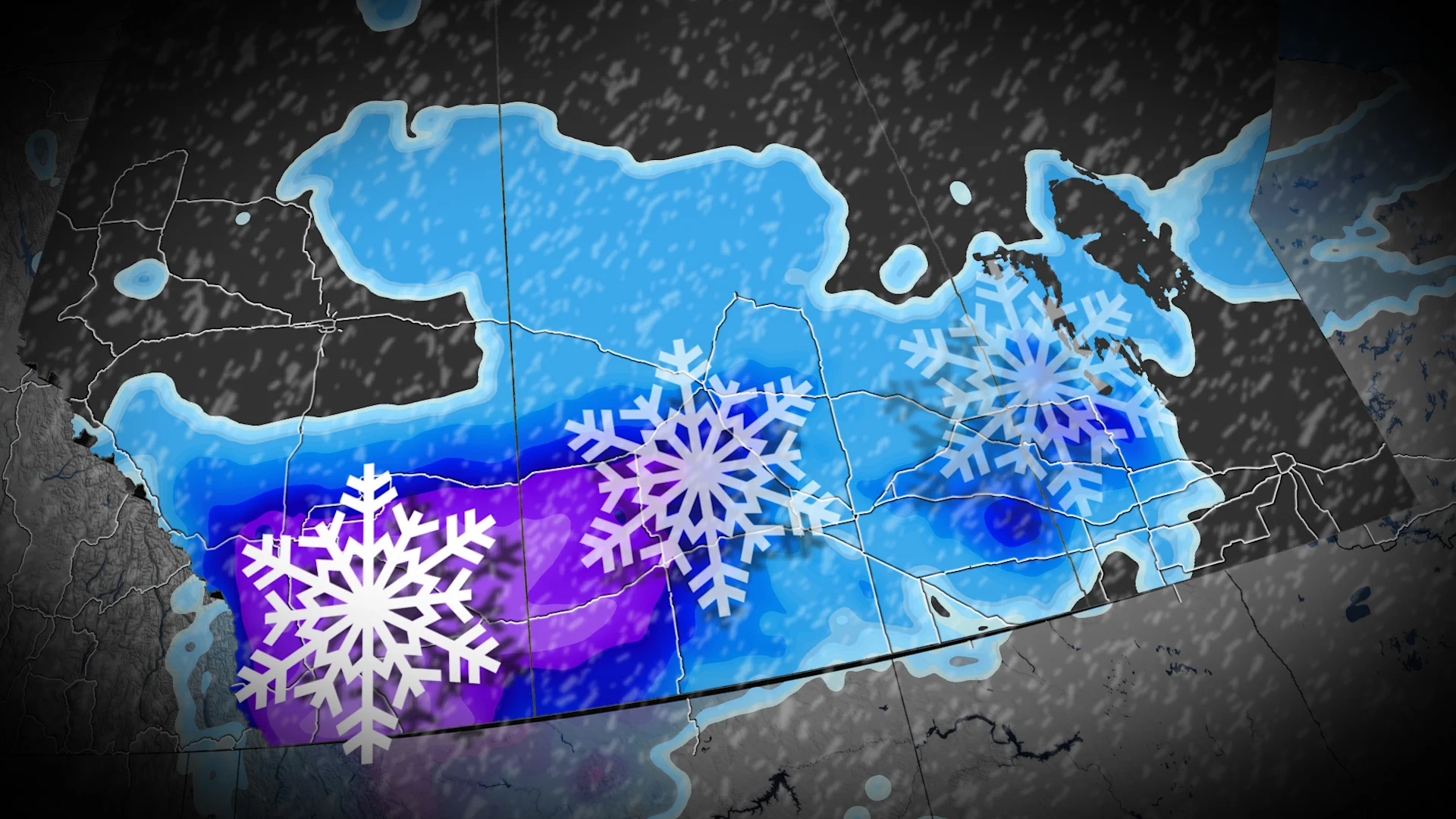
Travel impacts likely with widespread snow over southern Prairies

Get ready for significant snowfall across southern Alberta and Saskatchewan this week, with many areas seeing anywhere from 5-20 cm, potentially reaching over 25 cm in some locales. Drivers will likely encounter difficult road conditions.
An end to the stormless streak is brewing across the Prairies.
A low-pressure system tracking south of the border will bring snow to southern areas of Alberta and Saskatchewan on Tuesday and Wednesday.
SEE ALSO: Canada's polar vortex wild card is waking up much earlier than expected
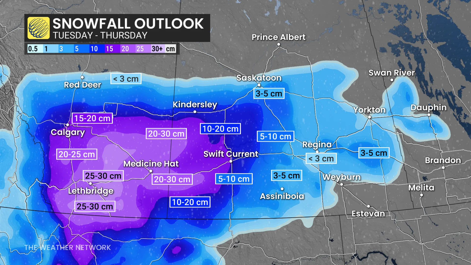
Southern areas of Alberta and Saskatchewan have the potential to see 5-25 cm of snow, with the highest totals expected in the former and along the border of the two provinces.
Snowfall will hit the southern Prairies this week
A deep trough extending southward across California will be the catalyst to develop a Wyoming-Montana low by Tuesday, but a lack of cold air reservoir means the storm won’t rapidly intensify.
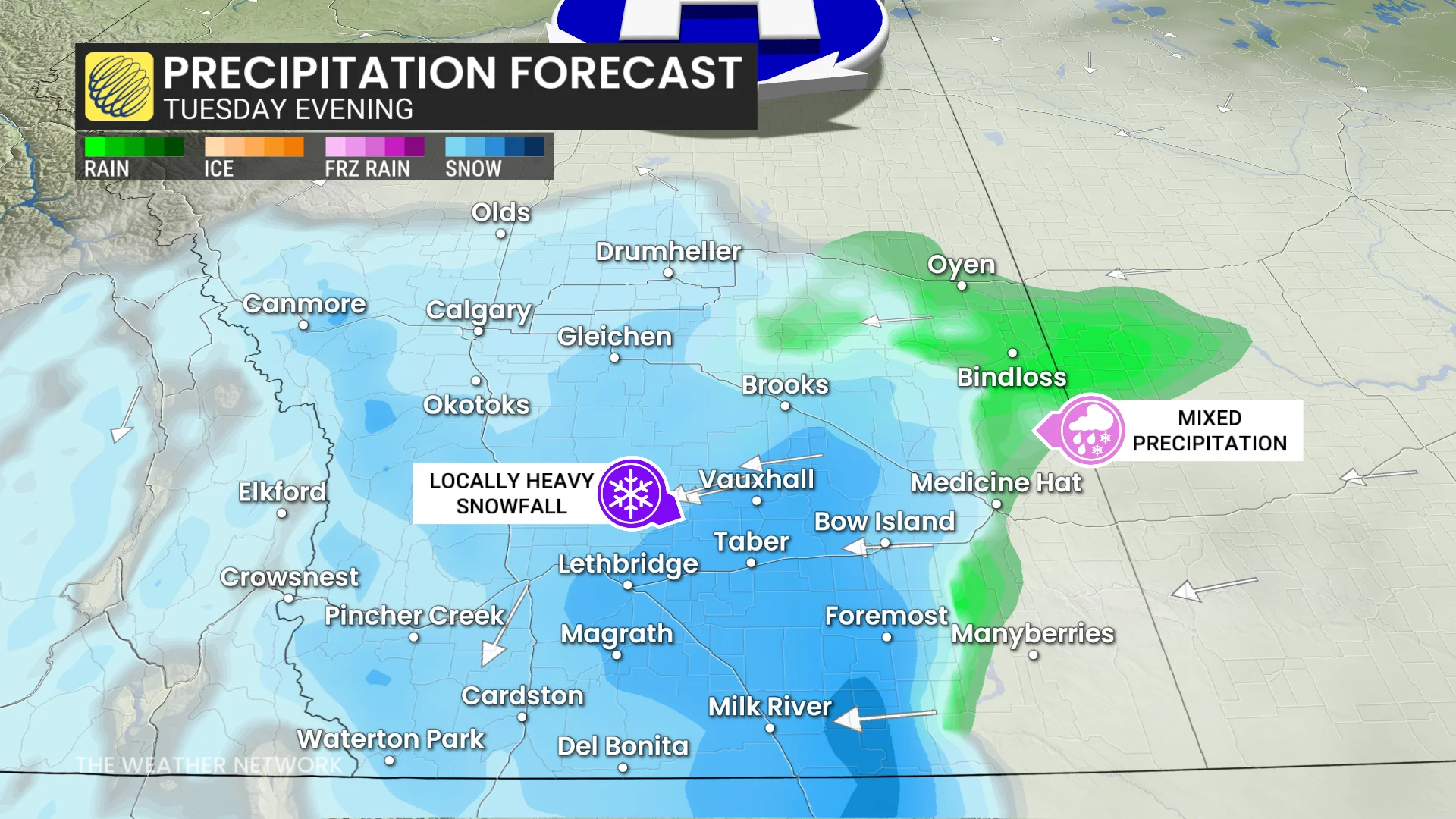
Snowfall lifts into southern Alberta Tuesday afternoon, slowly spreading north and east into Calgary, and reaching Saskatchewan by the evening.
Calgary snowfall lifts on Tuesday evening, continuing Wednesday. Totals of 5+ cm are expected.
Southeastern Alberta (Highway 3) and southwestern Saskatchewan (Trans-Canada Highway) will be in a more favourable region to accumulate snowfall, along with southern Saskatchewan. The best chance to see 20 cm will be in those regions.
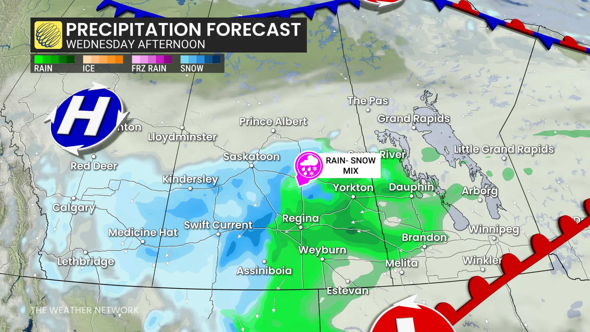
Meanwhile, Regina is forecast to see less than 5 cm of snowfall, as the system's warm front stays over the area until late Wednesday.
Any modest changes in elevation and precipitation intensity will greatly influence snowfall accumulations. The Cypress Hills region in Alberta is forecast to see, locally, more than 15 cm of snow, southeast of Medicine Hat, Alta.
The Trans-Canada Highway east of Brooks, Alta., to Swift Current, Sask., will be locally slick throughout Tuesday.
That will be the zone for higher wind gusts, between 30-40 km/h, on Wednesday morning.
Motorists can expect slick surfaces and untreated roadways, with reduced visibility under bursts of wet snow.
Temperatures will be marginal to support significant accumulations on roadways. Subtle shifts in storm track will alter the overall precipitation forecast across the Prairies.
WATCH: Three things to know about the upcoming Prairie snowfall
November snowfall normals
November snowfall normals for the Prairies include:
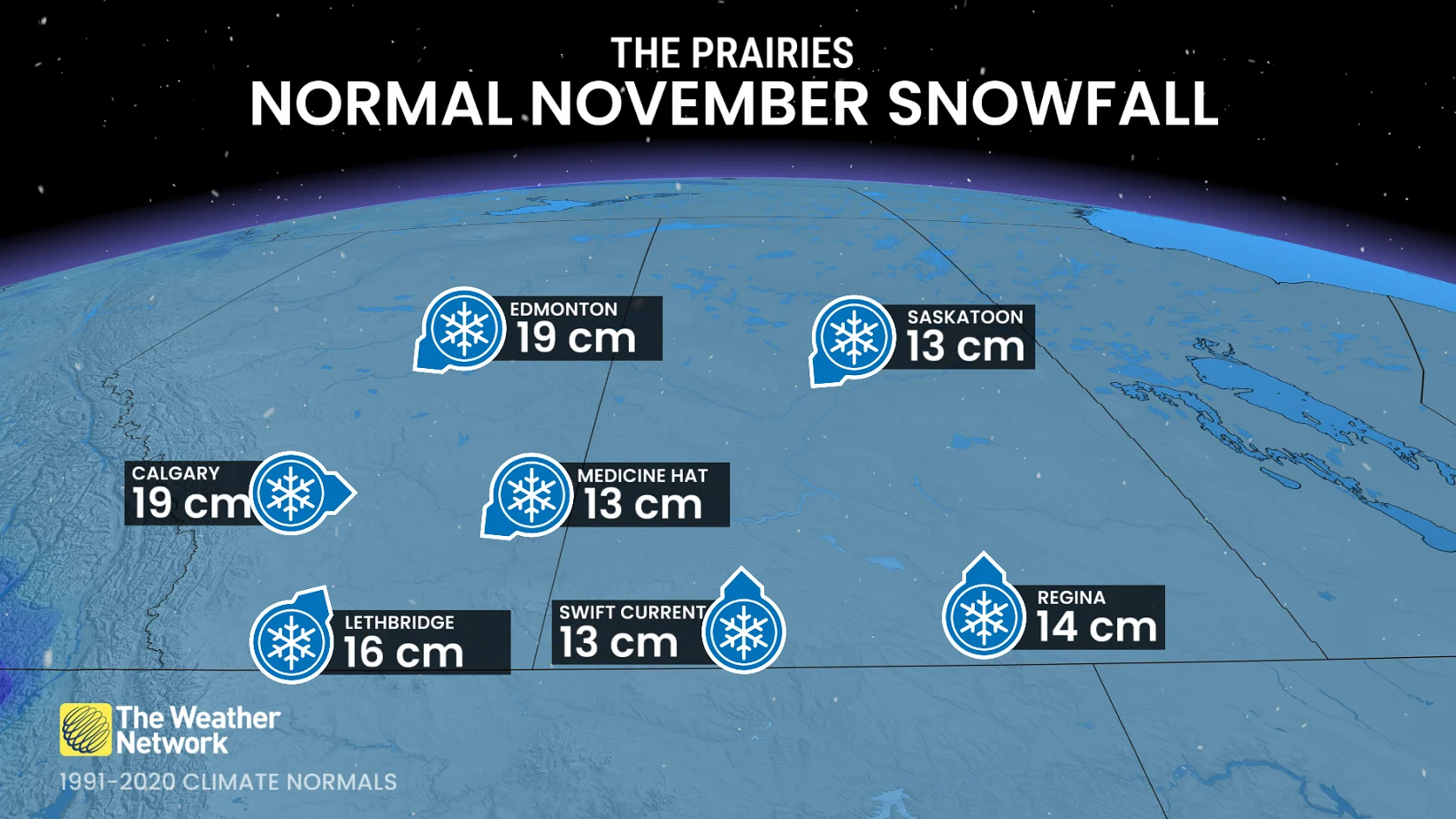
Calgary: 19 cm
Lethbridge: 16 cm
Medicine Hat: 13 cm
Swift Current: 13 cm
Regina: 14 cm
Stay with The Weather Network for more information and updates on your weather across the Prairies.