Coldest air in months: Unusually strong high pressure grips Ontario, Quebec

A dominant ridge of high pressure is bringing the coldest air mass in four months to Ontario and Quebec
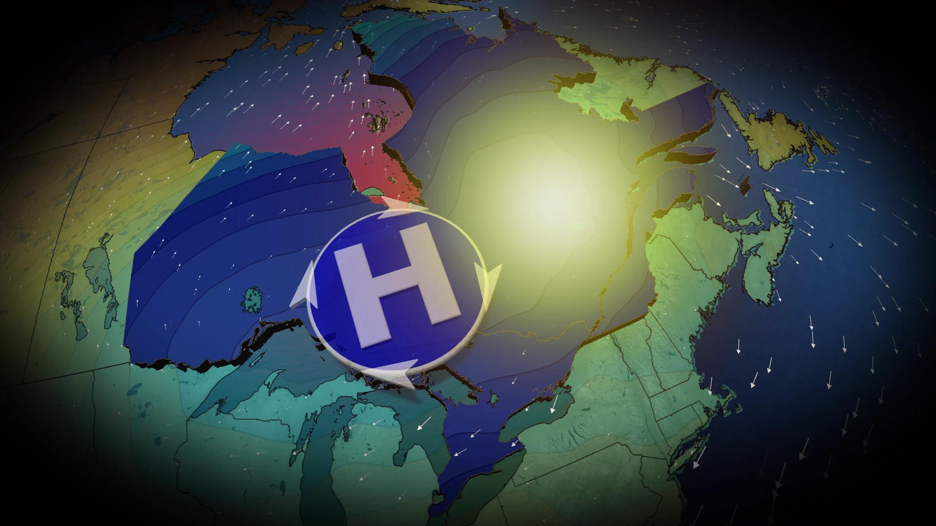
A powerful ridge of high pressure is building over eastern Canada, creating dry conditions and below-seasonal temperatures from Monday through Friday.
DON’T MISS: What does a classic fall storm look like in your part of Canada?
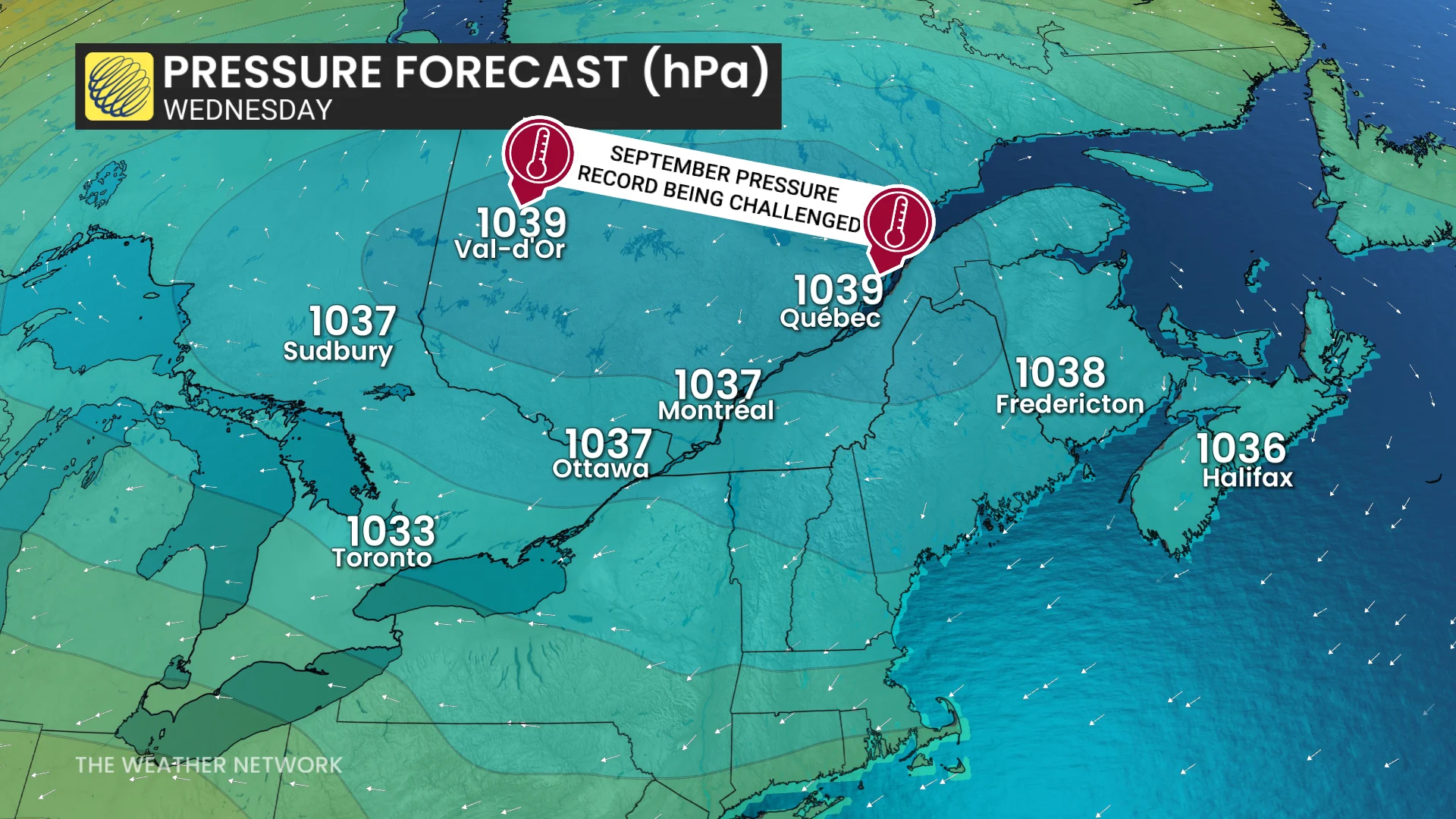
The system's intensity is notable, with pressure levels potentially reaching 1040 hPa over parts of Quebec.
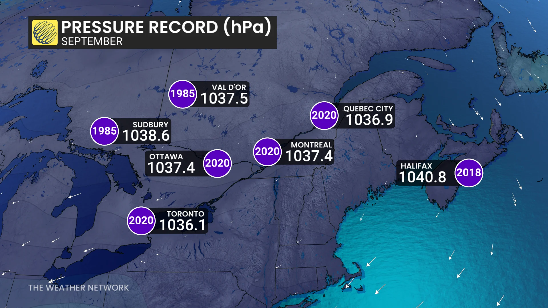
This could set new all-time September pressure records in cities like Val-d’Or and Quebec City, while Montreal and Ottawa are expected to come close to breaking their records.
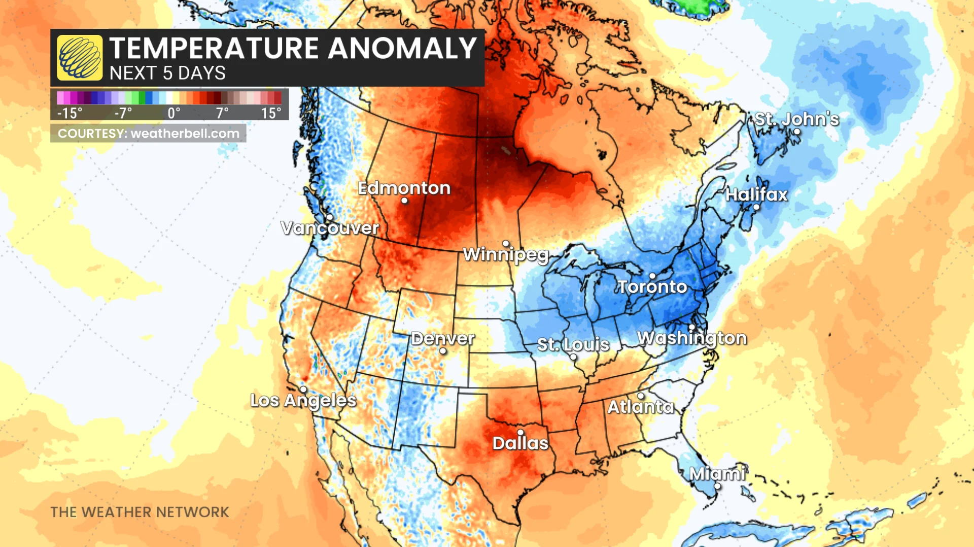
Over the next five days, temperatures across eastern Canada will stay below seasonal due to the influence of the high pressure system.
RELATED: Longest dry streak of 2026 in the works across southern Ontario
The system’s clockwise wind pattern will bring northwesterly flow to Atlantic Canada and northeasterly winds across southern Ontario and southern Quebec.
Impacts from this system also include extended dry spells across Ontario and Quebec.
The pattern will help suppress precipitation, resulting in an estimated rainfall deficit of 30 to 50 mm through the end of the month.
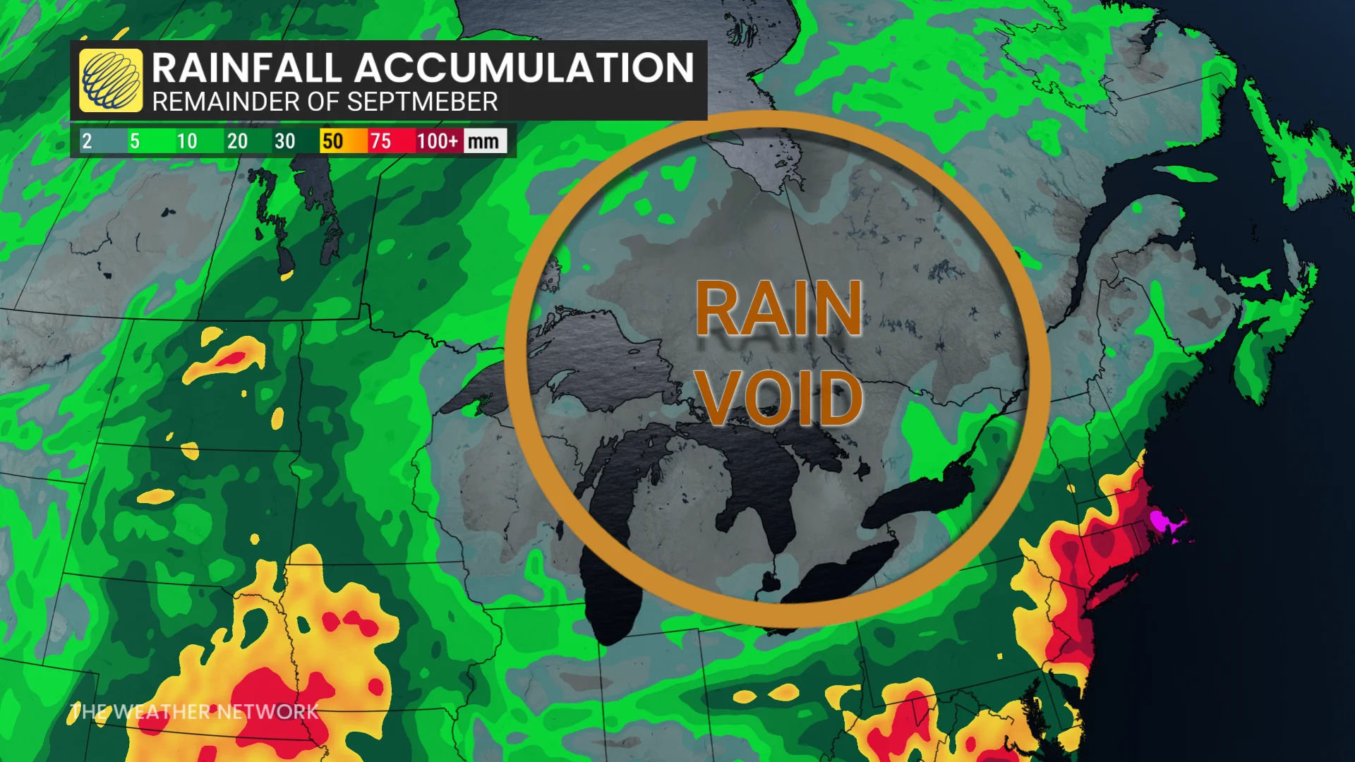
While the high pressure will result in stable weather, it’s always important to stay updated on any changes in the forecast as September weather can still bring surprises.